La Tour-Sans-Venin
Add to my favorites

Caution! Zone of vigilance near the route
La Tour Sans Venin - du 30/11/2026 au 05/12/2026 Upcoming
Suite à un incendie survenu le 4 août 2022, désormais fixé, l'accès aux bois des Vouillants est interdit au public à compter du 4 août et ce jusqu'à la levée du risque de reprise de l'incendie.
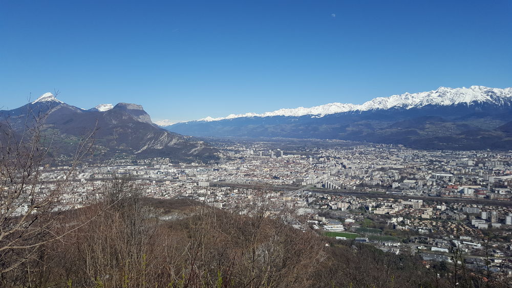
Cette promenade dans les coteaux du massif du Vercors vous fera traverser des bois aux essences variées alternant avec des prairies offrant de beaux panoramas sur la Chartreuse et Belledonne.
The characteristics of the route.

Fontaine (38)
- Distance 11.9 km
- Elevation gain 510 m
- Elevation lost 510 m
- Min. elevation 214 m
- Max. elevation. 663 m
- Duration (depending on pace) 4h30
- Marking Yes
Equipments : Car park, Admission fee : Free access.Opening : All year round.
Subject to favorable weather.
Area : Grenoble-Alpes Métropole
Report a problem
Website Pdf file Features of the application :
- Location and orientation on detailed maps thanks to the GPS of your smartphone
- Description of routes and points of interest on the route
- Photo gallery by route
- Detailed elevation profile
- Route tracking alert to warn you if you stray from the route
- Send predefined messages by SMS to your contacts
- Emergency module: trigger a call or send an emergency SMS in case of problem
- Agenda: access to events organized in the department
- News: find in the application the latest news on the web portal
- Adding achievements
- Add reports in case of problems encountered on the routes
- Share on social networks
Add your time and share your feelings
Services nearby

Arhome, Museum of the industrial innovation
Grenoble

Point Information Touristique de St Nizier du Moucherotte
Saint-Nizier-du-Moucherotte
Viscose Museum
Échirolles
The dauphinois museum
Grenoble
Musée Stendhal
Grenoble


Information updated on 2022-09-22 by Office de Tourisme Grenoble Alpes


Follow us on
the digital trails
the digital trails


![]()
The Isère Outdoor application was created
by the Département de l'Isère
Infos & contact
Conseil départemental de l'Isère
7 rue Fantin Latour
CS 41096
38 022 Grenoble cedex 1
Tel. 04 76 00 38 38
 Isère Outdoor - Parcours - La Tour-Sans-Venin
Hello, world! This is a toast message.
Isère Outdoor - Parcours - La Tour-Sans-Venin
Hello, world! This is a toast message.
Isère Outdoor - Parcours - La Tour-Sans-Venin
Hello, world! This is a toast message.


OK
Annuler