Hiking between Claix and Le Peuil
Add to my favorites

Caution! Zone of vigilance near the route
Aigle royal - du 01/01/2026 au 31/08/2026 In progress
Aigle royal - du 01/01/2026 au 31/08/2026 In progress
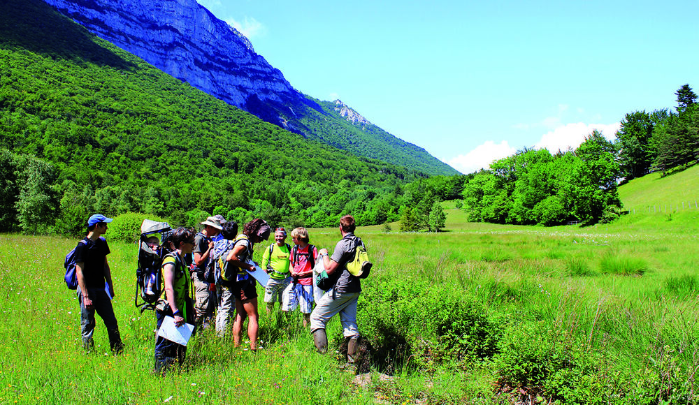
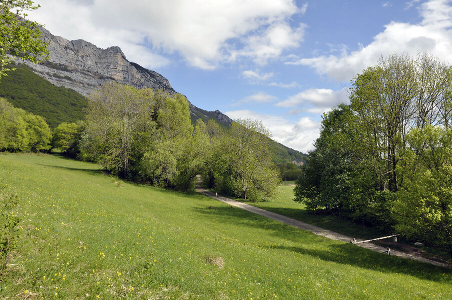
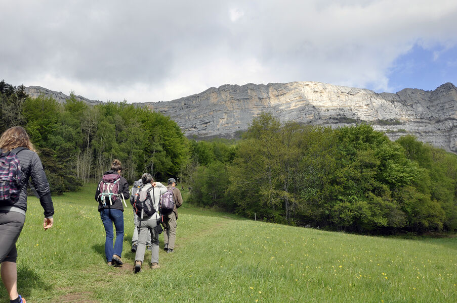
At the sight of the cliffs of the Vercors which dominate Claix, the tone is given. The 700 m difference in altitude to reach the Peuil plateau will leave some traces of fatigue. But what a pleasure to discover the stream of Pissarde and to appreciate its freshness
The characteristics of the route.

Claix (38)
- Distance 16.3 km
- Elevation gain 780 m
- Elevation lost 780 m
- Min. elevation 280 m
- Max. elevation. 949 m
- Duration (depending on pace) 6h30
- Marking Yes
Equipments : Car park, Admission fee : Free access.Opening : All year round.Step by step description : Start at the Claix village sign, above the town hall square. From here, climb the road towards Allières. Pass through the narrow streets of old Claix, then cross the locality known as La Croix. In Allières, turn right towards La pissarde. The cul-de-sac leads to a track which opens up a few hundred metres further on to the Pissarde path on the left. At the intersection with the road at the Savoyères sign, take the left-hand path towards Le Peuil. From Le Peuil, follow a track to reach a path with a steeper gradient. Stay on the signposted path towards Cossey. At the hamlet of Le Gampas, take the right-hand path down to Cossey, Claix's oldest hamlet. Turn right at the Rif stream. Admire the beautiful view of the Alps and the sun warming this slope; the scent of pine trees may remind you of Provence. After crossing this locality, the path leads to Bouveyres. Pass through the hamlet of Penatière before turning right to reach Cossey and its historic chapel. From here, turn right towards Les Cimentiers. The first road on the left leads to the crossroads with the D106, turn right for a few metres to find the Chemin des Cimentiers on the left. At the intersection, turn right towards Les Cimentiers. The path runs along the edge of the Comboire rock forest. Cross the Cimentiers footbridge and continue straight ahead to reach the hamlet of La Balme. Turn right to join a road that leads back to Claix via Les Perrouses.
NATURAL HERITAGE: THE PEUIL PEAT BOG
The 57-hectare Peuil peat bog is a unique and original site in the Vercors, as the karstic nature of the massif does not generally favor this type of environment. It is one of the few wetlands in the massif, and a precious ecosystem that must be preserved. Its cliff-side location makes it an undeniably attractive landscape, but it also boasts a wealth of species typical of peaty environments. Floristic richness is remarkable, with no fewer than 219 species recorded.
Area : Grenoble-Alpes Métropole
Report a problem
Website Pdf file Features of the application :
- Location and orientation on detailed maps thanks to the GPS of your smartphone
- Description of routes and points of interest on the route
- Photo gallery by route
- Detailed elevation profile
- Route tracking alert to warn you if you stray from the route
- Send predefined messages by SMS to your contacts
- Emergency module: trigger a call or send an emergency SMS in case of problem
- Agenda: access to events organized in the department
- News: find in the application the latest news on the web portal
- Adding achievements
- Add reports in case of problems encountered on the routes
- Share on social networks
Viviane38500
The 2023/07/19
En savoir plus
Ajouter votre chrono et partager vos sensations
2023/07/19 Viviane38500
Balade faite ce jour! Très joli balade mais il faut enlever la pastille verte "facile" n'est pas le terme que j'emploierai... Et niveau fraîcheur on repassera! Je sais que c'est la canicule mais sur toute la première partie de la rando les rivières sont à sec!
2023/07/19 Viviane38500
Balade faite ce jour! Très joli balade mais il faut enlever la pastille verte "facile" n'est pas le terme que j'emploierai... Et niveau fraîcheur on repassera! Je sais que c'est la canicule mais sur toute la première partie de la rando les rivières sont à sec!
Services nearby

Espace naturel sensible de la tourbière du Peuil
Claix

Espace Histo Bus Dauphinois
Le Pont-de-Claix
Musée Géo-Charles
Échirolles

Point Information Touristique de St Nizier du Moucherotte
Saint-Nizier-du-Moucherotte
Viscose Museum
Échirolles


Information updated on 2025-05-06 by Office de Tourisme Grenoble Alpes


Follow us on
the digital trails
the digital trails


![]()
The Isère Outdoor application was created
by the Département de l'Isère
Infos & contact
Conseil départemental de l'Isère
7 rue Fantin Latour
CS 41096
38 022 Grenoble cedex 1
Tel. 04 76 00 38 38
 Isère Outdoor - Parcours - Hiking between Claix and Le Peuil
Hello, world! This is a toast message.
Isère Outdoor - Parcours - Hiking between Claix and Le Peuil
Hello, world! This is a toast message.
Isère Outdoor - Parcours - Hiking between Claix and Le Peuil
Hello, world! This is a toast message.


OK
Annuler