From Beauregard to Michallons by the Grande Traversée du Vercors (GTV)
Add to my favorites

Caution! Zone of vigilance near the route
La Tour Sans Venin - du 30/11/2026 au 05/12/2026 Upcoming
Warning
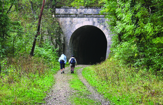
This route takes you under the foothills of the Vercors in the footsteps of the old tram line which linked Grenoble to Villard-de-Lans. You cross the old tunnels fitted out for the passage of the Tram and take the GR9 on the way back.
The characteristics of the route.

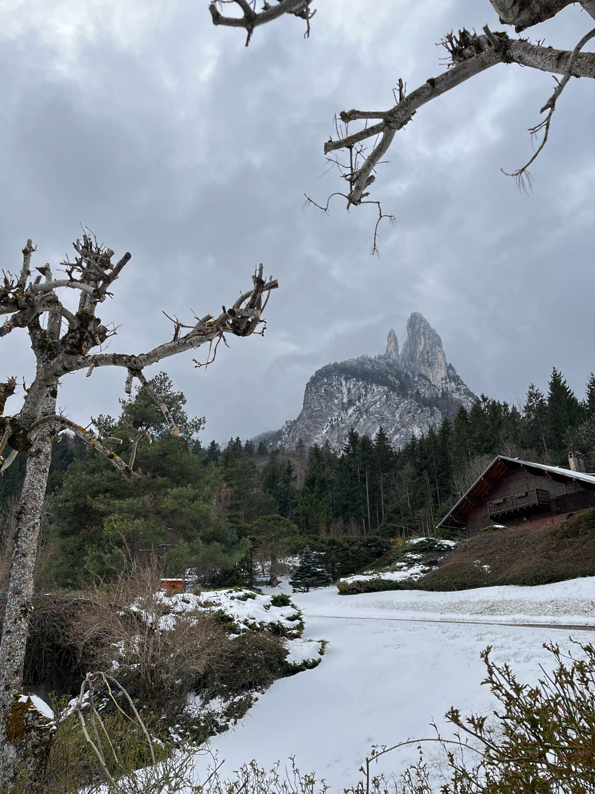
Seyssinet-Pariset (38)
- Distance 10.9 km
- Elevation gain 540 m
- Elevation lost 540 m
- Min. elevation 453 m
- Max. elevation. 964 m
- Duration (depending on pace) 3h30
- Marking Yes
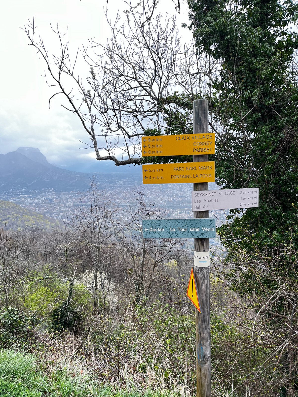
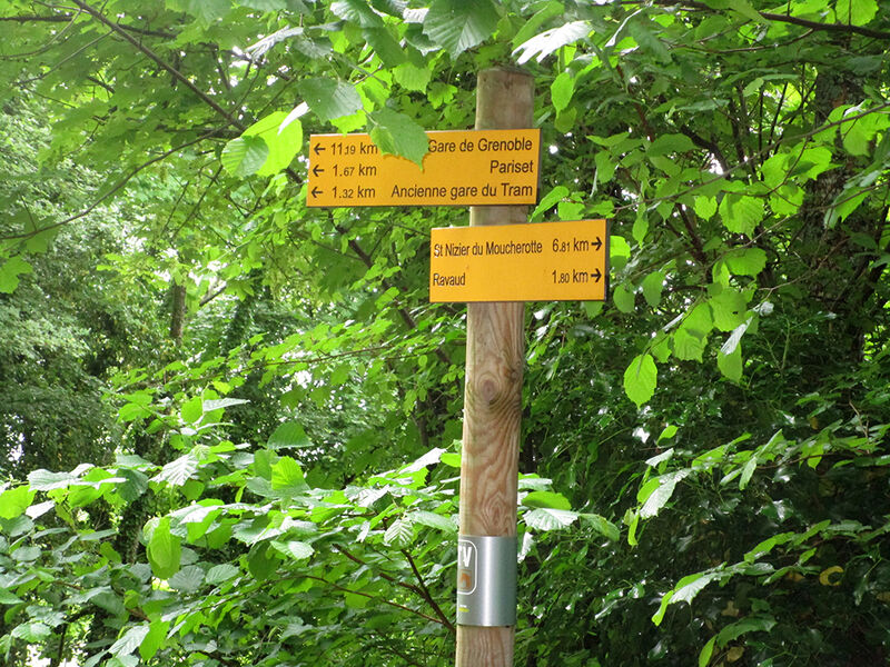
Marking : Yellow directional signs indicating the main accessible places in capital letters, the distance remaining to be traveled, as well as the name and distance of the next junction in lowercase. Between the signs, the routes are indicated by yellow markings.Equipments : Free car park, Car park, Delicate passages : No difficulty, caution on the roadside passage at the level of the Sans Venin towerAdmission fee : Free of charge.Opening : All year round daily.
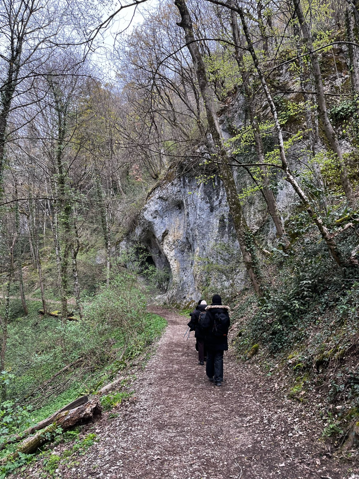
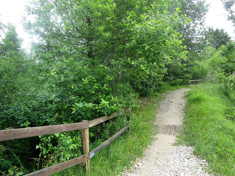
Subject to favorable weather.Step by step description : From the Vouillants parking lot, turn right along the narrow path that runs under the pond. At the Beauregard meadow, turn left towards Les Arcelles. After crossing the wooden footbridge, head for Pariset. This track narrows to give way to a small winding path strewn with roots. The exit onto the road is steep and dangerous, requiring great caution. Turn right and climb the route de St Nizier for 300 m. Stay on the right-hand side of the road, following the road markings to avoid encroaching on the traffic lane as far as the signpost at Pariset. Cross the route de St Nizier using the pedestrian crossing. Follow the signs for St Nizier and the old streetcar station. Climb the steep road and follow the sloping path. Turn right at the end of the road as far as the old streetcar station. Don't take the left-hand path (GR9) here, but continue straight ahead, passing the old streetcar station on the left, and shortly afterwards taking the left-hand path. This is the old Tram track. Take this path and continue to the Risset bridge, which you cross. Pass through the first and largest tunnel on the route, staying well in the middle (risk of falling into the water drainage ditches on the sides). Continue along the track through the second tunnel. At the Ravaud intersection, turn right in the direction of St Nizier and go to the end of the track. Go straight ahead on the route des arcelles and follow it to the Blanche Neige post, the junction between the old Tram track and the GR9. Descend along the GR9. Turn right onto the road to Les Pinières. Go straight ahead at the intersection below and take the small path on the right about 100 m further on. Descend the steep
until you reach the road from St Nizier to Les Pinières. Walk along
the right-hand side of the road for approx. 15 m and take the right-hand path
towards the old streetcar station. Go down the track for 550 m and
take the path on the right towards Pariset. Turn right at
the old streetcar tracks, then turn left towards Pariset. The
return by the same route as the ascent. In Pariset, go down
route de St Nizier for 300 m (left-hand side) and take the downhill path
Arcelles and return to the starting point via the Beauregard meadow.
de Beauregard.
Tour stages : Château de Beauregard, La prairie de Beauregard, Les Arcelles, Bel Air, Pariset, Ancienne Gare du Tram, Ravaud, Blanche Neige, Les Pinières, Ancienne Gare du Tram, Pariset, Bel Air, Les Arcelles, Prairie de Beauregard, Château de Beauregard.
Area : Grenoble-Alpes Métropole
Report a problem
Website Features of the application :
- Location and orientation on detailed maps thanks to the GPS of your smartphone
- Description of routes and points of interest on the route
- Photo gallery by route
- Detailed elevation profile
- Route tracking alert to warn you if you stray from the route
- Send predefined messages by SMS to your contacts
- Emergency module: trigger a call or send an emergency SMS in case of problem
- Agenda: access to events organized in the department
- News: find in the application the latest news on the web portal
- Adding achievements
- Add reports in case of problems encountered on the routes
- Share on social networks
FefeEnFefe
finished in 04:00:00
The 2026/03/29
En savoir plus
Ajouter votre chrono et partager vos sensations
Services nearby

Point Information Touristique de St Nizier du Moucherotte
Saint-Nizier-du-Moucherotte

Viscose Museum
Échirolles
Musée Géo-Charles
Échirolles
Arhome, Museum of the industrial innovation
Grenoble
Espace Histo Bus Dauphinois
Le Pont-de-Claix


Information updated on 2026-04-22 by Office de Tourisme Grenoble Alpes


Follow us on
the digital trails
the digital trails


![]()
The Isère Outdoor application was created
by the Département de l'Isère
Infos & contact
Conseil départemental de l'Isère
7 rue Fantin Latour
CS 41096
38 022 Grenoble cedex 1
Tel. 04 76 00 38 38
 Isère Outdoor - Parcours - From Beauregard to Michallons by the Grande Traversée du Vercors (GTV)
Hello, world! This is a toast message.
Isère Outdoor - Parcours - From Beauregard to Michallons by the Grande Traversée du Vercors (GTV)
Hello, world! This is a toast message.
Isère Outdoor - Parcours - From Beauregard to Michallons by the Grande Traversée du Vercors (GTV)
Hello, world! This is a toast message.


OK
Annuler