Forêt de l'Ours via the Combe du Bras
Add to my favorites

Caution! Zone of vigilance near the route
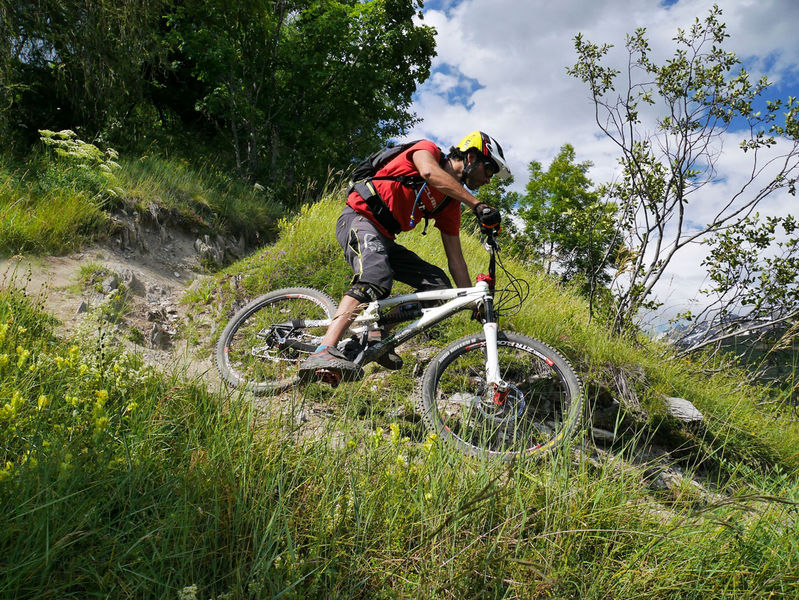
This great enduro route is perfect for experienced bikers. It’s one of the rare tracks that leads down to Bourg-d’Oisans from Alpe d’Huez.
The characteristics of the route.

Alpe d'Huez (38)
- Distance 17 km
- Elevation gain 430 m
- Elevation lost 1560 m
- Min. elevation 688 m
- Max. elevation. 1862 m
- Duration (depending on pace) 2h
- Marking Yes
Route in the “MTB in Oisans” guide (Oisans Tourisme)
Departure : Alpe d' Huez, 1850 m
Arrival: Allemond or Le Bourg-d'Oisans, 720 m
Length: 2 hours
Distance: 17 km
Highest point: 1 850 m
Lowest point: 720 m
Total height gain: 146 m
Total height loss: - 1280 m
Technique: 4/4
Endurance: 2/4
Map: Top 25 Bourg d'Oisans et l'Alpe d'Huez 3335 ET
ROUTE
> This route is signposted by the FFC [EN6].
> In Alpe d’Huez, ride up to the top of the resort, to the «Rond point des Pistes» roundabout and then onto the «Chemin Panoramique» that goes around the Grande Sure.
> Follow the panoramic path to a viewpoint table, where you can take a minute to admire the view, before switching into descent mode.
> Set off into the Combe du Bras, following the path straight down into the forest (not going up to the right). The upper part of the Combe du Bras features rather slippery soil bends. Lower down, the terrain becomes stony and more technical.
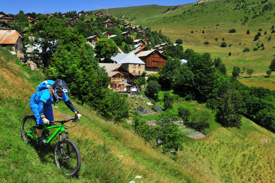
> This path brings you down to the Huez – Villard-Reculas tarmac road, which you take to the right for 3km to Villard-Reculas. The «Pas de la Confession» road daringly overhangs the entire Le Bourg-d’Oisans plain with superb viewpoints. Ride through Villard-Reculas. When you get to a car park, take the grassy path at the end to the left.
> The path into the Forêt de l’Ours starts below the war memorial, in a field where there are sometimes livestock. Take care, as «speed bumps» have been installed as far as the beginning of the wood.
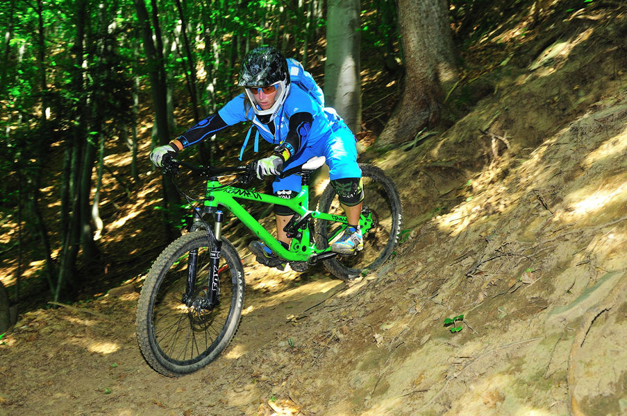
> Once in the woodland, the path is fast until a small footbridge. Just afterwards, go straight on at the switchback, following the signs [EN 6]. The first part has lovely banked switchbacks and then after a traverse, you get to the more technical section called ‘La Fontaine de l’Ours’.
> After this exciting section, you arrive directly in the Bourg-d’Oisans plain, close to the hamlet of Le Raffour. From here, you can either go straight on to Allemond, or turn left to Le Bourg-d’Oisans.Marking : FFC "EN 6" signpostingAdmission fee : Free access.Opening : From 01/06 to 01/11 daily. Subject to snow conditions.
Departure : Alpe d' Huez, 1850 m
Arrival: Allemond or Le Bourg-d'Oisans, 720 m
Length: 2 hours
Distance: 17 km
Highest point: 1 850 m
Lowest point: 720 m
Total height gain: 146 m
Total height loss: - 1280 m
Technique: 4/4
Endurance: 2/4
Map: Top 25 Bourg d'Oisans et l'Alpe d'Huez 3335 ET
ROUTE
> This route is signposted by the FFC [EN6].
> In Alpe d’Huez, ride up to the top of the resort, to the «Rond point des Pistes» roundabout and then onto the «Chemin Panoramique» that goes around the Grande Sure.
> Follow the panoramic path to a viewpoint table, where you can take a minute to admire the view, before switching into descent mode.
> Set off into the Combe du Bras, following the path straight down into the forest (not going up to the right). The upper part of the Combe du Bras features rather slippery soil bends. Lower down, the terrain becomes stony and more technical.
> This path brings you down to the Huez – Villard-Reculas tarmac road, which you take to the right for 3km to Villard-Reculas. The «Pas de la Confession» road daringly overhangs the entire Le Bourg-d’Oisans plain with superb viewpoints. Ride through Villard-Reculas. When you get to a car park, take the grassy path at the end to the left.
> The path into the Forêt de l’Ours starts below the war memorial, in a field where there are sometimes livestock. Take care, as «speed bumps» have been installed as far as the beginning of the wood.
> Once in the woodland, the path is fast until a small footbridge. Just afterwards, go straight on at the switchback, following the signs [EN 6]. The first part has lovely banked switchbacks and then after a traverse, you get to the more technical section called ‘La Fontaine de l’Ours’.
> After this exciting section, you arrive directly in the Bourg-d’Oisans plain, close to the hamlet of Le Raffour. From here, you can either go straight on to Allemond, or turn left to Le Bourg-d’Oisans.Marking : FFC "EN 6" signpostingAdmission fee : Free access.Opening : From 01/06 to 01/11 daily. Subject to snow conditions.
Area : Oisans
Report a problem
Website La forêt de l'Ours par la Combe du Bras Features of the application :
- Location and orientation on detailed maps thanks to the GPS of your smartphone
- Description of routes and points of interest on the route
- Photo gallery by route
- Detailed elevation profile
- Route tracking alert to warn you if you stray from the route
- Send predefined messages by SMS to your contacts
- Emergency module: trigger a call or send an emergency SMS in case of problem
- Agenda: access to events organized in the department
- News: find in the application the latest news on the web portal
- Adding achievements
- Add reports in case of problems encountered on the routes
- Share on social networks
Add your time and share your feelings
Services nearby

Musée d'Huez et de l'Oisans
Alpe d'Huez

Office de Tourisme
Alpe d'Huez
Tourist office of Villard-Reculas
Villard-Reculas
Oz en Oisans Tourist Office
Oz-en-Oisans

Cross-country skiing centre
Allemond


Follow us on
the digital trails
the digital trails


![]()
The Isère Outdoor application was created
by the Département de l'Isère
Infos & contact
Conseil départemental de l'Isère
7 rue Fantin Latour
CS 41096
38 022 Grenoble cedex 1
Tel. 04 76 00 38 38
 Isère Outdoor - Parcours - Forêt de l'Ours via the Combe du Bras
Hello, world! This is a toast message.
Isère Outdoor - Parcours - Forêt de l'Ours via the Combe du Bras
Hello, world! This is a toast message.
Isère Outdoor - Parcours - Forêt de l'Ours via the Combe du Bras
Hello, world! This is a toast message.


OK
Annuler