Mountain bike trail - Confluence du Rhône
Add to my favorites

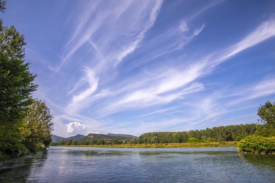
A route with no major changes in altitude, following the Rhône, Guiers and Bièvre rivers. Beautiful views over the Bugey region. Not to be missed!
The characteristics of the route.

Aoste (38)
- Distance 18.16 km
- Elevation gain 90 m
- Elevation lost 90 m
- Min. elevation 208 m
- Max. elevation. 262 m
- Duration (depending on pace) 1h30
- Marking Yes
Start from the Gallo-Roman Museum's parking in Aoste.
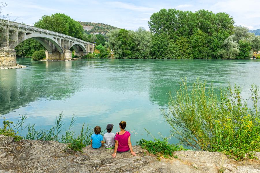
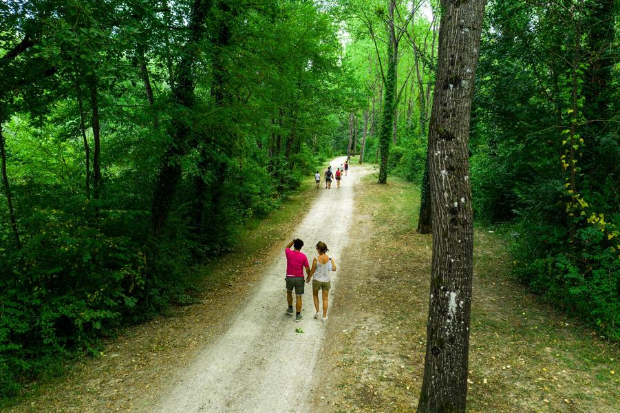
This is an accessible loop with large paths for pedestrians and cyclists between various watercourses and dikes (La Bièvre, Le Guiers and the junction with le Rhône). Take the time to embrace the landscape nearby Bugey's region.
ROUTE
After leaving Aosta, follow the Bièvre through the undergrowth on this wide, peaceful path. You pass through the village of St-Didier d'Aoste and enter the French Haut-Rhône Nature Reserve, where the Rhône River meets its tributaries, the Bièvre and the Guiers. This wetland with its many small islands is a refuge for the red kite, the European beaver and the great crested newt. You can also admire wild orchids and carnivorous plants such as the round-leaved sundew.
Follow the wide path along the Rhône and then the Guiers to Lac de Romagnieu, a leisure centre that charges a fee in summer and offers a wide range of activities: swimming, pétanque, volleyball, tennis, fishing, bar-restaurant, etc. It is generally possible to walk around the lake free of charge outside summer when the leisure centre is closed.
Between Romagnieu and Aoste, the route follows paths and small roads surrounded by cultivated fields.
WAYMARKING AND SIGNPOSTING
Follow the yellow marked path and the crossroads :
AOSTE > Normandoz > la Bièvre > Les Tuilières > St-Didier d'Aoste > la Digue du Rhône > Confluence > la Douane > le Château > Romagnieu > les Champagnes > AOSTEMarking : Follow the yellow marked path and the crossroads : AOSTE > Normandoz > la Bièvre > Les Tuilières > St-Didier d'Aoste > la Digue du Rhône > Confluence > la Douane > le Château > Romagnieu > les Champagnes > AOSTEEquipments : Car park, Admission fee : Free access.Opening : All year round daily.
Area : Vals du Dauphiné
Report a problem
Website Features of the application :
- Location and orientation on detailed maps thanks to the GPS of your smartphone
- Description of routes and points of interest on the route
- Photo gallery by route
- Detailed elevation profile
- Route tracking alert to warn you if you stray from the route
- Send predefined messages by SMS to your contacts
- Emergency module: trigger a call or send an emergency SMS in case of problem
- Agenda: access to events organized in the department
- News: find in the application the latest news on the web portal
- Adding achievements
- Add reports in case of problems encountered on the routes
- Share on social networks
Add your time and share your feelings
Services nearby

Galloroman Museum
Aoste

Malseroud's pond: Sensitive Natural Area
Les Abrets en Dauphiné
Dauphinois Weaving Museum
La Bâtie-Montgascon

Avenières Veyrins-Thuellin - Balcons du Dauphine Tourist Information Office
Les Avenières Veyrins-Thuellin

Relais Cyné de Faverges de la Tour
Faverges-de-la-Tour


Information updated on 2025-06-23 by Office de Tourisme des Vals du Dauphiné


Follow us on
the digital trails
the digital trails


![]()
The Isère Outdoor application was created
by the Département de l'Isère
Infos & contact
Conseil départemental de l'Isère
7 rue Fantin Latour
CS 41096
38 022 Grenoble cedex 1
Tel. 04 76 00 38 38
 Isère Outdoor - Parcours - Mountain bike trail - Confluence du Rhône
Hello, world! This is a toast message.
Isère Outdoor - Parcours - Mountain bike trail - Confluence du Rhône
Hello, world! This is a toast message.
Isère Outdoor - Parcours - Mountain bike trail - Confluence du Rhône
Hello, world! This is a toast message.


OK
Annuler