La passerelle de la Gaffe
Add to my favorites

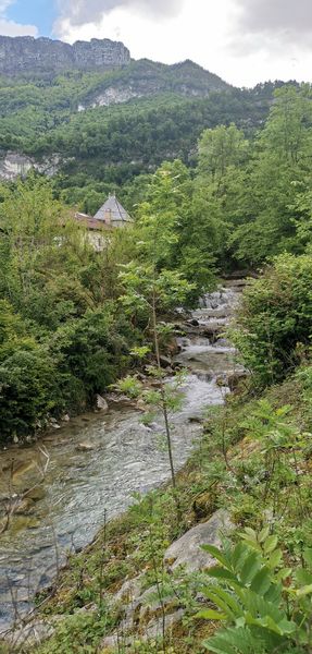
Au pied du Vercors, cette randonnée familiale chemine sans encombre jusqu’à la passerelle de Gaffe dans les majestueuses gorges de la Drevenne.
Route labeled FFRandonnée

The characteristics of the route.

Saint-Gervais (38)
- Distance 6.2 km
- Elevation gain 270 m
- Elevation lost 270 m
- Min. elevation 198 m
- Max. elevation. 330 m
- Duration (depending on pace) 2h
- Marking Yes
Equipments : Car park, Admission fee : Free access.Opening : From 01/01 to 31/12.
Area : Saint-Marcellin Vercors Isère
Report a problem
Website Pdf file Features of the application :
- Location and orientation on detailed maps thanks to the GPS of your smartphone
- Description of routes and points of interest on the route
- Photo gallery by route
- Detailed elevation profile
- Route tracking alert to warn you if you stray from the route
- Send predefined messages by SMS to your contacts
- Emergency module: trigger a call or send an emergency SMS in case of problem
- Agenda: access to events organized in the department
- News: find in the application the latest news on the web portal
- Adding achievements
- Add reports in case of problems encountered on the routes
- Share on social networks
yenneT
finished in 02:00:00
The 2026/04/06
En savoir plus
Ajouter votre chrono et partager vos sensations
2026/04/06 02:00:00
yenneT
yenneT
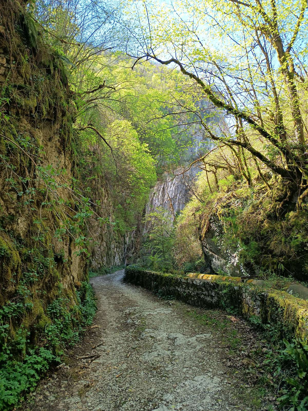
Évadez-vous dans le cadre préservé du Parc Naturel Régional du Vercors pour une randonnée ressourçante et accessible à tous. Ce parcours, facile d'accès et parfaitement balisé, sans difficulté technique, les bâtons peuvent être à prévoir car sa grimpe.
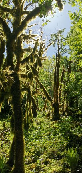
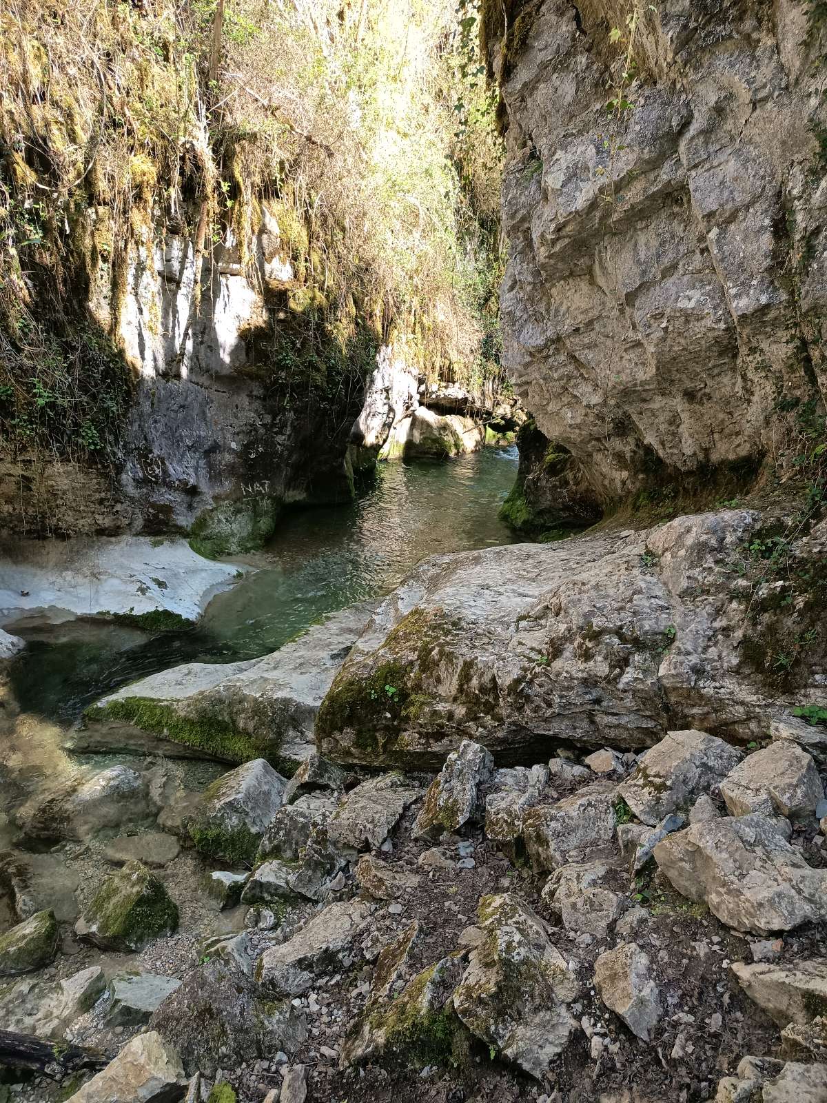
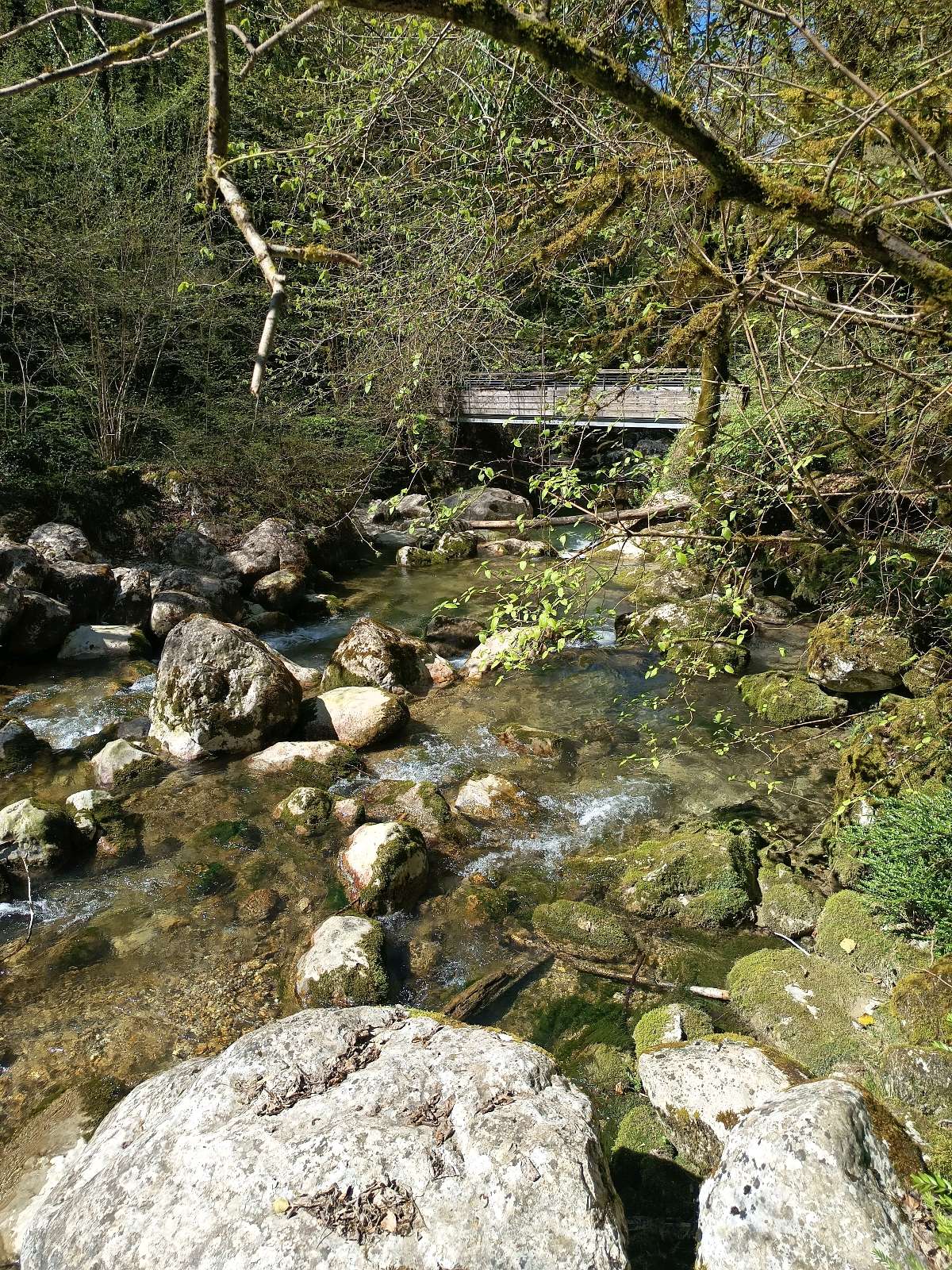
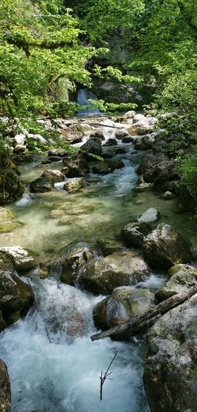
?L'itinéraire vous invite à suivre le cours de la Drevenne, une rivière aux eaux vives qui apporte une fraîcheur constante. Grâce à son tracé majoritairement ombragé sous la canopée, cette marche reste agréable, même lors des journées les plus chaudes.
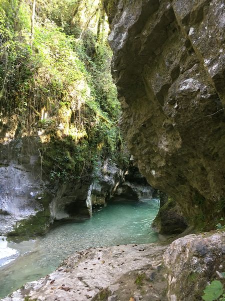
?Le point d'orgue de votre balade sera sans nul doute le passage par la Passerelle de la Gaffe. Ce spot incontournable offre un point de vue saisissant sur le relief et des panoramas dégagés sur la vallée en contrebas. Entre le murmure de l'eau et la majesté des falaises, profitez d'une immersion totale en pleine nature.
2026/04/06 02:00:00
yenneT
yenneT
Évadez-vous dans le cadre préservé du Parc Naturel Régional du Vercors pour une randonnée ressourçante et accessible à tous. Ce parcours, facile d'accès et parfaitement balisé, sans difficulté technique, les bâtons peuvent être à prévoir car sa grimpe.
?L'itinéraire vous invite à suivre le cours de la Drevenne, une rivière aux eaux vives qui apporte une fraîcheur constante. Grâce à son tracé majoritairement ombragé sous la canopée, cette marche reste agréable, même lors des journées les plus chaudes.
?Le point d'orgue de votre balade sera sans nul doute le passage par la Passerelle de la Gaffe. Ce spot incontournable offre un point de vue saisissant sur le relief et des panoramas dégagés sur la vallée en contrebas. Entre le murmure de l'eau et la majesté des falaises, profitez d'une immersion totale en pleine nature.
Services nearby

Espace naturel sensible du Domaine des Ecouges
Saint-Gervais

Le Grand Séchoir | Maison du pays de la noix
Vinay

Foyer de ski de fond Autrans
Autrans-Méaudre en Vercors
Centre Nordique d'Autrans
Autrans-Méaudre en Vercors

OTI Vercors - Bureau d'informations d'Autrans
Autrans-Méaudre en Vercors


Information updated on 2022-02-17 by Isère Attractivité


Follow us on
the digital trails
the digital trails


![]()
The Isère Outdoor application was created
by the Département de l'Isère
Infos & contact
Conseil départemental de l'Isère
7 rue Fantin Latour
CS 41096
38 022 Grenoble cedex 1
Tel. 04 76 00 38 38
 Isère Outdoor - Parcours - La passerelle de la Gaffe
Hello, world! This is a toast message.
Isère Outdoor - Parcours - La passerelle de la Gaffe
Hello, world! This is a toast message.
Isère Outdoor - Parcours - La passerelle de la Gaffe
Hello, world! This is a toast message.


OK
Annuler