Boucle vélo du Sappey-en- Chartreuse
Add to my favorites

Caution! Zone of vigilance near the route
Faucon pèlerin - du 01/02/2026 au 30/06/2026 In progress
Circaète Jean-le-Blanc - du 01/03/2026 au 30/09/2026 In progress
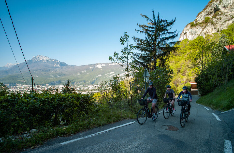
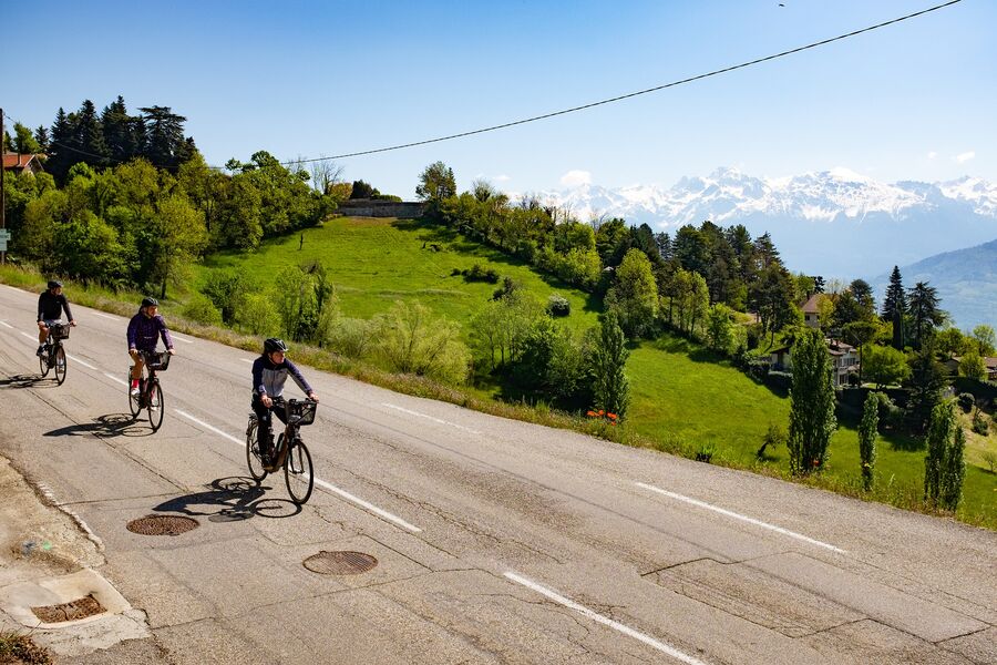
Reserved for seasoned cyclists, this is the most physical route in the entire Topo Vélo collection, with over 1000m of positive gradient and several passages at over 10%.
The characteristics of the route.
Grenoble (38)
- Distance 31 km
- Elevation gain 1090 m
- Elevation lost 1090 m
- Min. elevation 207 m
- Max. elevation. 1168 m
- Duration (depending on pace) 3h30
- Marking No
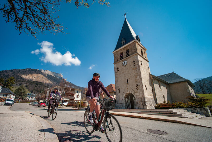
Close to Porte de France and the city center, the boulevard de l'Esplanade where you start your tour is equipped with parking spaces and is easily accessible by bike or streetcar E.
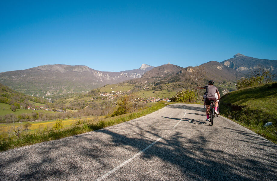
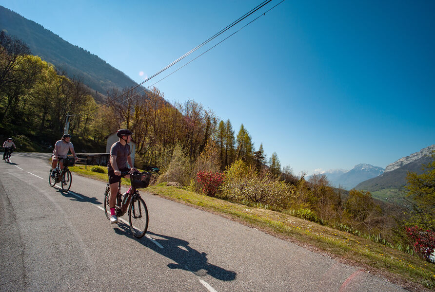
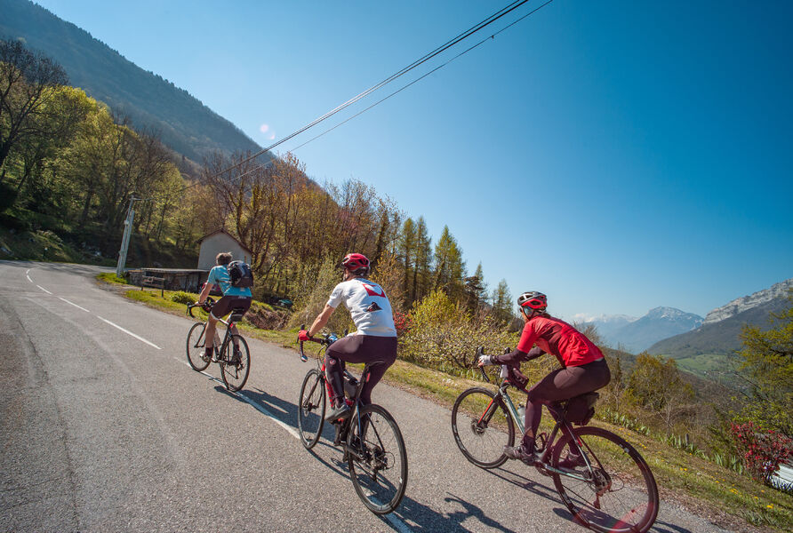
Soon after you set off, your ascent begins. After a brief breather at the Col de Clémencières, it picks up again to the Col de Palaquit. The second half of the route offers you a pure downhill winding descent for almost 15km.
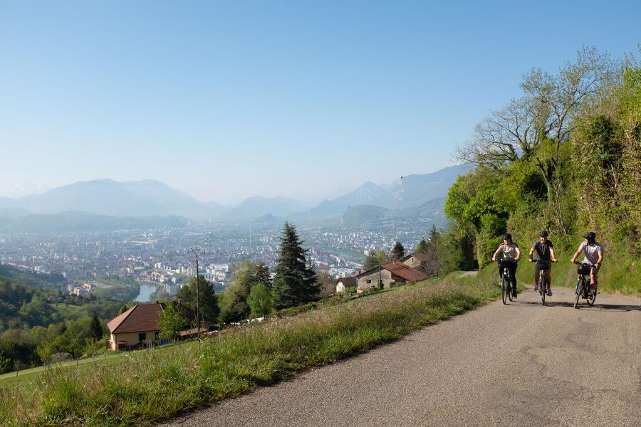
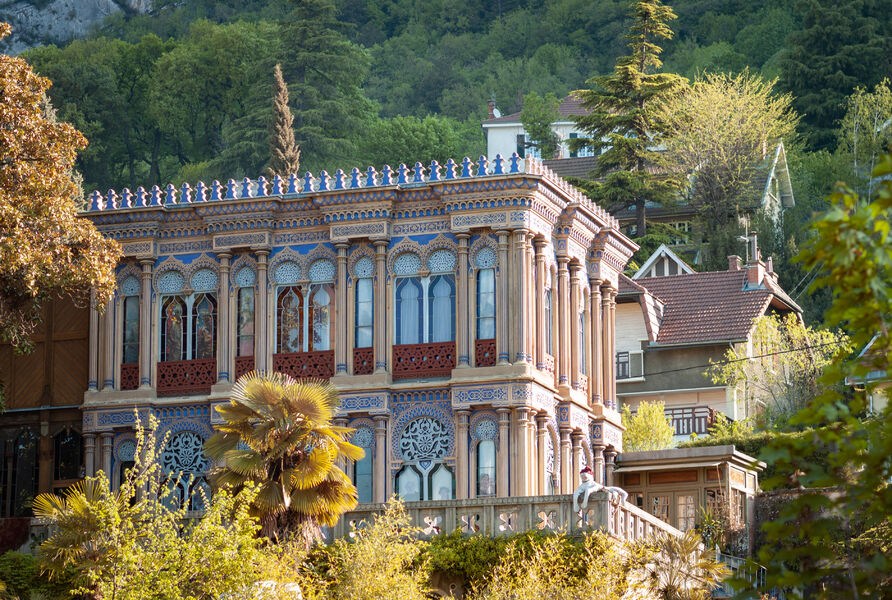
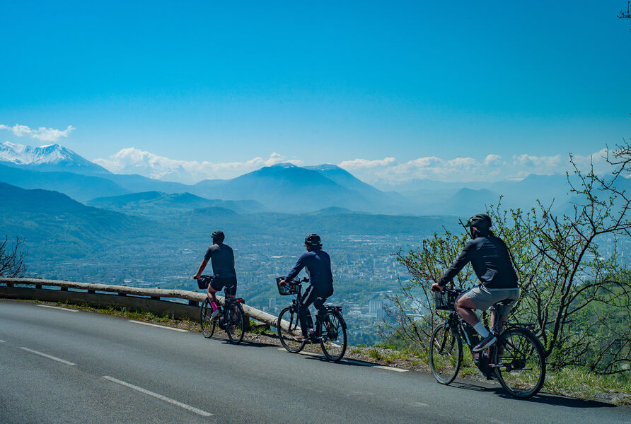
On the way up, you pass beautiful homes and charming chalets with breathtaking views over the valley. As the gradient rises, the undergrowth provides a welcome cooling effect. On the descent, you'll have to force yourself to concentrate on the road, as the panorama over Belledonne and the metropolis is so breathtaking.
From the parking lot, head north on Boulevard de l'Esplanade, then turn left onto Route de Lyon, using the cycle lane on the right-hand side of the road. Then follow the cycle path along the tramway tracks on the right.
Leave the cycle track on your right. Carefully cross Rue de la Résistance to take off on Rue de Narbonne, which takes you uphill for 4.5km, with sections at over 10%.
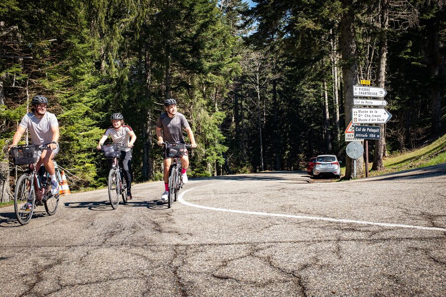
At Ripaillère, turn right towards Grenoble, Quaix, then left onto the D57, route de Clémencières, which becomes route de Sarcenas once you've passed the Col de Clémencières.
Leave the D57 for a few moments, turning right onto the Chemin de Bonnetière. At the end of the track, rejoin the D57 and continue climbing on the right. Just over 1km separates you from the Col de Palaquit, the highest point of your journey.
At the pass, turn right onto the Col de Porte road (D512). Follow this road downhill for 15km. Pass the Col de Vence, cross La Tronche and finally return to Grenoble along the banks of the Isère, whose course naturally takes you back to your starting point.Equipments : Parking nearby, Admission fee : Free access.Opening : All year round. Subject to favorable weather.
Soon after you set off, your ascent begins. After a brief breather at the Col de Clémencières, it picks up again to the Col de Palaquit. The second half of the route offers you a pure downhill winding descent for almost 15km.
On the way up, you pass beautiful homes and charming chalets with breathtaking views over the valley. As the gradient rises, the undergrowth provides a welcome cooling effect. On the descent, you'll have to force yourself to concentrate on the road, as the panorama over Belledonne and the metropolis is so breathtaking.
From the parking lot, head north on Boulevard de l'Esplanade, then turn left onto Route de Lyon, using the cycle lane on the right-hand side of the road. Then follow the cycle path along the tramway tracks on the right.
Leave the cycle track on your right. Carefully cross Rue de la Résistance to take off on Rue de Narbonne, which takes you uphill for 4.5km, with sections at over 10%.
At Ripaillère, turn right towards Grenoble, Quaix, then left onto the D57, route de Clémencières, which becomes route de Sarcenas once you've passed the Col de Clémencières.
Leave the D57 for a few moments, turning right onto the Chemin de Bonnetière. At the end of the track, rejoin the D57 and continue climbing on the right. Just over 1km separates you from the Col de Palaquit, the highest point of your journey.
At the pass, turn right onto the Col de Porte road (D512). Follow this road downhill for 15km. Pass the Col de Vence, cross La Tronche and finally return to Grenoble along the banks of the Isère, whose course naturally takes you back to your starting point.Equipments : Parking nearby, Admission fee : Free access.Opening : All year round. Subject to favorable weather.
Area : Grenoble-Alpes Métropole
Report a problem
Website Pdf file Features of the application :
- Location and orientation on detailed maps thanks to the GPS of your smartphone
- Description of routes and points of interest on the route
- Photo gallery by route
- Detailed elevation profile
- Route tracking alert to warn you if you stray from the route
- Send predefined messages by SMS to your contacts
- Emergency module: trigger a call or send an emergency SMS in case of problem
- Agenda: access to events organized in the department
- News: find in the application the latest news on the web portal
- Adding achievements
- Add reports in case of problems encountered on the routes
- Share on social networks
Add your time and share your feelings
Services nearby

Mountain Troops Museum
Grenoble
The dauphinois museum
Grenoble

Bastille Tourist Information Center
Grenoble
Musée Stendhal
Grenoble
Saint-Laurent Archaeological Museum, Grenoble
Grenoble


Information updated on 2024-08-21 by Office de Tourisme Grenoble Alpes


Follow us on
the digital trails
the digital trails


![]()
The Isère Outdoor application was created
by the Département de l'Isère
Infos & contact
Conseil départemental de l'Isère
7 rue Fantin Latour
CS 41096
38 022 Grenoble cedex 1
Tel. 04 76 00 38 38
 Isère Outdoor - Parcours - Boucle vélo du Sappey-en- Chartreuse
Hello, world! This is a toast message.
Isère Outdoor - Parcours - Boucle vélo du Sappey-en- Chartreuse
Hello, world! This is a toast message.
Isère Outdoor - Parcours - Boucle vélo du Sappey-en- Chartreuse
Hello, world! This is a toast message.


OK
Annuler