Boucle vélo Saint-Paul de Varces
Add to my favorites

Caution! Zone of vigilance near the route
Faucon pèlerin - du 01/02/2026 au 30/06/2026 In progress
Faucon pèlerin - du 01/02/2026 au 30/06/2026 In progress
Aigle royal - du 01/01/2026 au 31/08/2026 In progress
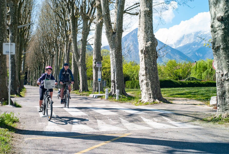
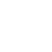
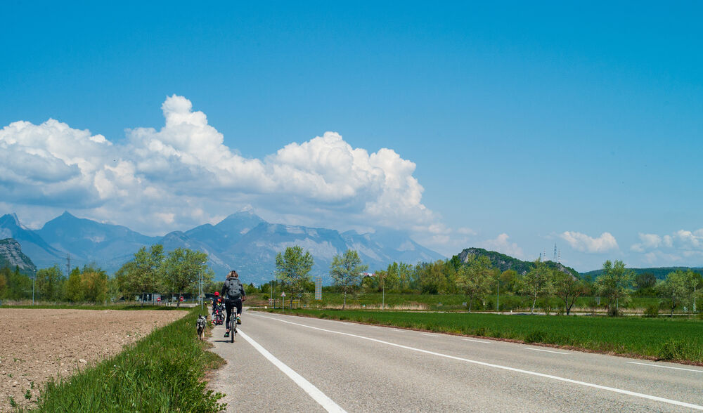
This roadside ride, with its steep gradients on the outward journey, is best reserved for the relatively experienced or those equipped with a VAE.
The characteristics of the route.
Varces-Allières-et-Risset (38)
- Distance 13.3 km
- Elevation gain 260 m
- Elevation lost 260 m
- Min. elevation 273 m
- Max. elevation. 463 m
- Duration (depending on pace) 1h20
- Marking No
The Place de la République, the starting point for your tour, is surrounded by shops and equipped with numerous shady benches. With plenty of parking, bordered by the D1075 and served by buses 25 and 26, it's the ideal meeting place.
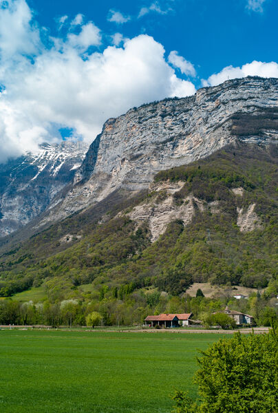
After leaving Varces-Allières-et-Risset, you take a small, busy stretch of road. You then begin a steady ascent on quiet roads. Finally, the route offers a beautiful descent back to your starting point. If you wish, you can complete the route with a short loop around Saint-Pierre church.
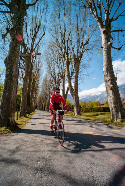
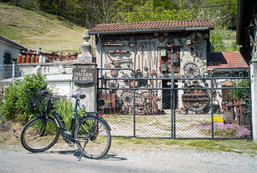
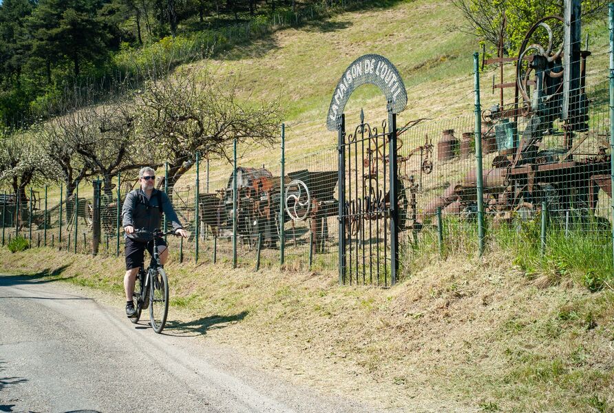
Shortly after your departure, you'll head up the allée des Platanes, which once led noble guests to the Château du Bocage. After passing the former fortified house of Brigaudière, the Maison de l'outil and its open-air collection are sure to brighten your climb. As you skirt the foothills of the Vercors, take a break in the church square at Saint-Paul-de-Varces. To finish on a high note, you'll need to climb up to Saint-Pierre church, whose forecourt offers a breathtaking view.
1 From Place de la République, turn right into Rue René Chrétien, then left into Rue Jean Jaurès. 200m further on, turn slightly right into rue du Portail Rouge.
2 Turn left into the allée des Platanes, which naturally leads to a right turn into rue La Valette. At the next junction, turn left onto rue de Mazetière.
3 At the traffic circle, take the third exit, route du Martinais-d'en-Haut, to cross the A51 motorway to Saint-Paul-de-Varces.
4 At the traffic circle, take the third exit, route de Grenoble. At the next junction, turn right onto chemin des Combes.
5 Continue straight on, Chemin du Rocher de la Bourgeoise. 900 m further on, turn slightly right, Chemin Saint-Ange.
6 After the church, turn right onto Charrière Chaude and follow this road for 1.5km.
7 Turn left onto chemin du Bémont, which becomes chemin de la bascule 2.1 km further on.
8 Turn right onto the D107, which will be known successively as route du Vercors, rue des Gaberts and rue du Vercors.
9 Return to your starting point, taking rue Jean Jaurès on your right. At the next junction, turn right into rue René Chrétien, but follow it all the way up.
10 Continue on Montée Perpero, which rises on your right. After 180m, turn left onto the chemin du cimetière. This takes you around the church of Saint-Pierre, before retracing your steps to return to your starting point at Place de la République.Equipments : Parking nearby, Admission fee : Free access.Opening : All year round. Subject to favorable weather.
After leaving Varces-Allières-et-Risset, you take a small, busy stretch of road. You then begin a steady ascent on quiet roads. Finally, the route offers a beautiful descent back to your starting point. If you wish, you can complete the route with a short loop around Saint-Pierre church.
Shortly after your departure, you'll head up the allée des Platanes, which once led noble guests to the Château du Bocage. After passing the former fortified house of Brigaudière, the Maison de l'outil and its open-air collection are sure to brighten your climb. As you skirt the foothills of the Vercors, take a break in the church square at Saint-Paul-de-Varces. To finish on a high note, you'll need to climb up to Saint-Pierre church, whose forecourt offers a breathtaking view.
1 From Place de la République, turn right into Rue René Chrétien, then left into Rue Jean Jaurès. 200m further on, turn slightly right into rue du Portail Rouge.
2 Turn left into the allée des Platanes, which naturally leads to a right turn into rue La Valette. At the next junction, turn left onto rue de Mazetière.
3 At the traffic circle, take the third exit, route du Martinais-d'en-Haut, to cross the A51 motorway to Saint-Paul-de-Varces.
4 At the traffic circle, take the third exit, route de Grenoble. At the next junction, turn right onto chemin des Combes.
5 Continue straight on, Chemin du Rocher de la Bourgeoise. 900 m further on, turn slightly right, Chemin Saint-Ange.
6 After the church, turn right onto Charrière Chaude and follow this road for 1.5km.
7 Turn left onto chemin du Bémont, which becomes chemin de la bascule 2.1 km further on.
8 Turn right onto the D107, which will be known successively as route du Vercors, rue des Gaberts and rue du Vercors.
9 Return to your starting point, taking rue Jean Jaurès on your right. At the next junction, turn right into rue René Chrétien, but follow it all the way up.
10 Continue on Montée Perpero, which rises on your right. After 180m, turn left onto the chemin du cimetière. This takes you around the church of Saint-Pierre, before retracing your steps to return to your starting point at Place de la République.Equipments : Parking nearby, Admission fee : Free access.Opening : All year round. Subject to favorable weather.
Area : Grenoble-Alpes Métropole
Report a problem
Website Pdf file Pdf file Features of the application :
- Location and orientation on detailed maps thanks to the GPS of your smartphone
- Description of routes and points of interest on the route
- Photo gallery by route
- Detailed elevation profile
- Route tracking alert to warn you if you stray from the route
- Send predefined messages by SMS to your contacts
- Emergency module: trigger a call or send an emergency SMS in case of problem
- Agenda: access to events organized in the department
- News: find in the application the latest news on the web portal
- Adding achievements
- Add reports in case of problems encountered on the routes
- Share on social networks
Add your time and share your feelings
Services nearby

Musée Champollion
Vif
Musée Autrefois
Champ-sur-Drac

Espace naturel sensible de la tourbière du Peuil
Claix
The chemistry Museum
Jarrie
Espace Histo Bus Dauphinois
Le Pont-de-Claix


Information updated on 2024-08-21 by Office de Tourisme Grenoble Alpes


Follow us on
the digital trails
the digital trails


![]()
The Isère Outdoor application was created
by the Département de l'Isère
Infos & contact
Conseil départemental de l'Isère
7 rue Fantin Latour
CS 41096
38 022 Grenoble cedex 1
Tel. 04 76 00 38 38
 Isère Outdoor - Parcours - Boucle vélo Saint-Paul de Varces
Hello, world! This is a toast message.
Isère Outdoor - Parcours - Boucle vélo Saint-Paul de Varces
Hello, world! This is a toast message.
Isère Outdoor - Parcours - Boucle vélo Saint-Paul de Varces
Hello, world! This is a toast message.


OK
Annuler