La Pierre Percée - 9,5 km - Vert
Add to my favorites

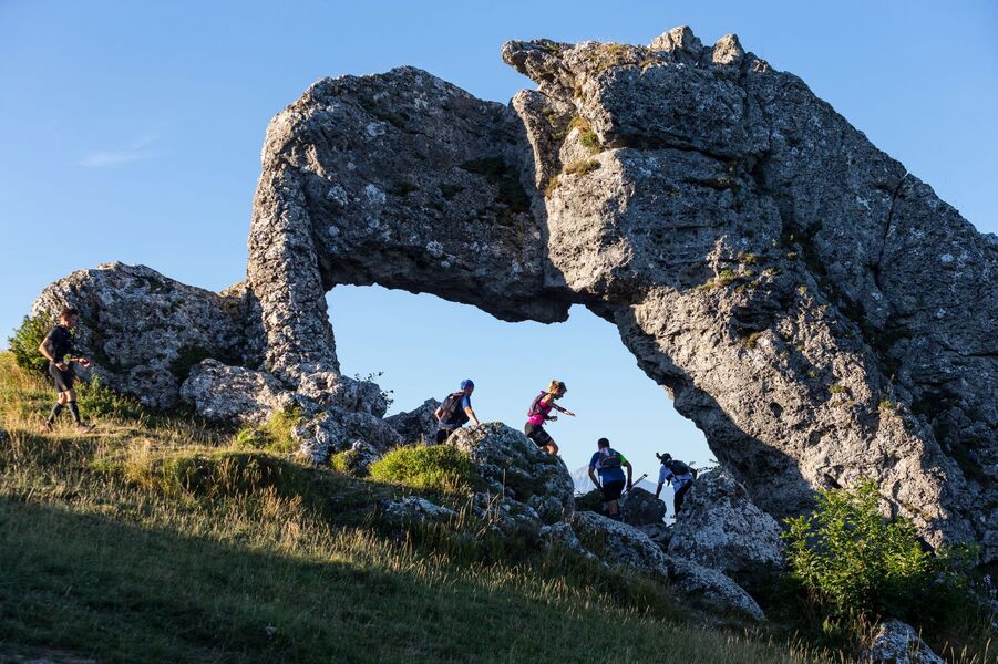
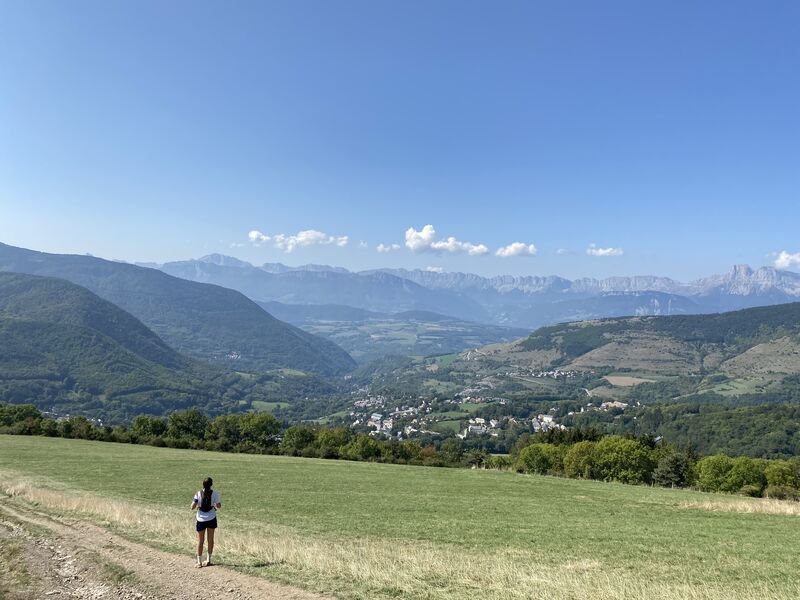
Après un départ assez facile, à plat, vous descendrez jusqu’à l’étang du Crey. La montée de la Pierre Percée est assez longue mais ombragée, et sur le final exposé, la marche sera peut-être bienvenue…Retour facile en descente.
The characteristics of the route.

La Motte-d'Aveillans (38)
- Distance 9.59 km
- Elevation gain 384 m
- Elevation lost 384 m
- Min. elevation 892 m
- Max. elevation. 1243 m
- Marking Yes
Features of the application :
- Location and orientation on detailed maps thanks to the GPS of your smartphone
- Description of routes and points of interest on the route
- Photo gallery by route
- Detailed elevation profile
- Route tracking alert to warn you if you stray from the route
- Send predefined messages by SMS to your contacts
- Emergency module: trigger a call or send an emergency SMS in case of problem
- Agenda: access to events organized in the department
- News: find in the application the latest news on the web portal
- Adding achievements
- Add reports in case of problems encountered on the routes
- Share on social networks
Add your time and share your feelings
Services nearby

Musuem "La Mine Image"
La Motte-d'Aveillans

Maison du Tourisme de La Motte d'Aveillans
La Motte-d'Aveillans

Belvédère Olivier Messiaen
Saint-Théoffrey
Museum "Musée Matheysin"
La Mure
Atelier Gilioli
Saint-Martin-de-la-Cluze


Information updated on 2021-08-05 by Matheysine Tourisme


Follow us on
the digital trails
the digital trails


![]()
The Isère Outdoor application was created
by the Département de l'Isère
Infos & contact
Conseil départemental de l'Isère
7 rue Fantin Latour
CS 41096
38 022 Grenoble cedex 1
Tel. 04 76 00 38 38
 Isère Outdoor - Parcours - La Pierre Percée - 9,5 km - Vert
Hello, world! This is a toast message.
Isère Outdoor - Parcours - La Pierre Percée - 9,5 km - Vert
Hello, world! This is a toast message.
Isère Outdoor - Parcours - La Pierre Percée - 9,5 km - Vert
Hello, world! This is a toast message.


OK
Annuler