Panoramic views of the Trièves - Cycling path n°3
Add to my favorites

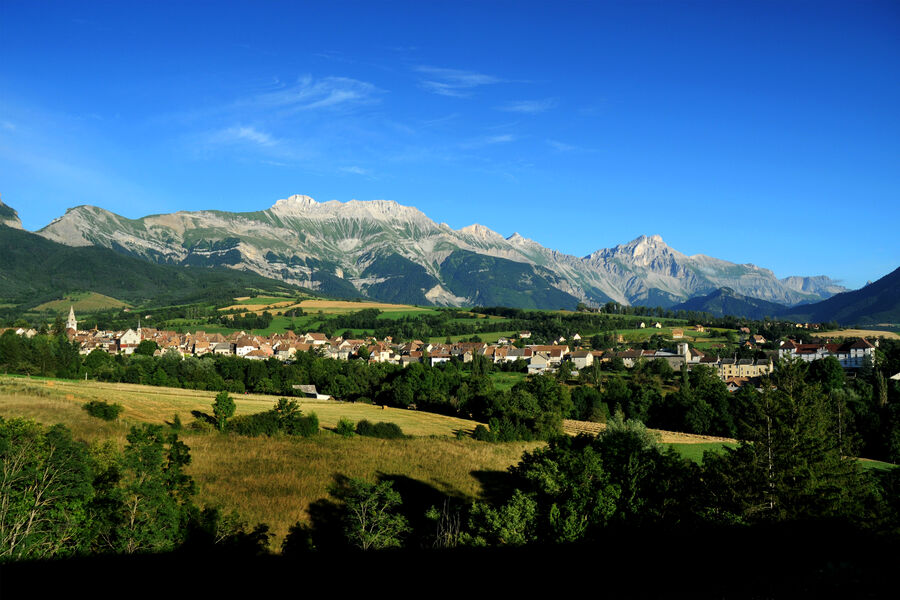
This loop offers many panoramic views of the Trièves and its cultivated land, which in spring is a colorful patchwork! Take the time to look up from the handlebars on this very pleasant route, punctuated by splendid viewpoints!
The characteristics of the route.

Mens (38)
- Distance 36 km
- Elevation gain 770 m
- Elevation lost 770 m
- Min. elevation 582 m
- Max. elevation. 986 m
- Duration (depending on pace) 1h50
- Marking No
Equipments : Parking nearby, Good plans : You'll find everything you need for minor repairs at every Tourist Office branch.Admission fee : Free access.Opening : All year round.
Subject to favorable weather.
Area : Trièves
Report a problem
Website Pdf file Pdf file Features of the application :
- Location and orientation on detailed maps thanks to the GPS of your smartphone
- Description of routes and points of interest on the route
- Photo gallery by route
- Detailed elevation profile
- Route tracking alert to warn you if you stray from the route
- Send predefined messages by SMS to your contacts
- Emergency module: trigger a call or send an emergency SMS in case of problem
- Agenda: access to events organized in the department
- News: find in the application the latest news on the web portal
- Adding achievements
- Add reports in case of problems encountered on the routes
- Share on social networks
Add your time and share your feelings
Services nearby

Musée du Trièves
Mens

Bureau d'Informations Touristiques de Mens - Office de Tourisme du Trièves
Mens
Point d'information Tréminis
Tréminis

Foyer nordique de Tréminis
Tréminis
Espace Giono
Lalley


Information updated on 2024-12-19 by Office de Tourisme du Trièves


Follow us on
the digital trails
the digital trails


![]()
The Isère Outdoor application was created
by the Département de l'Isère
Infos & contact
Conseil départemental de l'Isère
7 rue Fantin Latour
CS 41096
38 022 Grenoble cedex 1
Tel. 04 76 00 38 38
 Isère Outdoor - Parcours - Panoramic views of the Trièves - Cycling path n°3
Hello, world! This is a toast message.
Isère Outdoor - Parcours - Panoramic views of the Trièves - Cycling path n°3
Hello, world! This is a toast message.
Isère Outdoor - Parcours - Panoramic views of the Trièves - Cycling path n°3
Hello, world! This is a toast message.


OK
Annuler