From Obiou to Mont-Aiguille - Cycling path n°7
Add to my favorites

Caution! Zone of vigilance near the route
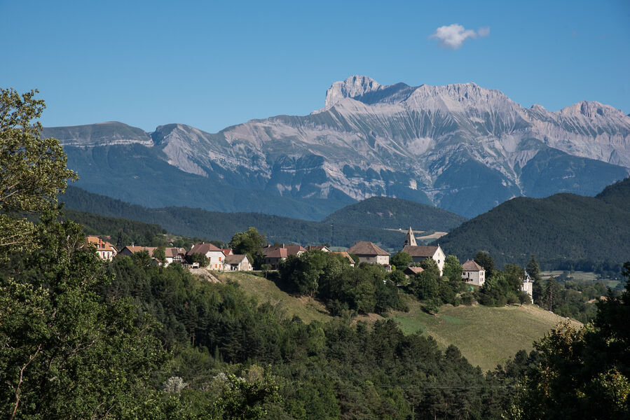
A pleasant, varied route through the back roads of the Trièves, taking in the scenery on both the Vercors and Dévoluy sides of the region, and admiring two emblematic peaks: Obiou and Mont Aiguille!
The characteristics of the route.

Clelles (38)
- Distance 53.4 km
- Elevation gain 970 m
- Elevation lost 970 m
- Min. elevation 582 m
- Max. elevation. 1112 m
- Duration (depending on pace) 2h45
- Marking No
Good plans : You'll find everything you need for minor repairs at every Tourist Office branch.Delicate passages : At the start of the route, you take the RD1075 with heavy traffic for 300m before turning left towards Longefonds. Please take care!Admission fee : Free access.Opening : All year round.
Area : Trièves
Report a problem
Website Pdf file Pdf file Features of the application :
- Location and orientation on detailed maps thanks to the GPS of your smartphone
- Description of routes and points of interest on the route
- Photo gallery by route
- Detailed elevation profile
- Route tracking alert to warn you if you stray from the route
- Send predefined messages by SMS to your contacts
- Emergency module: trigger a call or send an emergency SMS in case of problem
- Agenda: access to events organized in the department
- News: find in the application the latest news on the web portal
- Adding achievements
- Add reports in case of problems encountered on the routes
- Share on social networks
Add your time and share your feelings
Services nearby

Point d'information Chichilianne
Chichilianne

Foyer nordique de Chichilianne
Chichilianne

Espace Giono
Lalley
Bureau d'Informations Touristiques de Gresse en Vercors - Office de Tourisme du Trièves
Gresse-en-Vercors
Foyer nordique de Gresse-en-Vercors
Gresse-en-Vercors


Information updated on 2024-12-19 by Office de Tourisme du Trièves


Follow us on
the digital trails
the digital trails


![]()
The Isère Outdoor application was created
by the Département de l'Isère
Infos & contact
Conseil départemental de l'Isère
7 rue Fantin Latour
CS 41096
38 022 Grenoble cedex 1
Tel. 04 76 00 38 38
 Isère Outdoor - Parcours - From Obiou to Mont-Aiguille - Cycling path n°7
Hello, world! This is a toast message.
Isère Outdoor - Parcours - From Obiou to Mont-Aiguille - Cycling path n°7
Hello, world! This is a toast message.
Isère Outdoor - Parcours - From Obiou to Mont-Aiguille - Cycling path n°7
Hello, world! This is a toast message.


OK
Annuler