Randonnée : Les Adrets - Laval
Add to my favorites

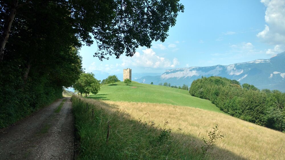
Itinéraire n° 41 : Cette boucle relativement facile est un joli trait d'union entre les villages des Adrets et de Laval. La tour Montfallet point d'exclamation entre les deux, veille sur la vallée du Grésivaudan pour protéger les Balcons des envahisseurs.
The characteristics of the route.

Laval-en-Belledonne (38)
- Distance 13.9 km
- Elevation gain 500 m
- Elevation lost 500 m
- Min. elevation 680 m
- Max. elevation. 1014 m
- Marking No
Opening : All year round.
Subject to favorable weather.
Area : Grésivaudan
Report a problem
Website Bel'Velec carte itinéraire n°41 Plan général Bel'velec - 8 itinéraires Pdf file Features of the application :
- Location and orientation on detailed maps thanks to the GPS of your smartphone
- Description of routes and points of interest on the route
- Photo gallery by route
- Detailed elevation profile
- Route tracking alert to warn you if you stray from the route
- Send predefined messages by SMS to your contacts
- Emergency module: trigger a call or send an emergency SMS in case of problem
- Agenda: access to events organized in the department
- News: find in the application the latest news on the web portal
- Adding achievements
- Add reports in case of problems encountered on the routes
- Share on social networks
Add your time and share your feelings
Services nearby

Bureau d'Information Touristique de Prapoutel / Les 7 Laux - Office de Tourisme Belledonne Chartreuse
Les Sept Laux Prapoutel

Espace naturel sensible du Marais de Montfort
Crolles

Refuge le Habert d'Aiguebelle
Laval

La Combe de Lancey Museum
La Combe-de-Lancey
Bureau d'Information Touristique du Pleynet / Les 7 Laux - Office de Tourisme Belledonne Chartreuse
Les Sept Laux Le Pleynet


Information updated on 2024-02-06 by Office de Tourisme de Belledonne Chartreuse


Follow us on
the digital trails
the digital trails


![]()
The Isère Outdoor application was created
by the Département de l'Isère
Infos & contact
Conseil départemental de l'Isère
7 rue Fantin Latour
CS 41096
38 022 Grenoble cedex 1
Tel. 04 76 00 38 38
 Isère Outdoor - Parcours - Randonnée : Les Adrets - Laval
Hello, world! This is a toast message.
Isère Outdoor - Parcours - Randonnée : Les Adrets - Laval
Hello, world! This is a toast message.
Isère Outdoor - Parcours - Randonnée : Les Adrets - Laval
Hello, world! This is a toast message.


OK
Annuler