Le Pré du Playnet
Add to my favorites

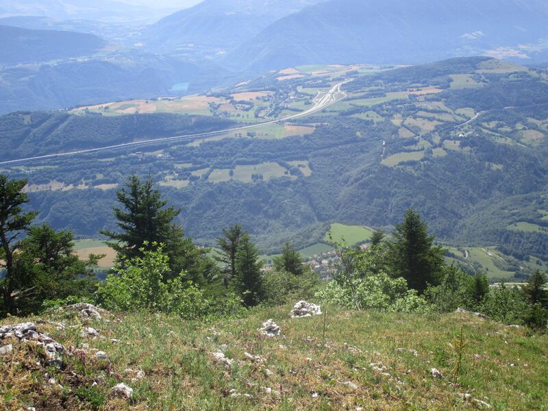
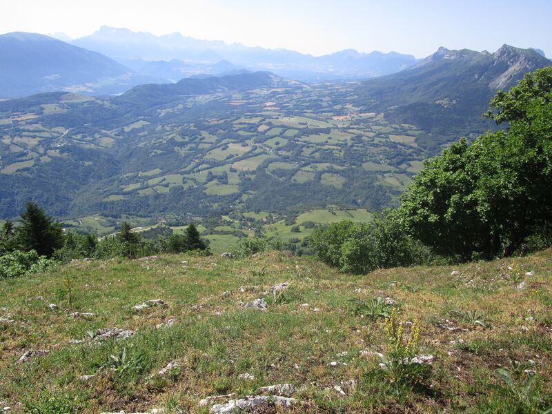
Un itinéraire sur les contreforts est du Vercors avec un parcours de crête passant par la prairie du Playnet, offrant un panorama exceptionnel sur le Trièves et le Dévoluy.
Route labeled FFRandonnée

The characteristics of the route.

Miribel-Lanchâtre (38)
- Distance 9.5 km
- Elevation gain 750 m
- Elevation lost 750 m
- Min. elevation 756 m
- Max. elevation. 1490 m
- Duration (depending on pace) 3h
- Marking Yes
Equipments : Car park, Admission fee : Free access.Opening : All year round.
Subject to favorable weather.Step by step description : 1. From the parking lot, take the small road towards Col de Soliet as far as the "Les Anémones" sign.
2. Turn left towards Prélenfrey/Chatelard. The path descends into the forest (in wet weather, take the path alongside the track), then crosses a clearing (panoramic view of Les Deux Sœurs). The route joins the D8B; cross it and follow it for 100 m. At Arzelier, leave the road and take the path on the right towards Prélenfrey. Continue downhill through the forest to the "Chatelard (1,006 m)" sign.
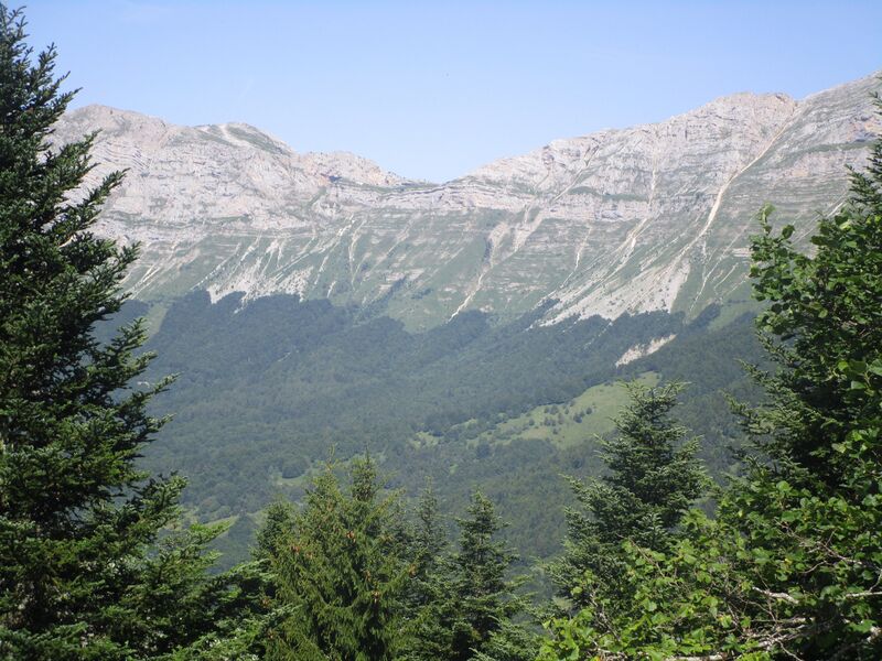
3. Cross the D8B to the right in the direction of Combe Ravier, then head up the undergrowth track (several paths, follow the yellow and green markings). Around 900 m before the crests, the track becomes steep (take care in wet weather).
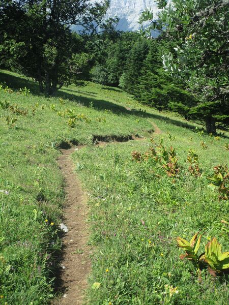
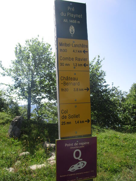
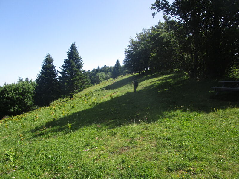
4. At the "Combe Ravier (1,230 m)" post, continue along the ridges towards Pré du Playnet. After a series of steep switchbacks through a forest of fir and beech, the path skirts the cliffs (take care!) and opens out onto a wide meadow at Playnet (panoramic view of all the surrounding massifs). Continue to the "Playnet (1,468 m)" signpost (picnic table).
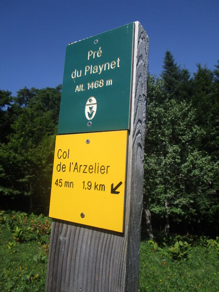
5. Leave the ridge path and descend towards the Col de l'Arzelier. The descent continues through the forest before reaching a clearing just before the pass (view of the Deux Soeurs and the Col de l'Arzelier).
2. At the "Les Anémones" sign, turn left to reach the parking lot.
Area : Grenoble-Alpes Métropole
Report a problem
Website Pdf map Features of the application :
- Location and orientation on detailed maps thanks to the GPS of your smartphone
- Description of routes and points of interest on the route
- Photo gallery by route
- Detailed elevation profile
- Route tracking alert to warn you if you stray from the route
- Send predefined messages by SMS to your contacts
- Emergency module: trigger a call or send an emergency SMS in case of problem
- Agenda: access to events organized in the department
- News: find in the application the latest news on the web portal
- Adding achievements
- Add reports in case of problems encountered on the routes
- Share on social networks
Add your time and share your feelings
Services nearby

Atelier Gilioli
Saint-Martin-de-la-Cluze

Refuge La Soldanelle
Château-Bernard

Point d'information du Môle (Lac de Monteynard-Avignonet)
Treffort
Bureau d'Informations Touristiques de Gresse en Vercors - Office de Tourisme du Trièves
Gresse-en-Vercors
Maison du Tourisme de La Motte d'Aveillans
La Motte-d'Aveillans


Follow us on
the digital trails
the digital trails


![]()
The Isère Outdoor application was created
by the Département de l'Isère
Infos & contact
Conseil départemental de l'Isère
7 rue Fantin Latour
CS 41096
38 022 Grenoble cedex 1
Tel. 04 76 00 38 38
 Isère Outdoor - Parcours - Le Pré du Playnet
Hello, world! This is a toast message.
Isère Outdoor - Parcours - Le Pré du Playnet
Hello, world! This is a toast message.
Isère Outdoor - Parcours - Le Pré du Playnet
Hello, world! This is a toast message.


OK
Annuler