The Auris loop
Add to my favorites

Caution! Zone of vigilance near the route
Cassini - du 20/06/2026 au 20/10/2026 In progress
Alpage d'Auris - du 22/05/2026 au 22/10/2026 In progress
Partie haute la Garde - du 01/06/2026 au 30/10/2026 In progress
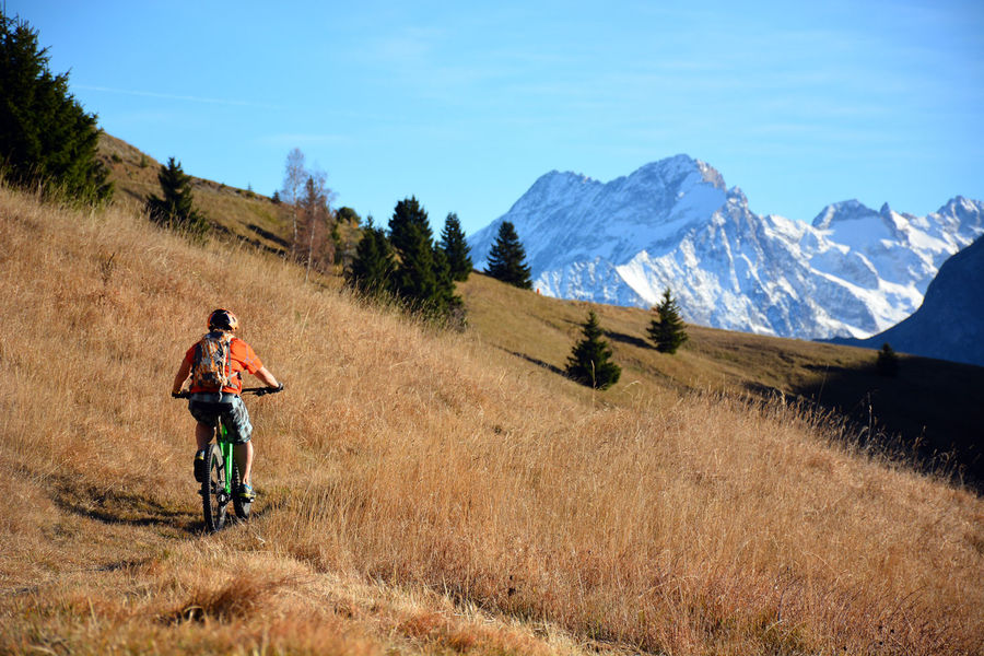
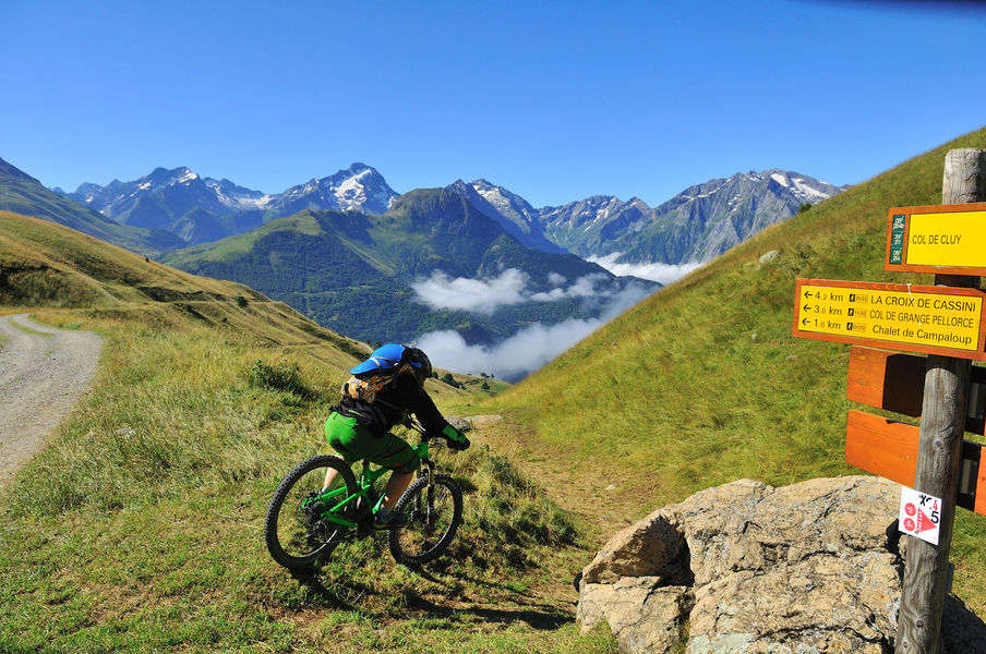
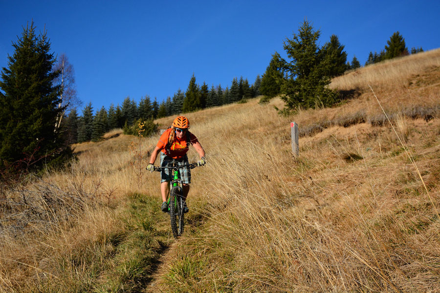
This typical cross-country loop winds its way along the balcony paths of Auris. This is a pleasant, south-facing route, where you can explore some interesting single tracks, ride through unspoiled hamlets and enjoy amazing views over La Meije.
The characteristics of the route.

Auris-en-Oisans (38)
- Distance 16.39 km
- Elevation gain 720 m
- Elevation lost 720 m
- Min. elevation 1295 m
- Max. elevation. 1793 m
- Duration (depending on pace) 3h30
- Marking No
Itinerary from the "VTT en Oisans" guide (Oisans Tourisme)
Start/finish (loop): Auris-en-Oisans (resort), 1,600 m
Duration: 3h30
Distance: 16 km
Highest point: 1,800 m
Lowest point: 1,298 m
Elevation gain: + 710 m
Negative altitude difference: - 710 m
Technical: 3/4
Endurance: 3/4
Map: Top 25 Bourg d'Oisans et l'Alpe d'Huez 3335 ET
ITINERARY
> From the Orgières parking lot in Auris, follow the signs for "Plancet" downhill to the right. The start of the trail is below the caravan park. Cross the beautiful spruce forest on a narrow path with a rather downhill profile for 2 km.
> When you reach the Piégut ridge, turn left down a straight, steep path to Plancet. You pass the small picnic area at Plancet and shortly afterwards, don't miss the intersection that takes you back to the hamlet of Certs. Cross the fence to the left and head across the fields to Les Certs.
> At Les Certs, cross the hamlet upwards to join a beautiful path that leads up to Les Cours. Cross Les Cours and head up to the Chemin du facteur, which takes you to the Croix de Trévoux. From here, join the road and turn left to reach the hamlet of Puy-le-Haut.
> From Le Puy, head for the Col de Cluy via the Chemin du Lauzat, then the 4x4 track that takes you past the Perchoux barn. The climb to the Col de Cluy (5 km, 500 m D+) is a fine one. Alternatively, you can shorten the climb by heading straight for the St-Giraud chapel on the 4x4 track.
> Just before reaching the Col de Cluy (1800 m), turn left onto a small grassy path that descends towards the Chapelle St-Giraud.
> Just before reaching the road, take the small path leading up to the chapelle St-Giraud. Pass behind the chapel and follow the path back to Auris, overhanging the road.Admission fee : Free access.Opening : From 01/06 to 31/10. Subject to favorable snow and weather conditions.
Start/finish (loop): Auris-en-Oisans (resort), 1,600 m
Duration: 3h30
Distance: 16 km
Highest point: 1,800 m
Lowest point: 1,298 m
Elevation gain: + 710 m
Negative altitude difference: - 710 m
Technical: 3/4
Endurance: 3/4
Map: Top 25 Bourg d'Oisans et l'Alpe d'Huez 3335 ET
ITINERARY
> From the Orgières parking lot in Auris, follow the signs for "Plancet" downhill to the right. The start of the trail is below the caravan park. Cross the beautiful spruce forest on a narrow path with a rather downhill profile for 2 km.
> When you reach the Piégut ridge, turn left down a straight, steep path to Plancet. You pass the small picnic area at Plancet and shortly afterwards, don't miss the intersection that takes you back to the hamlet of Certs. Cross the fence to the left and head across the fields to Les Certs.
> At Les Certs, cross the hamlet upwards to join a beautiful path that leads up to Les Cours. Cross Les Cours and head up to the Chemin du facteur, which takes you to the Croix de Trévoux. From here, join the road and turn left to reach the hamlet of Puy-le-Haut.
> From Le Puy, head for the Col de Cluy via the Chemin du Lauzat, then the 4x4 track that takes you past the Perchoux barn. The climb to the Col de Cluy (5 km, 500 m D+) is a fine one. Alternatively, you can shorten the climb by heading straight for the St-Giraud chapel on the 4x4 track.
> Just before reaching the Col de Cluy (1800 m), turn left onto a small grassy path that descends towards the Chapelle St-Giraud.
> Just before reaching the road, take the small path leading up to the chapelle St-Giraud. Pass behind the chapel and follow the path back to Auris, overhanging the road.Admission fee : Free access.Opening : From 01/06 to 31/10. Subject to favorable snow and weather conditions.
Area : Oisans
Report a problem
Website Topo Auris - VTT La boucle d'Auris Features of the application :
- Location and orientation on detailed maps thanks to the GPS of your smartphone
- Description of routes and points of interest on the route
- Photo gallery by route
- Detailed elevation profile
- Route tracking alert to warn you if you stray from the route
- Send predefined messages by SMS to your contacts
- Emergency module: trigger a call or send an emergency SMS in case of problem
- Agenda: access to events organized in the department
- News: find in the application the latest news on the web portal
- Adding achievements
- Add reports in case of problems encountered on the routes
- Share on social networks
Add your time and share your feelings
Services nearby

Auris-en-Oisans Tourist Office
Auris-en-Oisans

Alpe d'Huez Museum of History and Archaeology
Alpe d'Huez
Maison de l'Oisans et du Parc national des Écrins
Le Bourg-d'Oisans
GALTA the Alpine Treasures Gallery
Le Bourg-d'Oisans
Office de Tourisme
Alpe d'Huez




Follow us on
the digital trails
the digital trails





The Isère Outdoor application was created
by the Département de l'Isère
Infos & contact
Conseil départemental de l'Isère
7 rue Fantin Latour
CS 41096
38 022 Grenoble cedex 1
Tel. 04 76 00 38 38
 Isère Outdoor - Parcours - The Auris loop
Hello, world! This is a toast message.
Isère Outdoor - Parcours - The Auris loop
Hello, world! This is a toast message.
Isère Outdoor - Parcours - The Auris loop
Hello, world! This is a toast message.


OK
Annuler