Chamrousse 1750 - Lac Achard
Add to my favorites

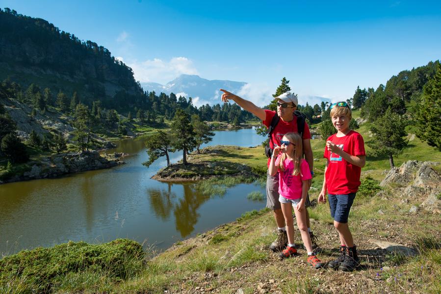
Departure point: Chamrousse 1750 Tourist Office - Roche Béranger.
This hike, suitable for young and old alike, will delight the whole family.
In an exceptional setting, you'll reach the edge of Lake Achard and its breathtaking view of the Taillefer.
The characteristics of the route.

Chamrousse (38)
- Distance 2.66 km
- Elevation gain 200 m
- Elevation lost 30 m
- Min. elevation 1747 m
- Max. elevation. 1937 m
- Duration (depending on pace) 1h30
- Marking Yes
Take the time to stop and soak up the silence, discover the wildlife awareness panels, contemplate the view and observe the thousand and one wonders nature has to offer: hundred-year-old pine, crossbill, houseleek, spider's web....
Round trip: 2h30 (5.2km)
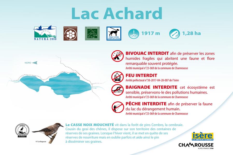
As Lac Achard is located in a Natura 2000 zone, we remind you that burning, camping, fishing and swimming are strictly forbidden (subject to fines). Bivouacs are prohibited from May 1 to October 31 + Infernet sector.
Please stay on the trails to preserve fragile environments.
? The little extra: the "hiking star" summer medal for children!
On presentation of a photo taken at the hiking site, brave little hikers will be awarded a named diploma + possible purchase of the "lac Achard" silver star to hang proudly on the backpack (on sale for €3 at Tourist Offices).Marking : Yellow and green markings (PR)Equipments : Parking nearby, Public WC, Good plans : Discovery of Swiss pinesDelicate passages : Rock slabs and rootsAdmission fee : Free access.Opening : From 15/04 to 29/11 daily. Please note: before June and after October, trail markers may be removed in preparation for winter.Warning : Achard lake natural site: peak season (May to October). Specific regulations by municipal by-law: fire, wood gathering, camping, gathering, fishing and swimming (even for dogs) are strictly forbidden (subject to fines). Dogs must be kept on a leash.
Round trip: 2h30 (5.2km)
As Lac Achard is located in a Natura 2000 zone, we remind you that burning, camping, fishing and swimming are strictly forbidden (subject to fines). Bivouacs are prohibited from May 1 to October 31 + Infernet sector.
Please stay on the trails to preserve fragile environments.
? The little extra: the "hiking star" summer medal for children!
On presentation of a photo taken at the hiking site, brave little hikers will be awarded a named diploma + possible purchase of the "lac Achard" silver star to hang proudly on the backpack (on sale for €3 at Tourist Offices).Marking : Yellow and green markings (PR)Equipments : Parking nearby, Public WC, Good plans : Discovery of Swiss pinesDelicate passages : Rock slabs and rootsAdmission fee : Free access.Opening : From 15/04 to 29/11 daily. Please note: before June and after October, trail markers may be removed in preparation for winter.Warning : Achard lake natural site: peak season (May to October). Specific regulations by municipal by-law: fire, wood gathering, camping, gathering, fishing and swimming (even for dogs) are strictly forbidden (subject to fines). Dogs must be kept on a leash.
Report a problem
Website Achard lake municipal by-law Topographic map Chamrousse 1750 - Achard lake Features of the application :
- Location and orientation on detailed maps thanks to the GPS of your smartphone
- Description of routes and points of interest on the route
- Photo gallery by route
- Detailed elevation profile
- Route tracking alert to warn you if you stray from the route
- Send predefined messages by SMS to your contacts
- Emergency module: trigger a call or send an emergency SMS in case of problem
- Agenda: access to events organized in the department
- News: find in the application the latest news on the web portal
- Adding achievements
- Add reports in case of problems encountered on the routes
- Share on social networks
Add your time and share your feelings
Services nearby

Arselle Peatbog (Preserved Natural Area)
Chamrousse

Chamrousse Tourist Office
Chamrousse

Romanche Museum
Livet-et-Gavet
Uriage-les-Bains Tourist Information Office
Saint-Martin-d'Uriage

Refuge de la Pra
Revel


Information updated on 2025-08-11 by Office du Tourisme de Chamrousse


Follow us on
the digital trails
the digital trails





The Isère Outdoor application was created
by the Département de l'Isère
Infos & contact
Conseil départemental de l'Isère
7 rue Fantin Latour
CS 41096
38 022 Grenoble cedex 1
Tel. 04 76 00 38 38
 Isère Outdoor - Parcours - Chamrousse 1750 - Lac Achard
Hello, world! This is a toast message.
Isère Outdoor - Parcours - Chamrousse 1750 - Lac Achard
Hello, world! This is a toast message.
Isère Outdoor - Parcours - Chamrousse 1750 - Lac Achard
Hello, world! This is a toast message.


OK
Annuler