Via Sancti Martini, from Pont-de-Beauvoisin to Val-de-Virieu via Lake Paladru
Add to my favorites

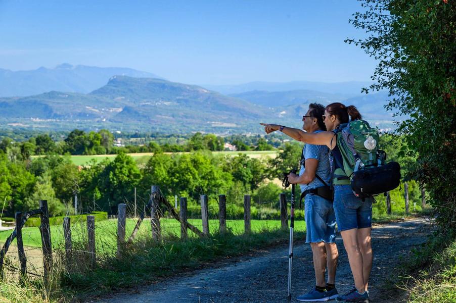
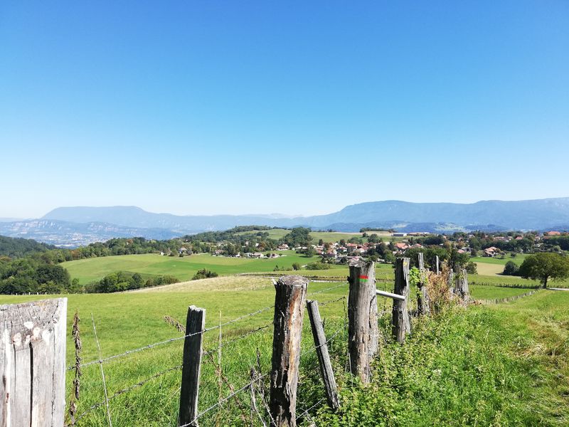
Between the Vals du Dauphiné and the iconic Chartreuse, walk part of the European Via Sancti Martini route. During your travel or after a detour at Paladru lake, the hills host wonderful surprises.
The characteristics of the route.

Pont-de-Beauvoisin (38)
- Distance 48.15 km
- Elevation gain 1130 m
- Elevation lost 1000 m
- Min. elevation 268 m
- Max. elevation. 661 m
- Duration (depending on pace) 48h
- Marking Yes
The Via Sancti Martini is a path labeled "Cultural Itinerary of the Europe Council". It follows Saint-Martin footsteps, bishop of Tours in the 4th century, a great traveller and universal figure, known for sharing his cloak with a disadvantaged person.
Connecting Szombathély, birthplace of Martin in Hungary, to Tours the French city where his tomb is located, it travels from east to west for 2500km.
The Pays Voironnais and Vals du Dauphiné offer a roaming route from station to station between Pont-de-Beauvoisin and Val-de-Virieu (Virieu-sur-Bourbre station):
- Day 1: 22,9 km/ + 600 m and - 310 m (overnight in Montferrat)
- Day 2: 21,4 km / +400 m and - 560 m
The itinerary based on values of sharing and exchange is an opportunity to discover the heritage, local products, know-how of the territory, providing rich and convivial encounters.
To discover on your way:
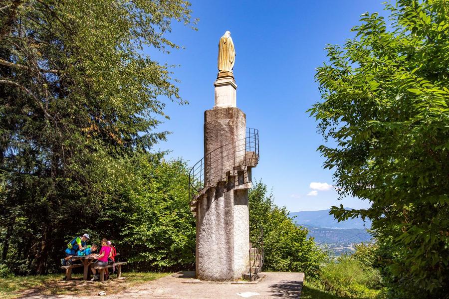
- landscapes with mountains and combs, covered with woods and meadows, offering many panoramas on the pre-Alps and Mont-Blanc, especially from the Troix Croix chapel and the Tour du Sacré-Coeur;
- small hamlets, fortified houses and castles with typical adobe architecture of the Bas-Dauphiné;
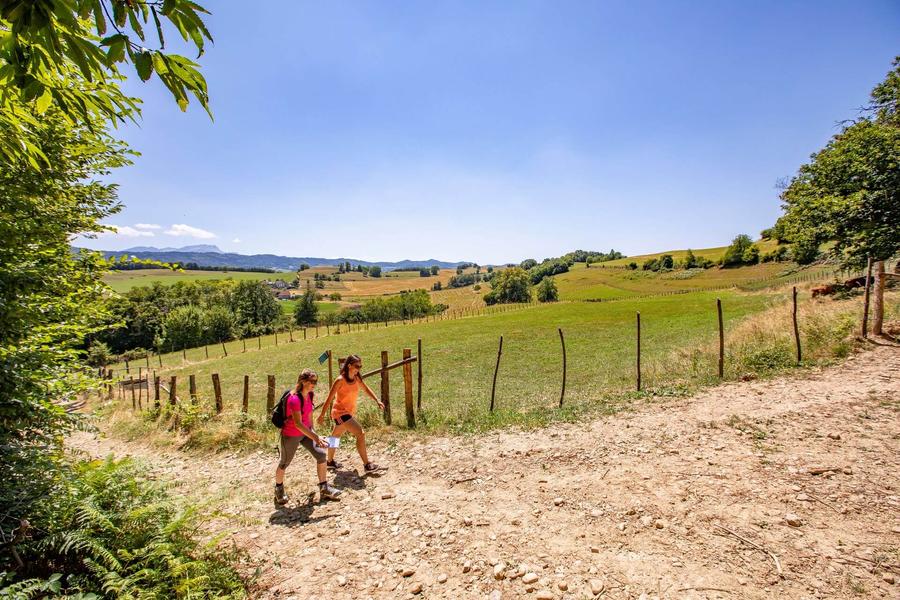
- verdurous nature, rolling meadows where cows graze and the blue waters of Lake Paladru;
- the Archaeological Museum of Paladru Lake, which exhibits first people remains living on its shores for a journey to the Neolithic and An Mil;
- memory of Saint-Martin represented locally in a fresco sharing his coat in Saint Martin de Vaulserre church and the Mont Saint-Martin bypassed by the road.
Signs : At each intersection between several hiking trails, a post indicates the next direction. The following signage poles should therefore be the following:
PONT DE BEAUVOISIN station > Les Sables > Le Grabier > Le Menou > Les Forêts > L'Antiquaire > Sacré-Coeur > La Sauge > Petit Velanne > Vicharière > Le Buisson > L'Ourcière > Les Rajans > Côtes Galloya > Verchère > Vernatet > St-Pierre de Paladru > Les Trois Croix > Bois de la Grande Rivoire > Croix Charpenne > Le Gréhaut > Chemin du Lavoir > Le Brocard > Croix du Jubilé > Les Sources > Chassignieu > Garamponière > La Mollat > Tancin > Cote 568 > Les Hauts d'Envelump > Beauregard > Virieu sur Bourbre station.
Alternative Route via Lake Paladru:
Day 1: 28 km / +640 m and –430 m
Day 2: 20.1 km / +410 m and –500 m
From the Verchère signpost, follow Chemin du Favier > Tripier > Le Chemin des Marais > Bas Paladru > Archaeological Museum > Bas Paladru > Paladru > Sous-Sonnière > Sonnière, then rejoin the route at the Les Trois Croix signpost.Marking : Follow the yellow markings and the signposts listed below: PONT DE BEAUVOISIN station > Les Sables > Le Grabier > Le Menou > Les Forêts > L'Antiquaire > Sacré-Coeur > La Sauge > Petit Velanne > Vicharière > Le Buisson > L'Ourcière > Les Rajans > Côtes Galloya > Verchère > Vernatet > St-Pierre de Paladru > Les Trois Croix > Bois de la Grande Rivoire > Croix Charpenne > Le Gréhaut > Chemin du Lavoir > Le Brocard > Croix du Jubilé > Les Sources > Chassignieu > Garamponière > La Mollat > Tancin > Cote 568 > Les Hauts d'Envelump > Beauregard > Virieu sur Bourbre stationAdmission fee : Free access.Opening : All year round daily.
Area : Pays Voironnais
Report a problem
Website Pdf file Features of the application :
- Location and orientation on detailed maps thanks to the GPS of your smartphone
- Description of routes and points of interest on the route
- Photo gallery by route
- Detailed elevation profile
- Route tracking alert to warn you if you stray from the route
- Send predefined messages by SMS to your contacts
- Emergency module: trigger a call or send an emergency SMS in case of problem
- Agenda: access to events organized in the department
- News: find in the application the latest news on the web portal
- Adding achievements
- Add reports in case of problems encountered on the routes
- Share on social networks
Add your time and share your feelings
Services nearby

Local Resistance and Deportation Museum
Pont-de-Beauvoisin

Vals du Dauphiné tourist information center in Pont-de-Beauvoisin
Pont-de-Beauvoisin
Wood machine and hand tools Museum
Pont-de-Beauvoisin
Pégoud Museum
Montferrat

Relais Cyné de Montferrat
Montferrat


Information updated on 2026-08-13 by Office de Tourisme du Pays Voironnais


Follow us on
the digital trails
the digital trails





The Isère Outdoor application was created
by the Département de l'Isère
Infos & contact
Conseil départemental de l'Isère
7 rue Fantin Latour
CS 41096
38 022 Grenoble cedex 1
Tel. 04 76 00 38 38
 Isère Outdoor - Parcours - Via Sancti Martini, from Pont-de-Beauvoisin to Val-de-Virieu via Lake Paladru
Hello, world! This is a toast message.
Isère Outdoor - Parcours - Via Sancti Martini, from Pont-de-Beauvoisin to Val-de-Virieu via Lake Paladru
Hello, world! This is a toast message.
Isère Outdoor - Parcours - Via Sancti Martini, from Pont-de-Beauvoisin to Val-de-Virieu via Lake Paladru
Hello, world! This is a toast message.


OK
Annuler