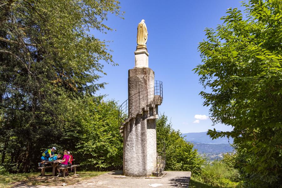
Au fil de l'Ainan vers le Sacré Coeur
Add to my favorites

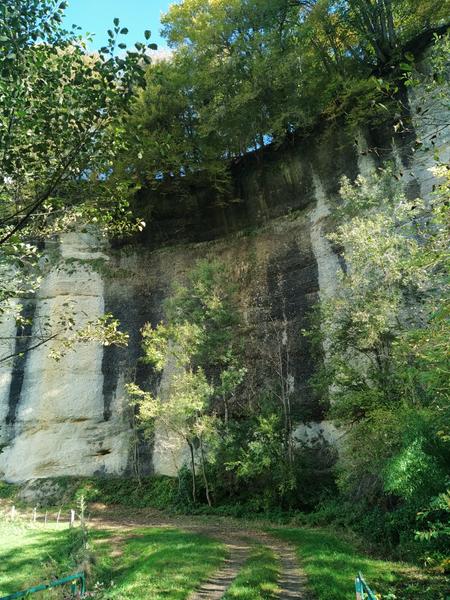
St-Bueil, perché sur son promontoire rocheux, attire immanquablement le regard. Approchez cette «grande roche» de près avant de suivre les rives ombragées de l’Ainan, qui fit autrefois la prospérité de la vallée grâce à ses moulins et ateliers de tissage.
The characteristics of the route.

Saint-Bueil (38)
- Distance 11.39 km
- Elevation gain 390 m
- Elevation lost 390 m
- Min. elevation 303 m
- Max. elevation. 588 m
- Duration (depending on pace) 3h16
- Marking Yes
Equipments : Parking nearby, Admission fee : Free access.Opening : All year round daily.
Area : Pays Voironnais
Report a problem
Website Features of the application :
- Location and orientation on detailed maps thanks to the GPS of your smartphone
- Description of routes and points of interest on the route
- Photo gallery by route
- Detailed elevation profile
- Route tracking alert to warn you if you stray from the route
- Send predefined messages by SMS to your contacts
- Emergency module: trigger a call or send an emergency SMS in case of problem
- Agenda: access to events organized in the department
- News: find in the application the latest news on the web portal
- Adding achievements
- Add reports in case of problems encountered on the routes
- Share on social networks
Add your time and share your feelings
Services nearby

Relais Cyné de Montferrat
Montferrat

Local Resistance and Deportation Museum
Le Pont-de-Beauvoisin
Wood Machine Museum
Le Pont-de-Beauvoisin

Tourist Information Office of Pont-de-Beauvoisin - Office de Tourisme des Vals du Dauphiné
Le Pont-de-Beauvoisin
Pégoud Museum
Montferrat


Information updated on 2026-05-04 by Office de Tourisme du Pays Voironnais


Follow us on
the digital trails
the digital trails


![]()
The Isère Outdoor application was created
by the Département de l'Isère
Infos & contact
Conseil départemental de l'Isère
7 rue Fantin Latour
CS 41096
38 022 Grenoble cedex 1
Tel. 04 76 00 38 38
 Isère Outdoor - Parcours - Au fil de l'Ainan vers le Sacré Coeur
Hello, world! This is a toast message.
Isère Outdoor - Parcours - Au fil de l'Ainan vers le Sacré Coeur
Hello, world! This is a toast message.
Isère Outdoor - Parcours - Au fil de l'Ainan vers le Sacré Coeur
Hello, world! This is a toast message.


OK
Annuler