Tire-Gerbe forest
Add to my favorites

Enjoy the coolness of the Tire-Gerbe forest in summer, or continue on to the Gole pond.
The characteristics of the route.

Rochetoirin (38)
- Distance 8.56 km
- Elevation gain 260 m
- Elevation lost 260 m
- Min. elevation 350 m
- Max. elevation. 469 m
- Duration (depending on pace) 2h15
- Marking Yes
ROUTE
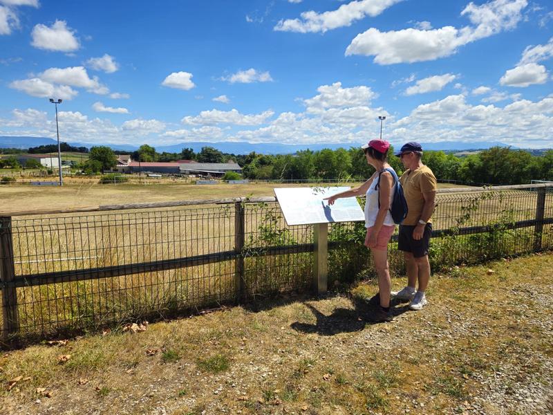
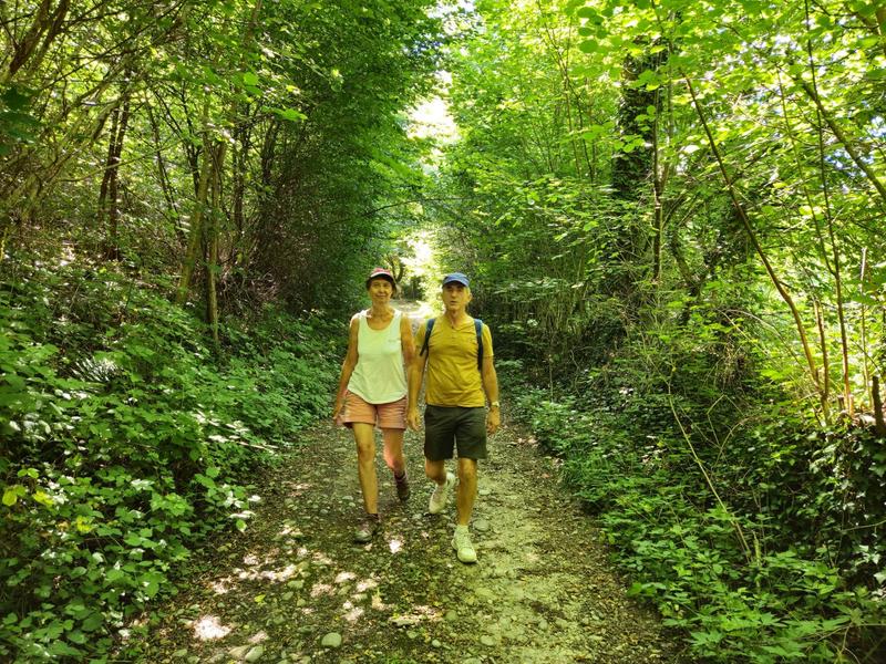
The starting point offers unobstructed view of the Vercors and Chartreuse mountains. An orientation table located between the church and the soccer stadium details the landscape. Take rue de Ravette opposite the town hall and follow the path to the hamlet of La Mitagnière. You then reach the Etang de l'Enfer before entering the Tire-Gerbe forest.
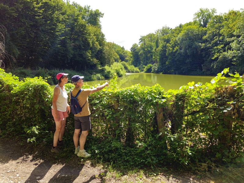
The forest path leads down to l'Enfer. At this point, you can extend the hike with a 1km round trip to discover the Etang de Gole, a sensitive natural area. Take a moment to observe the agile frog, dragonflies and great crested grebe.
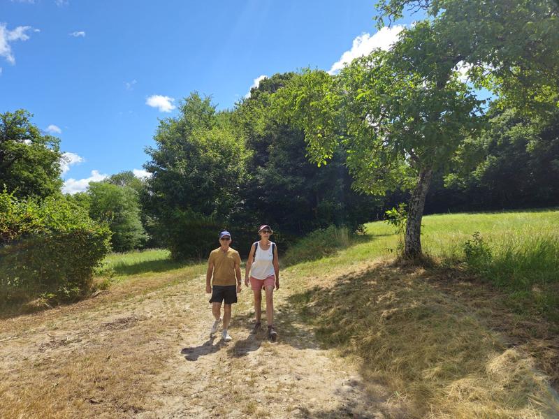
The return journey to Rochetoirin takes you along a pretty path in a bucolic setting, sometimes wooded, sometimes more open, then along the Reculfort road back to the starting point. Stay vigilant, however, as you follow the D54 for 150m shortly after l'Enfer.
WAYMARKING AND SIGNPOSTING
Follow yellow markings and the following signposts:
Tire-Gerbe > Le Grand Poste > L'Enfer > Possibility of a return trip to Etang de Gole > Bonnard > Le Gayet > Les Tournas > Return to ROCHETOIRINMarking : Follow yellow markings and the following signposts: Tire-Gerbe > Le Grand Poste > L'Enfer > Possibility of a return trip to Etang de Gole > Bonnard > Le Gayet > Les Tournas > Return to ROCHETOIRINEquipments : Free car park, Car park, Public WC, Admission fee : Free access.Opening : All year round daily.
The starting point offers unobstructed view of the Vercors and Chartreuse mountains. An orientation table located between the church and the soccer stadium details the landscape. Take rue de Ravette opposite the town hall and follow the path to the hamlet of La Mitagnière. You then reach the Etang de l'Enfer before entering the Tire-Gerbe forest.
The forest path leads down to l'Enfer. At this point, you can extend the hike with a 1km round trip to discover the Etang de Gole, a sensitive natural area. Take a moment to observe the agile frog, dragonflies and great crested grebe.
The return journey to Rochetoirin takes you along a pretty path in a bucolic setting, sometimes wooded, sometimes more open, then along the Reculfort road back to the starting point. Stay vigilant, however, as you follow the D54 for 150m shortly after l'Enfer.
WAYMARKING AND SIGNPOSTING
Follow yellow markings and the following signposts:
Tire-Gerbe > Le Grand Poste > L'Enfer > Possibility of a return trip to Etang de Gole > Bonnard > Le Gayet > Les Tournas > Return to ROCHETOIRINMarking : Follow yellow markings and the following signposts: Tire-Gerbe > Le Grand Poste > L'Enfer > Possibility of a return trip to Etang de Gole > Bonnard > Le Gayet > Les Tournas > Return to ROCHETOIRINEquipments : Free car park, Car park, Public WC, Admission fee : Free access.Opening : All year round daily.
Area : Vals du Dauphiné
Report a problem
Website Forêt de Tire-Gerbe Forêt de Tire-Gerbe Features of the application :
- Location and orientation on detailed maps thanks to the GPS of your smartphone
- Description of routes and points of interest on the route
- Photo gallery by route
- Detailed elevation profile
- Route tracking alert to warn you if you stray from the route
- Send predefined messages by SMS to your contacts
- Emergency module: trigger a call or send an emergency SMS in case of problem
- Agenda: access to events organized in the department
- News: find in the application the latest news on the web portal
- Adding achievements
- Add reports in case of problems encountered on the routes
- Share on social networks
Add your time and share your feelings
Services nearby

Tourist information office of La Tour du Pin - Office de Tourisme des Vals du Dauphiné
La Tour-du-Pin

Etang de Gôle Sensitive Natural Area
Montcarra

Saint-Chef Museum
Saint-Chef
Saint-Chef - Balcons du Dauphine Tourist Information Office
Saint-Chef

Relais Cyné de Faverges de la Tour
Faverges-de-la-Tour


Information updated on 2026-04-15 by Office de Tourisme des Vals du Dauphiné


Follow us on
the digital trails
the digital trails


![]()
The Isère Outdoor application was created
by the Département de l'Isère
Infos & contact
Conseil départemental de l'Isère
7 rue Fantin Latour
CS 41096
38 022 Grenoble cedex 1
Tel. 04 76 00 38 38
 Isère Outdoor - Parcours - Tire-Gerbe forest
Hello, world! This is a toast message.
Isère Outdoor - Parcours - Tire-Gerbe forest
Hello, world! This is a toast message.
Isère Outdoor - Parcours - Tire-Gerbe forest
Hello, world! This is a toast message.


OK
Annuler