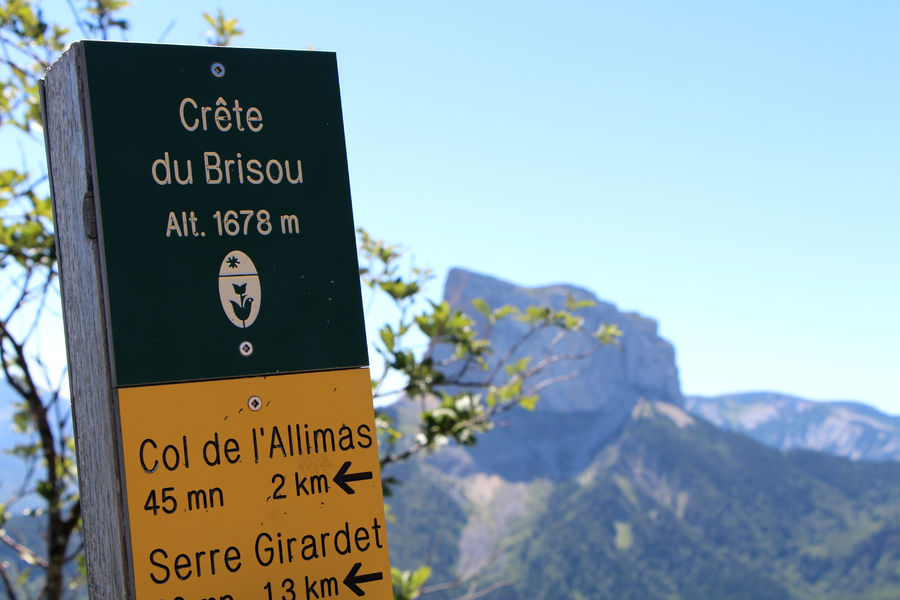
La Crête du Brisou
Add to my favorites

Caution! Zone of vigilance near the route
Pierre Blanche - du 15/06/2026 au 15/09/2026 In progress
Le Brizou - du 15/06/2026 au 15/09/2026 In progress
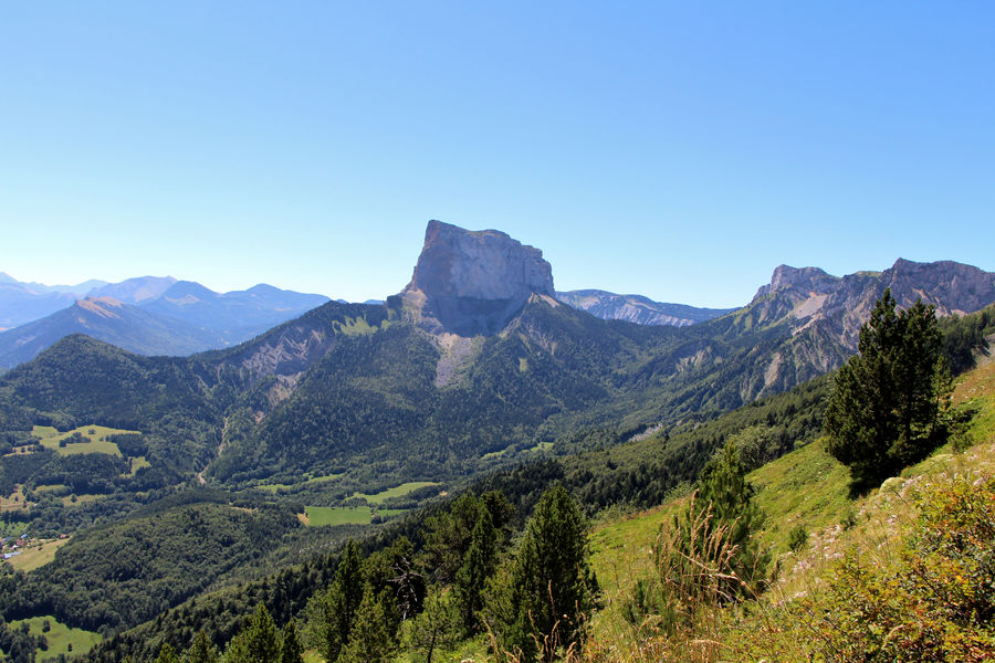
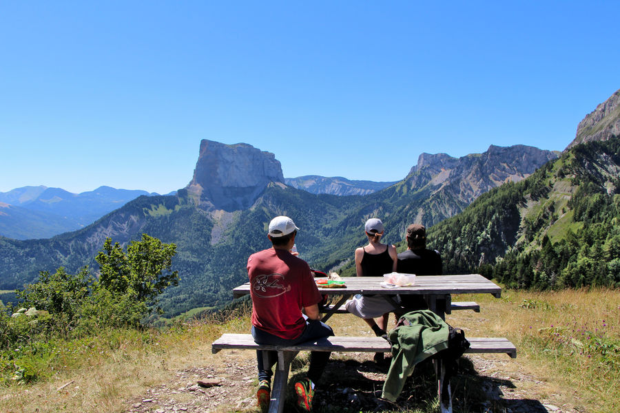
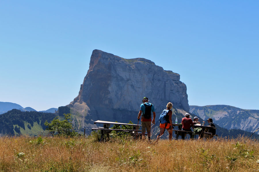
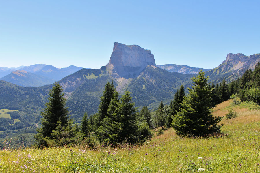
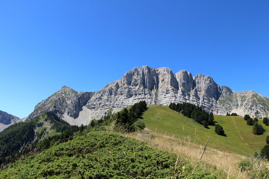
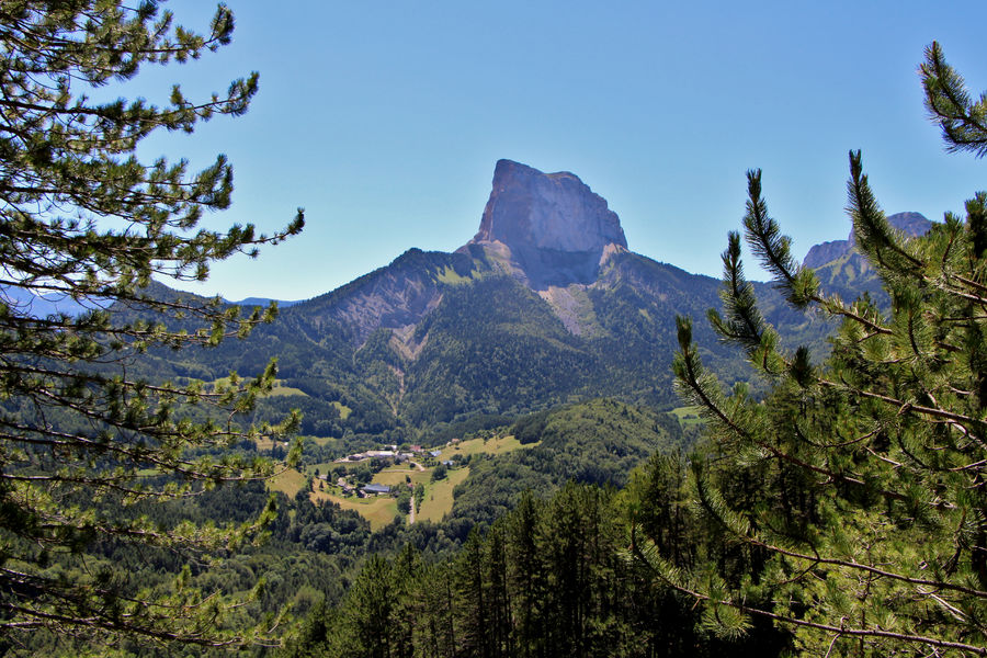
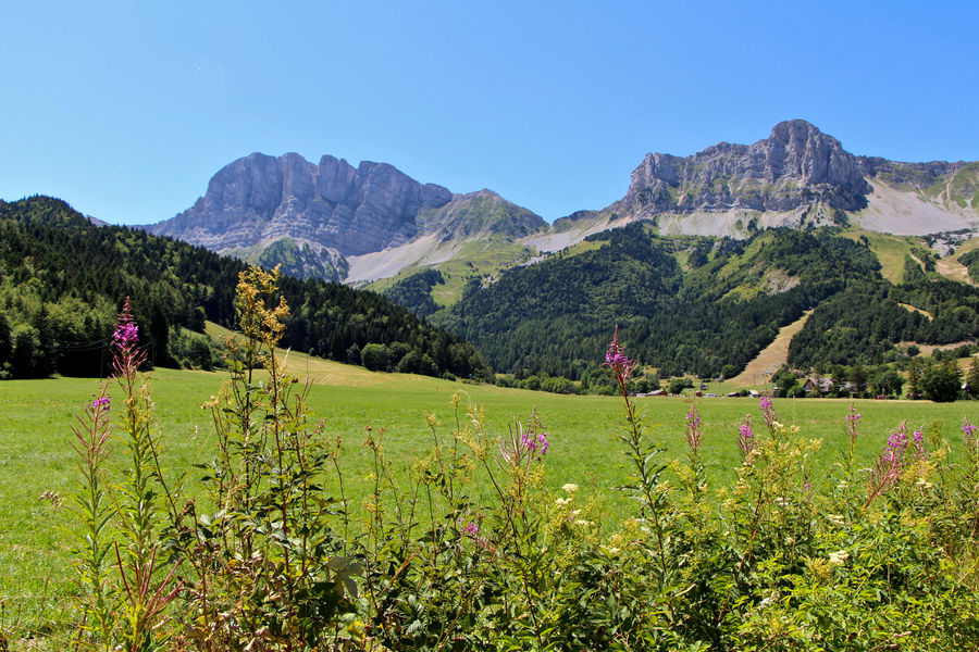
A varied walk alternating between forested and open stretches, the Brisou ridge offers magnificent views of Mont-Aiguille and Grand-Veymont. Two picnic tables make for a pleasant break at the summit!
The characteristics of the route.

Gresse-en-Vercors (38)
- Distance 8.89 km
- Elevation gain 520 m
- Elevation lost 520 m
- Min. elevation 1232 m
- Max. elevation. 1675 m
- Duration (depending on pace) 4h
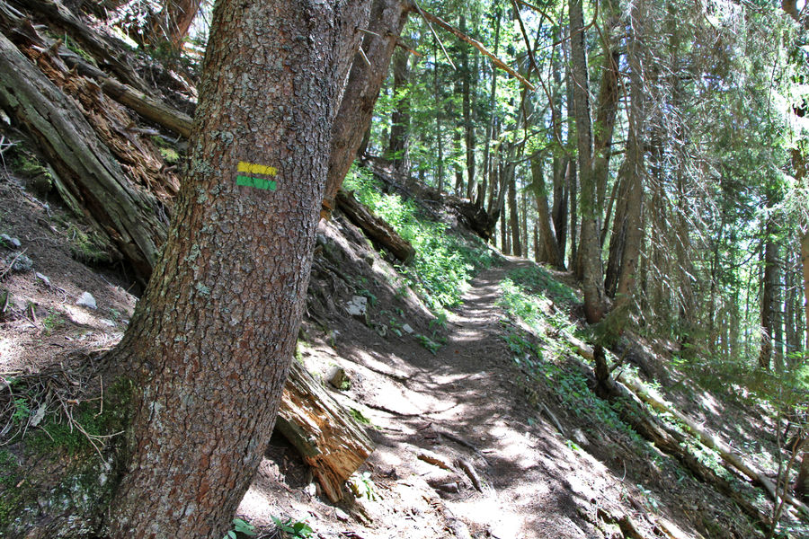
- Marking Yes
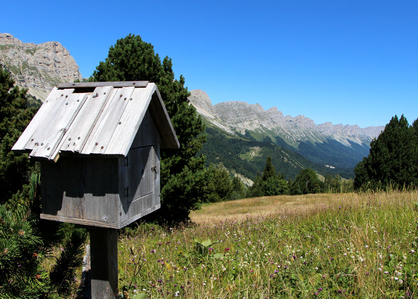
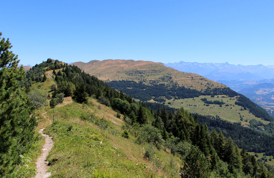
After the short but athletic ascent through the forest, the reward is incredible: a 360° panoramic view. Look out for the little wooden letterbox almost at the end of the crête du Brisou to leave a note or a drawing in the souvenir book!Marking : The markings are yellow-green lines (PR).Equipments : Free car park, Car park, Delicate passages : Short section between Serre Girardet and Col de l'Allimas requiring caution (gully with significant erosion).
During the summer, ewes with guard dogs are present. Follow the itinerary carefully and behave appropriately in the event of an encounter with the herd (bypassing them, keeping calm, speaking calmly to the dogs, etc.).Admission fee : Free access.Opening : All year round.
Subject to favorable snow and weather conditions.Step by step description : Start: Park at the end of the Gresse en Vercors ski resort parking lot, just after the bridge. A "Champ de l'Herse" hiking post is located near the bridge, on the right bank.
1) Follow the trail for about 100 m to the first signpost, then turn left towards "Crête du Brisou" (the route passes close to the ski jumps).
2) Follow the track, passing under the Blavet ski lift, then continue uphill until you reach a small plateau, where you turn right to reach the top of the Blavet ski lift.
3) The main difficulty of the hike is ahead of you: the ascent through the forest, which then leads to the mountain pasture and follows the ridge to reach the summit of Les Alleyrons (picnic tables) and the "Crête du Brisou" sign.
4) To go back down, follow the signs for "Serre Girardet" along the ridge to the left. After the plateau, the path descends into the forest.
5) Continue downhill, winding through the forest as far as the "Serre Girardet" post, then turn left in the direction of "Col de l'Allimas" (beware of a small, erosion-prone section requiring special attention).
7) From "Col de l'Allimas", follow signs for "Combe Rouge", skirting the road and then taking the track on the left.
8) From "Combe Rouge", turn left onto the small path leading to the Odyssée Verte, direction "Aux Fayolles".
9) From "Aux Fayolles", take the track on the right towards "Côte Emblay" (just beside the Odyssée Verte dry toilets).
10)At "Côte Emblay", continue towards "Girard".
11) All that remains is to return to your starting point, following the signs for "Champ de l'Herse" along the road to the Gresse en Vercors ski resort.
Area : Trièves
Report a problem
Website Pdf file Features of the application :
- Location and orientation on detailed maps thanks to the GPS of your smartphone
- Description of routes and points of interest on the route
- Photo gallery by route
- Detailed elevation profile
- Route tracking alert to warn you if you stray from the route
- Send predefined messages by SMS to your contacts
- Emergency module: trigger a call or send an emergency SMS in case of problem
- Agenda: access to events organized in the department
- News: find in the application the latest news on the web portal
- Adding achievements
- Add reports in case of problems encountered on the routes
- Share on social networks
Add your time and share your feelings
Services nearby

Foyer nordique de Gresse-en-Vercors
Gresse-en-Vercors

Bureau d'Informations Touristiques de Gresse en Vercors - Office de Tourisme du Trièves
Gresse-en-Vercors
Foyer nordique de Chichilianne
Chichilianne
Point d'information Chichilianne
Chichilianne
Point d'information du Môle (Lac de Monteynard-Avignonet)
Treffort


Information updated on 2025-01-09 by Office de Tourisme du Trièves


Follow us on
the digital trails
the digital trails


![]()
The Isère Outdoor application was created
by the Département de l'Isère
Infos & contact
Conseil départemental de l'Isère
7 rue Fantin Latour
CS 41096
38 022 Grenoble cedex 1
Tel. 04 76 00 38 38
 Isère Outdoor - Parcours - La Crête du Brisou
Hello, world! This is a toast message.
Isère Outdoor - Parcours - La Crête du Brisou
Hello, world! This is a toast message.
Isère Outdoor - Parcours - La Crête du Brisou
Hello, world! This is a toast message.


OK
Annuler