Le col de l'Allimas
Add to my favorites

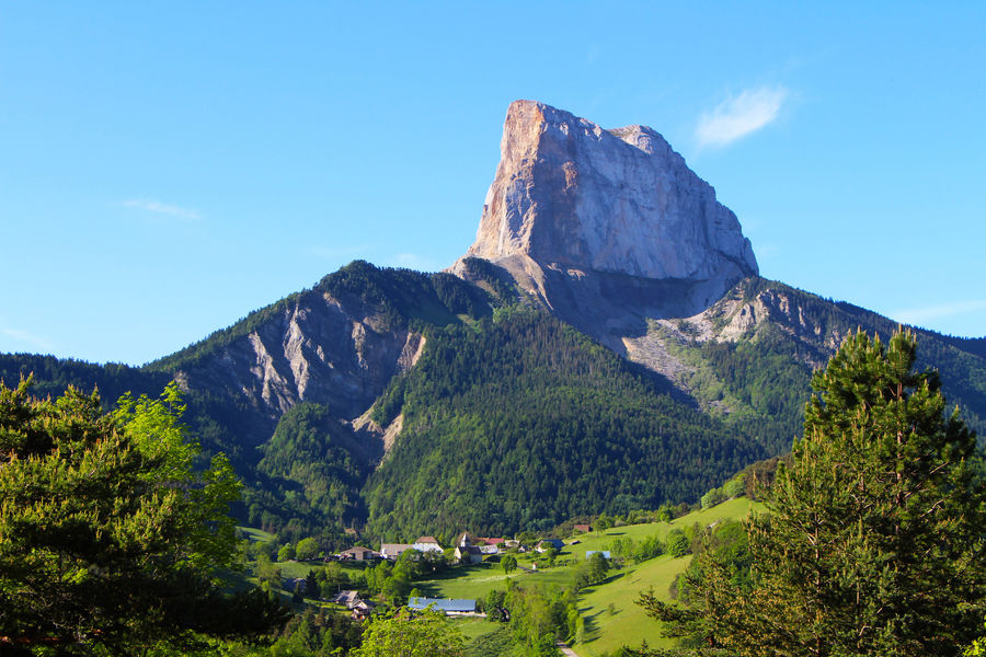
A pleasant walk from the village of Gresse en Vercors to the Col de l'Allimas and its magnificent view of Mont-Aiguille: ideal for a family picnic!
The characteristics of the route.

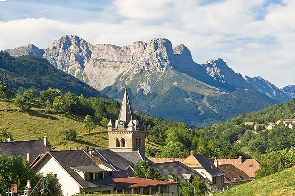
Gresse-en-Vercors (38)
- Distance 7.17 km
- Elevation gain 240 m
- Elevation lost 240 m
- Min. elevation 1189 m
- Max. elevation. 1362 m
- Duration (depending on pace) 2h
- Marking Yes
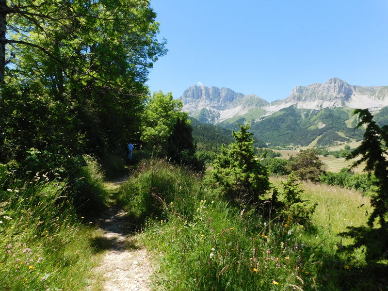
This hike offers views of Grand-Veymont, the cliffs of the Balcon Est du Vercors and Mont-Aiguille. In spring, exceptional flora accompanies your hike, including Lys-Martagon (a protected orchid). This hike alternates between open country and forest passages, for a variety of pleasures! You'll pass by the Odyssée Verte, a fun way to discover the world of the forest on tree-suspended footbridges.Marking : Marked with yellow lines (PR)Equipments : Car park, Free car park, Admission fee : Free access.Opening : All year round.
Subject to favorable snow and weather conditions.Step by step description : Departure: park near the church in the village of Gresse en Vercors, or in the parking lot at the entrance to the village, opposite the hotel-restaurant Le Chalet. Go to the municipal information point next to the church, where you will find the starting point.
1. Follow the signs for "Pas du Bru" up into the village, between the two restaurants "La Chicholière" and "Auberge Buissonnière". Continue straight ahead until you reach a crow's-foot, where you go straight ahead again to take a small path that rises gently and offers the first views of the mountains.
2. At the "Pas du Bru" post, follow the track to the right for a few dozen metres to reach the "Combe Rouge" post.
3. Then turn left towards "Col de l'Allimas", climbing steadily through the forest before joining a wider track. The track leads to the Col de l'Allimas, where you can admire Mont-Aiguille.
4. Return to the asphalt road for a few hundred metres before taking the right-hand track towards "Uclaire".
5. From "Uclaire", follow the signs for "Pas du Bru", going downhill to cross the Aulanier stream easily, then back up to the asphalt road. Cross the road to take the track to the "Pas du Bru" signpost.
6. At the "Pas du Bru" post, turn right to return to the starting point, following the same route in the opposite direction. You're back in the village, your starting point!
Area : Trièves
Report a problem
Website Pdf file Features of the application :
- Location and orientation on detailed maps thanks to the GPS of your smartphone
- Description of routes and points of interest on the route
- Photo gallery by route
- Detailed elevation profile
- Route tracking alert to warn you if you stray from the route
- Send predefined messages by SMS to your contacts
- Emergency module: trigger a call or send an emergency SMS in case of problem
- Agenda: access to events organized in the department
- News: find in the application the latest news on the web portal
- Adding achievements
- Add reports in case of problems encountered on the routes
- Share on social networks
Add your time and share your feelings
Services nearby

Bureau d'Informations Touristiques de Gresse en Vercors - Office de Tourisme du Trièves
Gresse-en-Vercors

Foyer nordique de Gresse-en-Vercors
Gresse-en-Vercors
Point d'information du Môle (Lac de Monteynard-Avignonet)
Treffort
Foyer nordique de Chichilianne
Chichilianne
Point d'information Chichilianne
Chichilianne


Information updated on 2023-01-05 by Office de Tourisme du Trièves


Follow us on
the digital trails
the digital trails


![]()
The Isère Outdoor application was created
by the Département de l'Isère
Infos & contact
Conseil départemental de l'Isère
7 rue Fantin Latour
CS 41096
38 022 Grenoble cedex 1
Tel. 04 76 00 38 38
 Isère Outdoor - Parcours - Le col de l'Allimas
Hello, world! This is a toast message.
Isère Outdoor - Parcours - Le col de l'Allimas
Hello, world! This is a toast message.
Isère Outdoor - Parcours - Le col de l'Allimas
Hello, world! This is a toast message.


OK
Annuler