Rando Châteaux - Les Châteaux de Chichilianne
Add to my favorites

Discover the local heritage on a castle-themed hike!
This hike was created as part of the "Châteaux en Trièves, hier et aujourd'hui" exhibition at the Musée du Trièves in 2022.
The characteristics of the route.

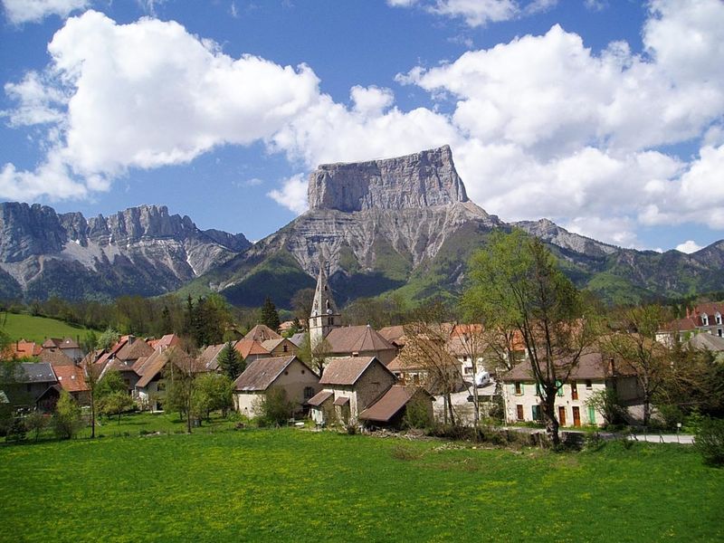
Chichilianne (38)
- Distance 8.46 km
- Elevation gain 230 m
- Elevation lost 230 m
- Min. elevation 964 m
- Max. elevation. 1071 m
- Duration (depending on pace) 3h
- Marking Yes
Marking : PDIPR signposting (yellow-green)Equipments : Car park, Admission fee : Free access.Opening : All year round.Step by step description : From the parking lot entrance, walk down the main street (route du Mont-Aiguille) past the town hall
then the bakery to Château de Passières. Then take the street opposite the château (chemin des
between the playground and the riding school.
At the next junction, turn right onto the "Route du Mont-Aiguille".
Just after the bridge, you'll find the hiking signpost "Pont de la Catte".
Turn right towards "Chateau-Vieux".
Continue straight on, with a short climb to "Pierre aux Corneilles".
Turn left to reach the "Les Crêtes" sign.
Descend towards "Au Transformateur", then continue towards "Ruthière". After passing
Château de Ruthières, continue to the top of the village and take the left-hand track to the "Aux Fontaines" post.
"Aux Fontaines" sign. Continue along the left-hand track with a magnificent view of Mont-Aiguille as far as "Pont
de Donnière". Cross the bridge and follow the tarmac road through Donnière. At the foot of the climb,
take the left-hand track to "Les Crêtes".
Turn right towards "Tracol".
Cross the asphalt road to continue straight ahead and cross the river.
After the river, at the "Le Cros" post, the path turns left to return to the village on a beautiful
to "Rapon" and then "Chichilianne", your starting point.
Area : Trièves
Report a problem
Website Pdf file Features of the application :
- Location and orientation on detailed maps thanks to the GPS of your smartphone
- Description of routes and points of interest on the route
- Photo gallery by route
- Detailed elevation profile
- Route tracking alert to warn you if you stray from the route
- Send predefined messages by SMS to your contacts
- Emergency module: trigger a call or send an emergency SMS in case of problem
- Agenda: access to events organized in the department
- News: find in the application the latest news on the web portal
- Adding achievements
- Add reports in case of problems encountered on the routes
- Share on social networks
Add your time and share your feelings
Services nearby

Point d'information Chichilianne
Chichilianne

Foyer nordique de Chichilianne
Chichilianne
Foyer nordique de Gresse-en-Vercors
Gresse-en-Vercors

Espace Giono
Lalley
Bureau d'Informations Touristiques de Gresse en Vercors - Office de Tourisme du Trièves
Gresse-en-Vercors


Information updated on 2025-02-24 by Office de Tourisme du Trièves


Follow us on
the digital trails
the digital trails


![]()
The Isère Outdoor application was created
by the Département de l'Isère
Infos & contact
Conseil départemental de l'Isère
7 rue Fantin Latour
CS 41096
38 022 Grenoble cedex 1
Tel. 04 76 00 38 38
 Isère Outdoor - Parcours - Rando Châteaux - Les Châteaux de Chichilianne
Hello, world! This is a toast message.
Isère Outdoor - Parcours - Rando Châteaux - Les Châteaux de Chichilianne
Hello, world! This is a toast message.
Isère Outdoor - Parcours - Rando Châteaux - Les Châteaux de Chichilianne
Hello, world! This is a toast message.


OK
Annuler