Hiking: Leaving from Theys
Add to my favorites

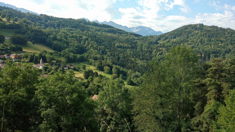
Route no. 10: A very rural loop, perfect as a gentle start to exploring the Bel'Vélec area. The only difficult part between Hurtière and the Col de la Croix des Adrets can be avoided by taking the D255 if necessary.
The characteristics of the route.

Theys (38)
- Distance 14.54 km
- Elevation gain 620 m
- Elevation lost 620 m
- Min. elevation 601 m
- Max. elevation. 945 m
- Marking No
Admission fee : Free access.Opening : All year round.
Area : Grésivaudan
Report a problem
Website Pdf file Features of the application :
- Location and orientation on detailed maps thanks to the GPS of your smartphone
- Description of routes and points of interest on the route
- Photo gallery by route
- Detailed elevation profile
- Route tracking alert to warn you if you stray from the route
- Send predefined messages by SMS to your contacts
- Emergency module: trigger a call or send an emergency SMS in case of problem
- Agenda: access to events organized in the department
- News: find in the application the latest news on the web portal
- Adding achievements
- Add reports in case of problems encountered on the routes
- Share on social networks
Add your time and share your feelings
Services nearby

Foyer de ski de fond du Barioz
Crêts en Belledonne

Bureau d'Information Touristique de Prapoutel / Les 7 Laux - Office de Tourisme Belledonne Chartreuse
Les Sept Laux Prapoutel
Bureau d'Information Touristique du Pleynet / Les 7 Laux - Office de Tourisme Belledonne Chartreuse
Les Sept Laux Le Pleynet

Crêt du Poulet refuge
Crêts en Belledonne

Espace naturel sensible du Marais de Montfort
Crolles


Information updated on 2024-03-05 by Office de Tourisme de Belledonne Chartreuse


Follow us on
the digital trails
the digital trails


![]()
The Isère Outdoor application was created
by the Département de l'Isère
Infos & contact
Conseil départemental de l'Isère
7 rue Fantin Latour
CS 41096
38 022 Grenoble cedex 1
Tel. 04 76 00 38 38
 Isère Outdoor - Parcours - Hiking: Leaving from Theys
Hello, world! This is a toast message.
Isère Outdoor - Parcours - Hiking: Leaving from Theys
Hello, world! This is a toast message.
Isère Outdoor - Parcours - Hiking: Leaving from Theys
Hello, world! This is a toast message.


OK
Annuler