Itinéraire raquettes - Boucle du Col de Porte
Add to my favorites

Caution! Zone of vigilance near the route
Piste de ski col de Porte - du 15/09/2026 au 28/09/2026 Upcoming
Easy loop walk, ideal for families, from Col de Porte, in the forest
The characteristics of the route.
Sarcenas (38)
- Distance 3.14 km
- Elevation gain 150 m
- Elevation lost 150 m
- Min. elevation 1295 m
- Max. elevation. 1420 m
- Duration (depending on pace) 1h
- Marking Yes
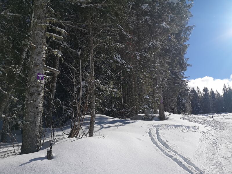
Marking : Follow the purple markers indicating number 2 "Boucle du Col de Porte".
Start opposite the cross-country ski trailhead.
Be careful, you'll have to cross the slopes to get to the start, and walk along the slopes! Please take care not to obstruct skiers.
Signs are posted at junctions and along the route.Admission fee : Free access.Opening : From 01/12 to 31/03 daily.
Subject to favorable snow and weather conditions.Step by step description : Park in the Col de Porte resort parking lot. The start is signposted just to the right of the Le Cartusia restaurant, under a wooden arch with a clearly visible white snowshoe logo on a purple background. Both loops start from the same point, just behind the hotel's ski lift. Loop 1, or the Chaumes loop, takes 45 minutes, while Loop 2, or the Col de Porte loop, lasts a good hour. The most courageous can combine the two for a single long loop. The "snowshoe" markings are very present and easy to follow.
The Chaumes loop wends its way through the fir forest, then joins the ski slope with a lovely view of the Chamechaude summit and returns to the start.
The Col de Porte loop climbs slightly higher and turns off to the right of the ski run. It too winds through the forest.
Col de Porte loop (loop 2)
Minimum altitude: 1,326 m
Maximum altitude: 1,436 m
Area : Grenoble-Alpes Métropole
Report a problem
Website Itinéraire raquettes - Boucle du Col de Porte_Sarcenas Features of the application :
- Location and orientation on detailed maps thanks to the GPS of your smartphone
- Description of routes and points of interest on the route
- Photo gallery by route
- Detailed elevation profile
- Route tracking alert to warn you if you stray from the route
- Send predefined messages by SMS to your contacts
- Emergency module: trigger a call or send an emergency SMS in case of problem
- Agenda: access to events organized in the department
- News: find in the application the latest news on the web portal
- Adding achievements
- Add reports in case of problems encountered on the routes
- Share on social networks
Add your time and share your feelings
Services nearby

Col de Porte
Sarcenas

Sappey-en-Chartreuse Tourist Information Center
Le Sappey-en-Chartreuse
Location de matériel au foyer de ski de fond
Saint-Pierre-de-Chartreuse

Museum of Contemporary Sacred Art
Saint-Pierre-de-Chartreuse

Espace naturel sensible du col du Coq
Plateau des Petites Roches


Follow us on
the digital trails
the digital trails


![]()
The Isère Outdoor application was created
by the Département de l'Isère
Infos & contact
Conseil départemental de l'Isère
7 rue Fantin Latour
CS 41096
38 022 Grenoble cedex 1
Tel. 04 76 00 38 38
 Isère Outdoor - Parcours - Itinéraire raquettes - Boucle du Col de Porte
Hello, world! This is a toast message.
Isère Outdoor - Parcours - Itinéraire raquettes - Boucle du Col de Porte
Hello, world! This is a toast message.
Isère Outdoor - Parcours - Itinéraire raquettes - Boucle du Col de Porte
Hello, world! This is a toast message.


OK
Annuler