L'Auberge de Malaterre depuis Bois Barbu
Add to my favorites

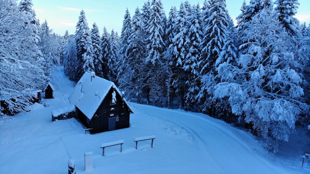
The Nordic area of the Haut Vercors offers 50km of marked and secure trails starting from Corrençon, Villard de Lans and Herbouilly. The walking guide is available from Tourist Offices and describes other possible routes in winter.
The characteristics of the route.
Villard-de-Lans (38)
- Distance 9.41 km
- Elevation gain 290 m
- Elevation lost 290 m
- Min. elevation 1094 m
- Max. elevation. 1277 m
- Duration (depending on pace) 4h
- Marking Yes
Equipments : Parking nearby, Covered picnic area, Public WC, Admission fee : Free of chargeOpening : From 15/12 to 30/03.
Subject to snow conditions.
Area : Massif du Vercors
Report a problem
Website Features of the application :
- Location and orientation on detailed maps thanks to the GPS of your smartphone
- Description of routes and points of interest on the route
- Photo gallery by route
- Detailed elevation profile
- Route tracking alert to warn you if you stray from the route
- Send predefined messages by SMS to your contacts
- Emergency module: trigger a call or send an emergency SMS in case of problem
- Agenda: access to events organized in the department
- News: find in the application the latest news on the web portal
- Adding achievements
- Add reports in case of problems encountered on the routes
- Share on social networks
Add your time and share your feelings
Services nearby

Office Municipal de Tourisme de Villard de Lans
Villard-de-Lans

Maison du Patrimoine
Villard-de-Lans

Foyer de ski de fond des Hauts Plateaux
Corrençon-en-Vercors
OTI Vercors - Bureau d'informations de Méaudre
Autrans-Méaudre en Vercors

Auberge des Allières
Lans-en-Vercors


Information updated on 2024-12-17 by Office Municipal de Tourisme de Villard-de-Lans


Follow us on
the digital trails
the digital trails


![]()
The Isère Outdoor application was created
by the Département de l'Isère
Infos & contact
Conseil départemental de l'Isère
7 rue Fantin Latour
CS 41096
38 022 Grenoble cedex 1
Tel. 04 76 00 38 38
 Isère Outdoor - Parcours - L'Auberge de Malaterre depuis Bois Barbu
Hello, world! This is a toast message.
Isère Outdoor - Parcours - L'Auberge de Malaterre depuis Bois Barbu
Hello, world! This is a toast message.
Isère Outdoor - Parcours - L'Auberge de Malaterre depuis Bois Barbu
Hello, world! This is a toast message.


OK
Annuler