The Combes track
Add to my favorites

Caution! Zone of vigilance near the route
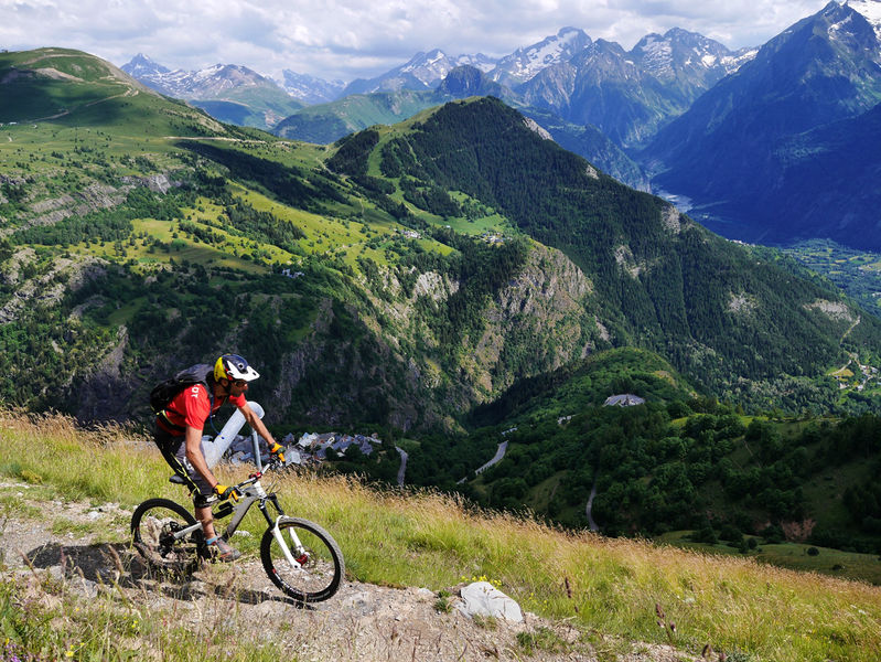
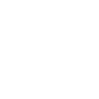
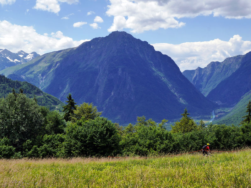
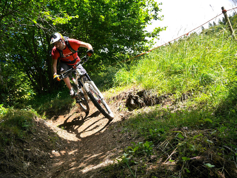
This a varied route through pasture and woodland, descending gradually into the Eau d’Olle Valley. It switches between short descents and uphill sections, without any major technical difficulties, although a good level of fitness is required.
The characteristics of the route.
Alpe d'Huez (38)
- Distance 33.72 km
- Elevation gain 1130 m
- Elevation lost 2250 m
- Min. elevation 688 m
- Max. elevation. 1863 m
- Duration (depending on pace) 3h30
- Marking Yes
Route in the “MTB in Oisans” guide (Oisans Tourisme)
Departure: Alpe d'Huez ("Rond point des pistes" roundabout), 1 850 m
Arrival: Le Bourg-d'Oisans, 720 m
Time: 3 1/2 hours
Distance: 33 km
Highest point: 1 850 m
Lowest point: 712 m
Total ascent: 583 m
Total descent: -1 718 m
Technique: 2/4
Endurance: 3/4
Map: Top 25 Bourg d'Oisans et l'Alpe d'Huez 3335 ET
ROUTE
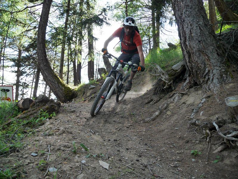
> The route follows the FFC signposting [XC 6] as far as Oz.
> Ride up to the very top of the resort, to the «Rond point des pistes» roundabout and on to the «Chemin panoramique » (on the left of the «Le Signal» chairlift), which goes round the Grande Sûre.
> Follow this panoramic and the Combe du Bras path. The first part is on earth switchbacks, whereas, lower down, the path becomes stonier and more technical.
> When you arrive at the Huez - Villard-Reculas road, turn right for 3km to Villard-Reculas.
> Just before entering Villard-Reculas, follow the [XC 6] until Pré Reynaud.
> At Pré Reynaud, turn left to Le Bessay. After crossing the ‘Pont du Gay’ bridge, go through Le Faubourg, with its old mountain barns.
> From Le Bessay, ride up the road for about 500m to the hairpin bend and take the ‘Chemin de la Rompure’ towards Enversin-d’Oz.
> In L’Enversin, turn down to the left, riding below the village. Around the last houses, don’t miss the small path down to the left, signposted Pourchery.
> In Pourchery, after the chalet called «Maitreya», turn left towards the Lac du Verney, following the FFC signs (XC 7). The path cuts across the road on several occasions. Cross the hamlet of Le Verney, then the Eau d’Olle river via the Himalayan footbridge and ride along the side of the lake back to Allemond.
> It’s now a 10 km flat ride back to Bourg-d’Oisans. One option is to follow the dyke, via Le Raffour.
Or to go back to Alpe d'Huez in the summer, cross over the dam to Allemond to take the cable car up to Oz and then to Alpe d'Huez. Remember that you need a ticket to take the cable car.Marking : Route XC 6 - Espace VTT/FFC Alpe d'Huez grand domaine VTTEquipments : Car park, Free car park, Admission fee : Free access.Opening : From 01/06 to 31/10 daily.
Departure: Alpe d'Huez ("Rond point des pistes" roundabout), 1 850 m
Arrival: Le Bourg-d'Oisans, 720 m
Time: 3 1/2 hours
Distance: 33 km
Highest point: 1 850 m
Lowest point: 712 m
Total ascent: 583 m
Total descent: -1 718 m
Technique: 2/4
Endurance: 3/4
Map: Top 25 Bourg d'Oisans et l'Alpe d'Huez 3335 ET
ROUTE
> The route follows the FFC signposting [XC 6] as far as Oz.
> Ride up to the very top of the resort, to the «Rond point des pistes» roundabout and on to the «Chemin panoramique » (on the left of the «Le Signal» chairlift), which goes round the Grande Sûre.
> Follow this panoramic and the Combe du Bras path. The first part is on earth switchbacks, whereas, lower down, the path becomes stonier and more technical.
> When you arrive at the Huez - Villard-Reculas road, turn right for 3km to Villard-Reculas.
> Just before entering Villard-Reculas, follow the [XC 6] until Pré Reynaud.
> At Pré Reynaud, turn left to Le Bessay. After crossing the ‘Pont du Gay’ bridge, go through Le Faubourg, with its old mountain barns.
> From Le Bessay, ride up the road for about 500m to the hairpin bend and take the ‘Chemin de la Rompure’ towards Enversin-d’Oz.
> In L’Enversin, turn down to the left, riding below the village. Around the last houses, don’t miss the small path down to the left, signposted Pourchery.
> In Pourchery, after the chalet called «Maitreya», turn left towards the Lac du Verney, following the FFC signs (XC 7). The path cuts across the road on several occasions. Cross the hamlet of Le Verney, then the Eau d’Olle river via the Himalayan footbridge and ride along the side of the lake back to Allemond.
> It’s now a 10 km flat ride back to Bourg-d’Oisans. One option is to follow the dyke, via Le Raffour.
Or to go back to Alpe d'Huez in the summer, cross over the dam to Allemond to take the cable car up to Oz and then to Alpe d'Huez. Remember that you need a ticket to take the cable car.Marking : Route XC 6 - Espace VTT/FFC Alpe d'Huez grand domaine VTTEquipments : Car park, Free car park, Admission fee : Free access.Opening : From 01/06 to 31/10 daily.
Area : Oisans
Report a problem
Website Le chemin des Combes Features of the application :
- Location and orientation on detailed maps thanks to the GPS of your smartphone
- Description of routes and points of interest on the route
- Photo gallery by route
- Detailed elevation profile
- Route tracking alert to warn you if you stray from the route
- Send predefined messages by SMS to your contacts
- Emergency module: trigger a call or send an emergency SMS in case of problem
- Agenda: access to events organized in the department
- News: find in the application the latest news on the web portal
- Adding achievements
- Add reports in case of problems encountered on the routes
- Share on social networks
Add your time and share your feelings
Services nearby

Musée d'Huez et de l'Oisans
Alpe d'Huez

Office de Tourisme
Alpe d'Huez
Tourist office of Villard-Reculas
Villard-Reculas
Oz en Oisans Tourist Office
Oz-en-Oisans

Cross-country skiing centre
Allemond


Follow us on
the digital trails
the digital trails


![]()
The Isère Outdoor application was created
by the Département de l'Isère
Infos & contact
Conseil départemental de l'Isère
7 rue Fantin Latour
CS 41096
38 022 Grenoble cedex 1
Tel. 04 76 00 38 38
 Isère Outdoor - Parcours - The Combes track
Hello, world! This is a toast message.
Isère Outdoor - Parcours - The Combes track
Hello, world! This is a toast message.
Isère Outdoor - Parcours - The Combes track
Hello, world! This is a toast message.


OK
Annuler