Le Sert n°1
Add to my favorites

Caution! Zone of vigilance near the route
Piefroid - du 15/06/2026 au 01/10/2026 In progress
Rif tord - du 01/06/2026 au 15/10/2026 In progress
La Quarlie - du 01/06/2026 au 15/10/2026 In progress
Aigle royal - du 01/01/2026 au 31/08/2026 In progress
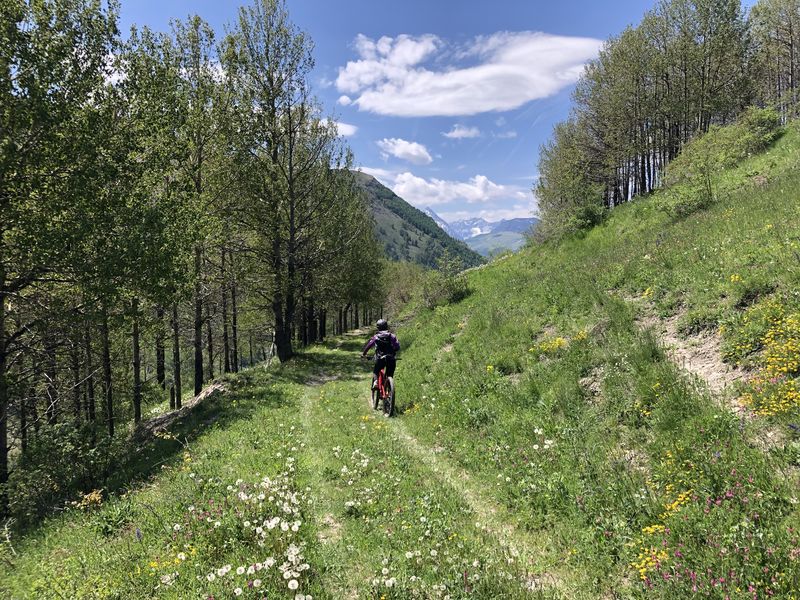
Un parcours qui vous fait passer par le cœur du village de Besse-en-Oisans avant de vous amener vers un environnement plus nature. Le cadre est magnifique.
The characteristics of the route.

Besse (38)
- Distance 6.55 km
- Elevation gain 220 m
- Elevation lost 220 m
- Min. elevation 1517 m
- Max. elevation. 1704 m
- Marking Yes
Equipments : Charging station for 2 electric wheels, Free car park, Car park, Bar, Admission fee : Free access.
Area : Oisans
Report a problem
Pdf file Le Sert n°1 Features of the application :
- Location and orientation on detailed maps thanks to the GPS of your smartphone
- Description of routes and points of interest on the route
- Photo gallery by route
- Detailed elevation profile
- Route tracking alert to warn you if you stray from the route
- Send predefined messages by SMS to your contacts
- Emergency module: trigger a call or send an emergency SMS in case of problem
- Agenda: access to events organized in the department
- News: find in the application the latest news on the web portal
- Adding achievements
- Add reports in case of problems encountered on the routes
- Share on social networks
Add your time and share your feelings
Services nearby

Pastures Museum
Besse-en-Oisans

Tourist office of le Ferrand
Besse-en-Oisans

Refuge Les Clôts
Mizoën
Hut Fay
Mizoën
Refuge Les Mouterres
Mizoën


Information updated on 2023-12-04 by Département de l'Isère


Follow us on
the digital trails
the digital trails


![]()
The Isère Outdoor application was created
by the Département de l'Isère
Infos & contact
Conseil départemental de l'Isère
7 rue Fantin Latour
CS 41096
38 022 Grenoble cedex 1
Tel. 04 76 00 38 38
 Isère Outdoor - Parcours - Le Sert n°1
Hello, world! This is a toast message.
Isère Outdoor - Parcours - Le Sert n°1
Hello, world! This is a toast message.
Isère Outdoor - Parcours - Le Sert n°1
Hello, world! This is a toast message.


OK
Annuler