Mountain biking route les Coteaux de Chapareillan
Add to my favorites

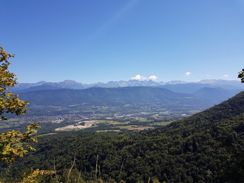
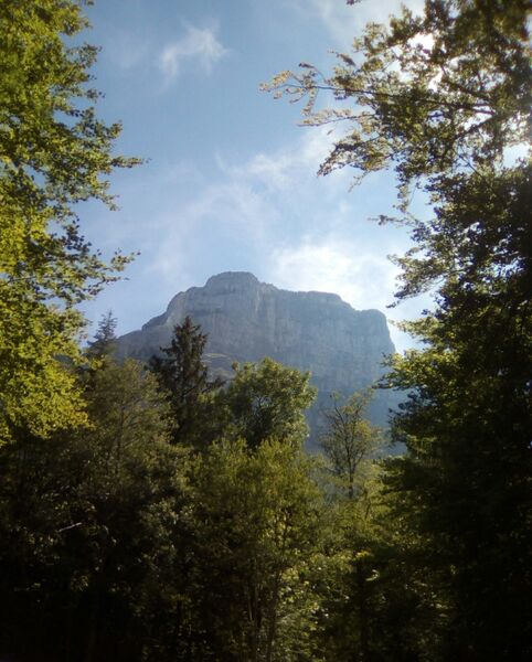
This is not a very demanding ride through the hillside of the vineyards of Savoie. Take all afternoon to come and enjoy the natural beauty of this village situated at the foot of Mont Granier, on the edge of the Grésivaudan valley, the Chartreuse mountain range and Savoie.
The characteristics of the route.

Chapareillan (38)
- Distance 9.79 km
- Elevation gain 290 m
- Elevation lost 290 m
- Min. elevation 266 m
- Max. elevation. 533 m
- Marking No
Level : easy
Very accessible ride with few technical or physical difficulties.
Short distance and moderate difference in altitudeOpening : Accessible throughout the year depending on weather conditions
Very accessible ride with few technical or physical difficulties.
Short distance and moderate difference in altitudeOpening : Accessible throughout the year depending on weather conditions
Area : Grésivaudan
Report a problem
Pdf file Features of the application :
- Location and orientation on detailed maps thanks to the GPS of your smartphone
- Description of routes and points of interest on the route
- Photo gallery by route
- Detailed elevation profile
- Route tracking alert to warn you if you stray from the route
- Send predefined messages by SMS to your contacts
- Emergency module: trigger a call or send an emergency SMS in case of problem
- Agenda: access to events organized in the department
- News: find in the application the latest news on the web portal
- Adding achievements
- Add reports in case of problems encountered on the routes
- Share on social networks
Add your time and share your feelings
Services nearby

Bureau d'information Touristique Pontcharra
Pontcharra
Bureau d'Information Touristique d'Allevard-les-Bains
Allevard-les-Bains
Service animation du Bureau d'Information Touristique d'Allevard
Allevard-les-Bains

Allevard Museum
Allevard-les-Bains
Coeur de Chartreuse Tourist Information center at Saint Pierre d'Entremont
Saint-Pierre-d'Entremont


Information updated on 2022-04-15 by Office de Tourisme de Belledonne Chartreuse


Follow us on
the digital trails
the digital trails


![]()
The Isère Outdoor application was created
by the Département de l'Isère
Infos & contact
Conseil départemental de l'Isère
7 rue Fantin Latour
CS 41096
38 022 Grenoble cedex 1
Tel. 04 76 00 38 38
 Isère Outdoor - Parcours - Mountain biking route les Coteaux de Chapareillan
Hello, world! This is a toast message.
Isère Outdoor - Parcours - Mountain biking route les Coteaux de Chapareillan
Hello, world! This is a toast message.
Isère Outdoor - Parcours - Mountain biking route les Coteaux de Chapareillan
Hello, world! This is a toast message.


OK
Annuler