Loop around Chamrousse
Add to my favorites

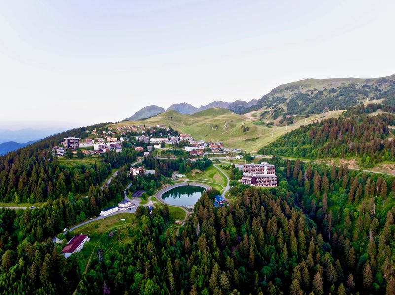
Departure: Chamrousse 1750 - Roche-Béranger Tourist Office (or Chamrousse 1650 - Recoin).
In less than 3 hours, take a tour of the resort ! Chamrousse 1750 > Vallons lake > Chamrousse 1650 > Chamrousse 1750!
Warning: this route is not referred to as "tour de Chamrousse" on the signposts.
The characteristics of the route.

Chamrousse (38)
- Distance 8.47 km
- Elevation gain 460 m
- Elevation lost 460 m
- Min. elevation 1641 m
- Max. elevation. 1863 m
- Duration (depending on pace) 2h
- Marking Yes
With its small vertical drop and the easy access to the resort, this walk will please the people willing to discover hiking. Take the time to contemplate the scenery or have a short break at lake Vallons.
From the commercial galerie of Roche-Béranger, take the path climbing up till the Vallons lake. Walk down the hill until the side of the resort 1650 (Recoin) to get back to the starting point by the pedestrian path, in the bottom of the resort.
? Little extra: "Hiking star" a medal for children in summer too!
Showing us a picture taken during their hike, courageous little walkers will be awarded a diploma with their name + bronze star "Vallons lake" on sale (3€ at the Tourist Offices) to wear proudly on the backpack.Marking : There is no specific signposting for this route, but follow the various yellow and green signs (PR).Equipments : Parking nearby, Public WC, Good plans : Panoramic view of the Grenoble valley, picnic area at the Lac des Vallons. This loop includes several ways to come back to the resort at any time.Delicate passages : Be careful crossing the main road: in the center of Recoin and in the center of Roche Béranger at the town hall.Admission fee : Free access.Opening : From 07/06 to 31/10 daily. Subject to snow conditions.Warning : Following the replacement of the La Bérangère chairlift, work is underway on the footpaths and mountain bike trails.
Area : Massif du Vercors
Report a problem
Website Chamrousse loop Features of the application :
- Location and orientation on detailed maps thanks to the GPS of your smartphone
- Description of routes and points of interest on the route
- Photo gallery by route
- Detailed elevation profile
- Route tracking alert to warn you if you stray from the route
- Send predefined messages by SMS to your contacts
- Emergency module: trigger a call or send an emergency SMS in case of problem
- Agenda: access to events organized in the department
- News: find in the application the latest news on the web portal
- Adding achievements
- Add reports in case of problems encountered on the routes
- Share on social networks
Add your time and share your feelings
Services nearby

Chamrousse Tourist Office
Chamrousse

Arselle Peatbog (Preserved Natural Area)
Chamrousse

Romanche Museum
Livet-et-Gavet
Office Thermal et Touristique d'Uriage-les-Bains
Saint-Martin-d'Uriage

Refuge de la Pra
Revel


Information updated on 2025-10-23 by Office du Tourisme de Chamrousse


Follow us on
the digital trails
the digital trails


![]()
The Isère Outdoor application was created
by the Département de l'Isère
Infos & contact
Conseil départemental de l'Isère
7 rue Fantin Latour
CS 41096
38 022 Grenoble cedex 1
Tel. 04 76 00 38 38
 Isère Outdoor - Parcours - Loop around Chamrousse
Hello, world! This is a toast message.
Isère Outdoor - Parcours - Loop around Chamrousse
Hello, world! This is a toast message.
Isère Outdoor - Parcours - Loop around Chamrousse
Hello, world! This is a toast message.


OK
Annuler