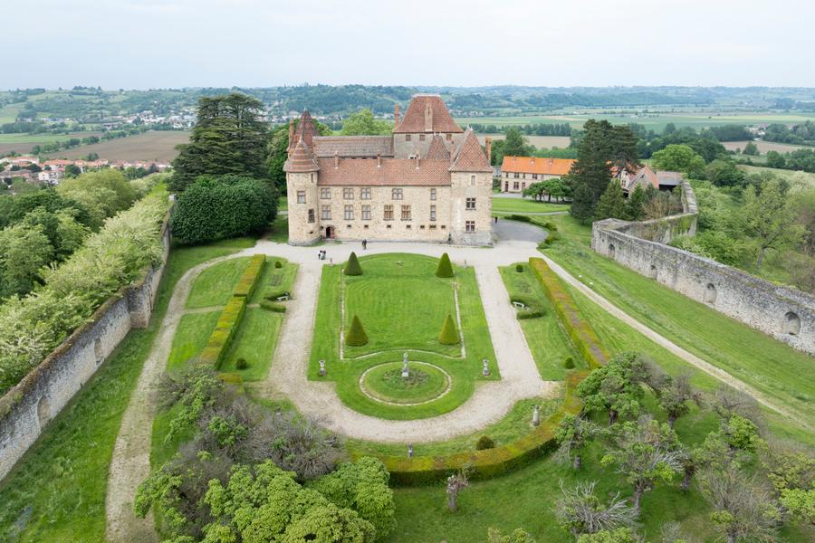
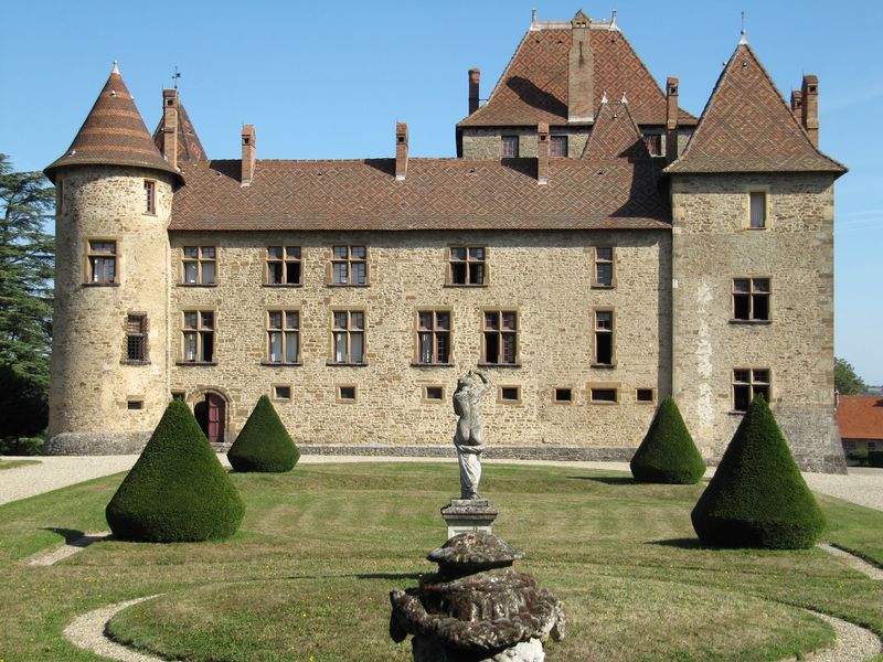
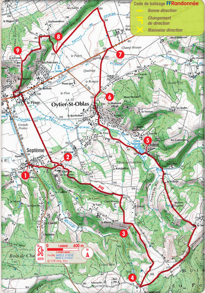
Sentier de Septème à Oytier
Add to my favorites

Small and quite tracks offer nice views on the hills and landscape of the Pilat.
The characteristics of the route.

Septème (38)
- Distance 17.01 km
- Elevation gain 290 m
- Elevation lost 290 m
- Min. elevation 235 m
- Max. elevation. 377 m
- Duration (depending on pace) 5h15
- Marking Yes
Equipments : Picnic area, Opening : All year round daily.
Area : Vienne Condrieu
Report a problem
Pdf file Features of the application :
- Location and orientation on detailed maps thanks to the GPS of your smartphone
- Description of routes and points of interest on the route
- Photo gallery by route
- Detailed elevation profile
- Route tracking alert to warn you if you stray from the route
- Send predefined messages by SMS to your contacts
- Emergency module: trigger a call or send an emergency SMS in case of problem
- Agenda: access to events organized in the department
- News: find in the application the latest news on the web portal
- Adding achievements
- Add reports in case of problems encountered on the routes
- Share on social networks
Add your time and share your feelings
Services nearby

Flood meadow
Pont-Évêque

Textile Industry Museum
Vienne
Saint-André-le-Bas Cloister
Vienne
Fine Arts and Archaeology Museum
Vienne
Archaelogical Museum - Saint Peter's Church
Vienne


Information updated on 2025-10-23 by Office de Tourisme de Vienne Condrieu Agglomération


Follow us on
the digital trails
the digital trails


![]()
The Isère Outdoor application was created
by the Département de l'Isère
Infos & contact
Conseil départemental de l'Isère
7 rue Fantin Latour
CS 41096
38 022 Grenoble cedex 1
Tel. 04 76 00 38 38
 Isère Outdoor - Parcours - Sentier de Septème à Oytier
Hello, world! This is a toast message.
Isère Outdoor - Parcours - Sentier de Septème à Oytier
Hello, world! This is a toast message.
Isère Outdoor - Parcours - Sentier de Septème à Oytier
Hello, world! This is a toast message.


OK
Annuler