Black Milan trail
Add to my favorites

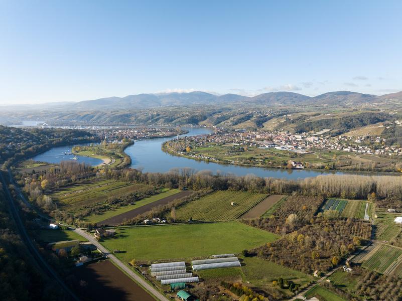
On the track on the black kite, come and dicover the wealth of the Rhône valley: view on the regional park of the Pilat, vineyards of Côte-Rôtie and Condrieu.
The characteristics of the route.

Chonas-l'Amballan (38)
- Distance 7.38 km
- Elevation gain 290 m
- Elevation lost 290 m
- Min. elevation 152 m
- Max. elevation. 321 m
- Duration (depending on pace) 2h30
- Marking Yes
Hike around Chonas-l'Amballan
Starting point: Chonas-l'Amballan town hall car park.
- Main route: walk along the wall surrounding the south of the castle, then turn left onto Champ-Sever path. This turns left and joins Saint-Laurent path.
- Alternative route via the Allée des Tilleuls: from the car park, walk past the old stables towards the church, go around the castle walls and turn right onto the paved path to the Chemin de Saint-Laurent.
DETAILED ROUTE:
- From the Chemin de Saint-Laurent, continue right along the uphill path (marker C – troglodyte cellar). At the crossroads, continue straight ahead along the dirt track.
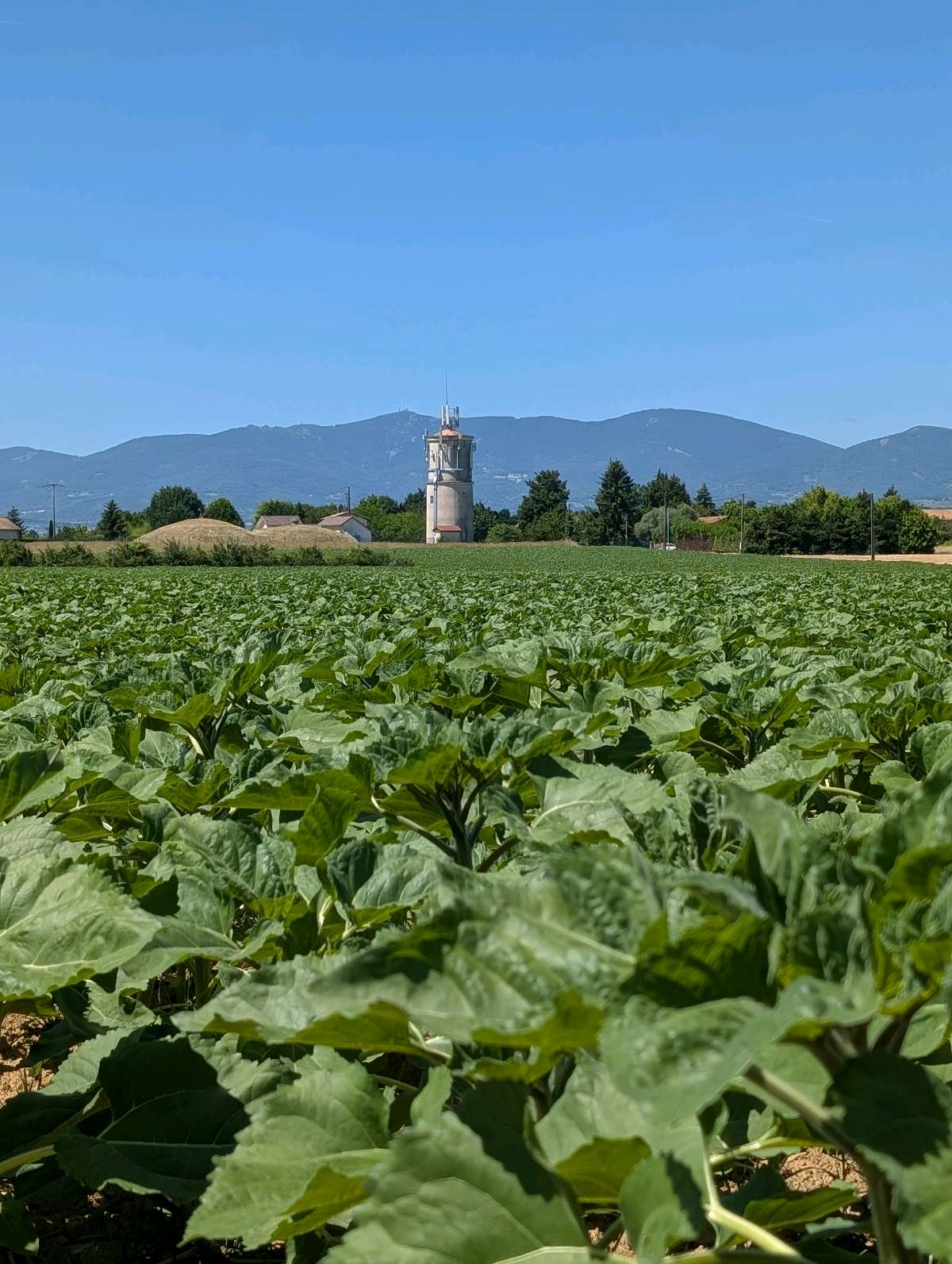
- On the plateau, enjoy the view of the Alps and the Crêts du Pilat. Turn left towards the water tower, then right onto Chemin de l'Abri. At the ‘Château d'eau’ signpost, follow the signs for Gerbey and descend towards the Rhône.
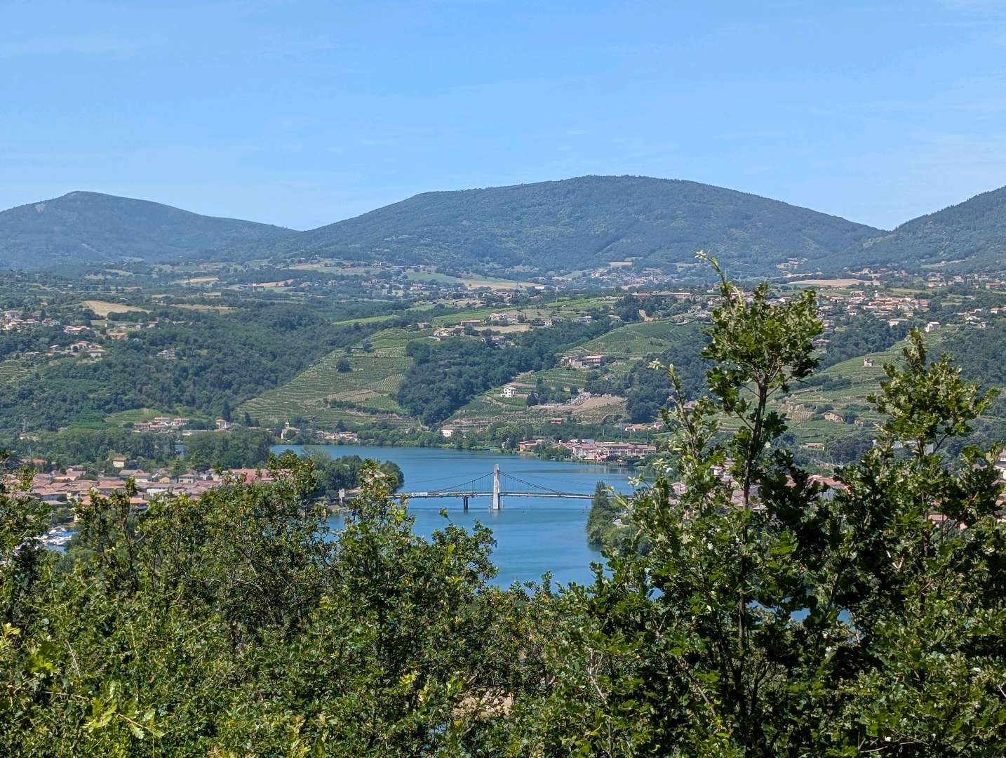
- Near the rocks, take the Chemin de l'Escadron to the viewpoint (panoramic view of Condrieu, Les Roches-de-Condrieu, the leisure centre and Île du Beurre). It then descends into the forest.
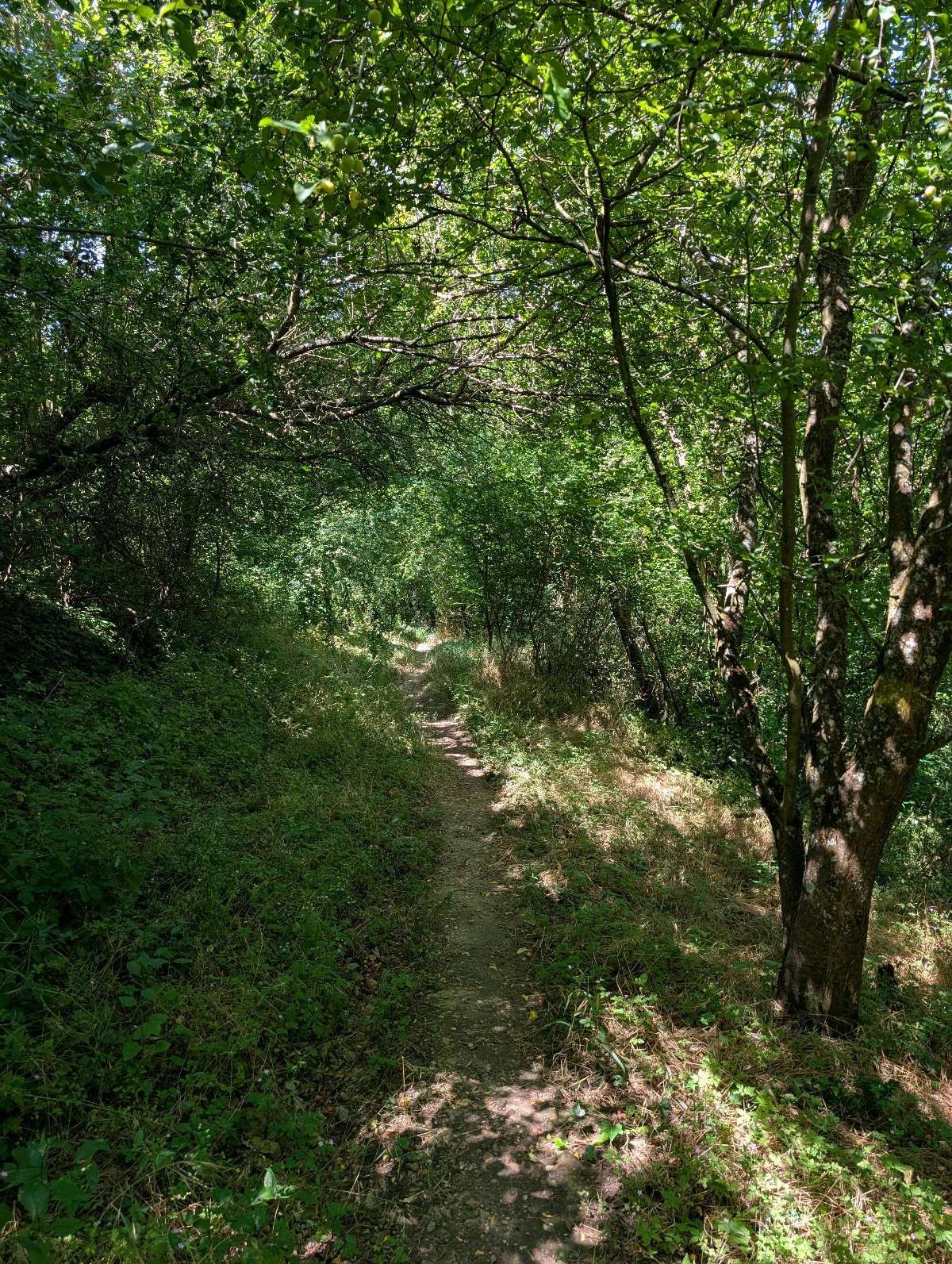
- At the bottom, turn left onto the path running alongside the railway line (take care with children for 750 m).
- At the Gerbey signpost, head back up towards Chonas via the Chemin de Bellevue, then the stabilised path (M marker).
- Enjoy the viewpoint with its orientation table facing the renowned vineyards (Côtes du Rhône, Côte-Rôtie, Condrieu), then continue climbing to the agricultural plateau (marker A).
- When you reach the plateau road (Chemin des Grandes-Bruyères), turn left then right onto Chemin de Berbin.
- At the Berbin signpost, turn left onto the paved path towards Chonas. Along the way, discover century-old mulberry trees (marker S) and adobe houses (marker P).
- Cross Chemin du Marais, then at the next crossroads, turn right to walk alongside the cemetery.
- Then go down the path to Chemin de la Roux, then left to reach the village and the starting point.
THINGS TO SEE ALONG THE WAY:
- In Les Roches-de-Condrieu: the grain market and the church.
- In Chonas-l'Amballan: the castle, the fountain and the wash house.
- In Gerbey: the reed bed and the alluvial forest.
OBSERVATIONS:
- Take care when crossing busy roads.
- Horse riders are not allowed along the lake.
- In Chonas-l'Amballan, the term ‘chemin’ refers to a street as well as a path or dirt track.Equipments : Picnic area, Opening : All year round daily.
Starting point: Chonas-l'Amballan town hall car park.
- Main route: walk along the wall surrounding the south of the castle, then turn left onto Champ-Sever path. This turns left and joins Saint-Laurent path.
- Alternative route via the Allée des Tilleuls: from the car park, walk past the old stables towards the church, go around the castle walls and turn right onto the paved path to the Chemin de Saint-Laurent.
DETAILED ROUTE:
- From the Chemin de Saint-Laurent, continue right along the uphill path (marker C – troglodyte cellar). At the crossroads, continue straight ahead along the dirt track.
- On the plateau, enjoy the view of the Alps and the Crêts du Pilat. Turn left towards the water tower, then right onto Chemin de l'Abri. At the ‘Château d'eau’ signpost, follow the signs for Gerbey and descend towards the Rhône.
- Near the rocks, take the Chemin de l'Escadron to the viewpoint (panoramic view of Condrieu, Les Roches-de-Condrieu, the leisure centre and Île du Beurre). It then descends into the forest.
- At the bottom, turn left onto the path running alongside the railway line (take care with children for 750 m).
- At the Gerbey signpost, head back up towards Chonas via the Chemin de Bellevue, then the stabilised path (M marker).
- Enjoy the viewpoint with its orientation table facing the renowned vineyards (Côtes du Rhône, Côte-Rôtie, Condrieu), then continue climbing to the agricultural plateau (marker A).
- When you reach the plateau road (Chemin des Grandes-Bruyères), turn left then right onto Chemin de Berbin.
- At the Berbin signpost, turn left onto the paved path towards Chonas. Along the way, discover century-old mulberry trees (marker S) and adobe houses (marker P).
- Cross Chemin du Marais, then at the next crossroads, turn right to walk alongside the cemetery.
- Then go down the path to Chemin de la Roux, then left to reach the village and the starting point.
THINGS TO SEE ALONG THE WAY:
- In Les Roches-de-Condrieu: the grain market and the church.
- In Chonas-l'Amballan: the castle, the fountain and the wash house.
- In Gerbey: the reed bed and the alluvial forest.
OBSERVATIONS:
- Take care when crossing busy roads.
- Horse riders are not allowed along the lake.
- In Chonas-l'Amballan, the term ‘chemin’ refers to a street as well as a path or dirt track.Equipments : Picnic area, Opening : All year round daily.
Area : Vienne Condrieu
Report a problem
Pdf file Features of the application :
- Location and orientation on detailed maps thanks to the GPS of your smartphone
- Description of routes and points of interest on the route
- Photo gallery by route
- Detailed elevation profile
- Route tracking alert to warn you if you stray from the route
- Send predefined messages by SMS to your contacts
- Emergency module: trigger a call or send an emergency SMS in case of problem
- Agenda: access to events organized in the department
- News: find in the application the latest news on the web portal
- Adding achievements
- Add reports in case of problems encountered on the routes
- Share on social networks
Bridget66
finished in 02:05:00
The 2026/06/13
En savoir plus
Ajouter votre chrono et partager vos sensations
Services nearby

La Villa de Licinius
Clonas-sur-Varèze

Tourist office of Vienne
Vienne
Archaelogical Museum - Saint Peter's Church
Vienne
Fine Arts and Archaeology Museum
Vienne
Saint-André-le-Bas Cloister
Vienne


Information updated on 2025-09-08 by Office de Tourisme de Vienne Condrieu Agglomération


Follow us on
the digital trails
the digital trails


![]()
The Isère Outdoor application was created
by the Département de l'Isère
Infos & contact
Conseil départemental de l'Isère
7 rue Fantin Latour
CS 41096
38 022 Grenoble cedex 1
Tel. 04 76 00 38 38
 Isère Outdoor - Parcours - Black Milan trail
Hello, world! This is a toast message.
Isère Outdoor - Parcours - Black Milan trail
Hello, world! This is a toast message.
Isère Outdoor - Parcours - Black Milan trail
Hello, world! This is a toast message.


OK
Annuler