King's forest at Biol le Haut (short)
Add to my favorites

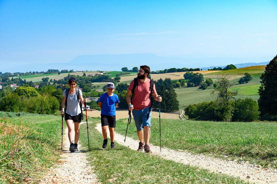
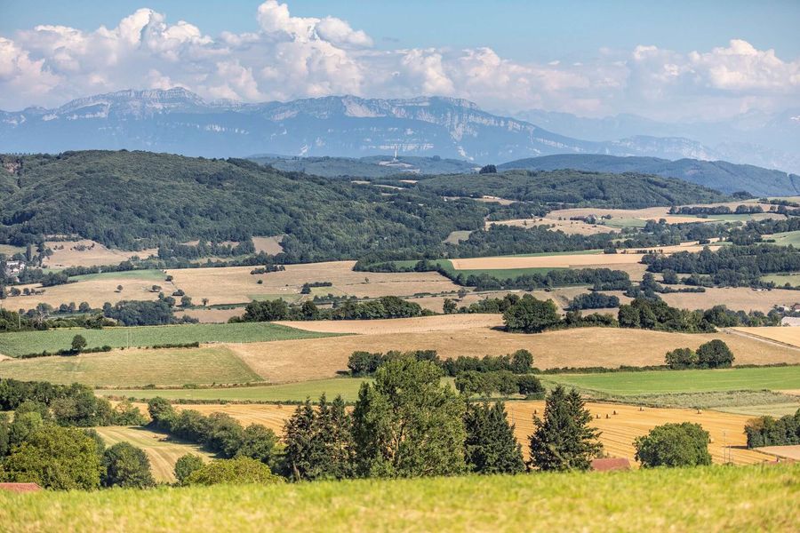
The ingredients for a beautiful hike : chestnut and oak forests, all punctuated by beautiful views of the Dent du Chat, Dévoluy, Mont Blanc, Chartreuse and Belledonne.
The characteristics of the route.

Biol (38)
- Distance 12.21 km
- Elevation gain 350 m
- Elevation lost 350 m
- Min. elevation 571 m
- Max. elevation. 679 m
- Duration (depending on pace) 3h30
- Marking Yes
From the car park, follow the yellow signs and the following junctions:
Aux Bois > Les Trois Coches > Les Planches > Le Sibuet > Le Bouteau > Les Azimets > Aux Bois > Retour Biol-le-Haut
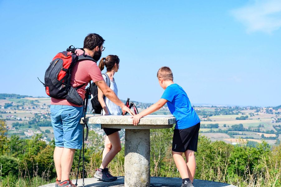
Head up a narrow road towards Les Bois, stopping in front of the Americans' stele and the viewpoint indicator on your left to observe the Bugey peaks, the Monts du Chat, the Epine range, the Chartreuse mountains and the Vercors peaks from left to right. On a clear day, you can even see Mont Blanc!
You then enter the Biol woods. At Les Trois Coches, head in the direction of Le Foulu to pass through small hamlets bordered by meadows and copses before returning to the forest on the hilly wide paths to Les Planches.
Return to Biol-le-Haut along the hilly forest track towards Les Trois Coches.
Alternatively, start from the Chasseurs car park, accessible from the route de Flachères (400m after the ST DIDIER DE BIZONNES village exit sign, take the track on the right - find your way by the electricity pole at the bottom).Marking : From the car park, follow the yellow signs and the following junctions: Aux Bois > Les Trois Coches > Les Planches > Le Sibuet > Le Bouteau > Les Azimets > Aux Bois > Retour Biol-le-Haut Alternatively, start from the Chasseurs car park, accessible from the road de Flachères (400m after the ST DIDIER DE BIZONNES village exit sign, take the track on the right - find the electricity pole at the bottom).Equipments : Public WC, Car park, Admission fee : Free access.Opening : All year round daily.
Aux Bois > Les Trois Coches > Les Planches > Le Sibuet > Le Bouteau > Les Azimets > Aux Bois > Retour Biol-le-Haut
Head up a narrow road towards Les Bois, stopping in front of the Americans' stele and the viewpoint indicator on your left to observe the Bugey peaks, the Monts du Chat, the Epine range, the Chartreuse mountains and the Vercors peaks from left to right. On a clear day, you can even see Mont Blanc!
You then enter the Biol woods. At Les Trois Coches, head in the direction of Le Foulu to pass through small hamlets bordered by meadows and copses before returning to the forest on the hilly wide paths to Les Planches.
Return to Biol-le-Haut along the hilly forest track towards Les Trois Coches.
Alternatively, start from the Chasseurs car park, accessible from the route de Flachères (400m after the ST DIDIER DE BIZONNES village exit sign, take the track on the right - find your way by the electricity pole at the bottom).Marking : From the car park, follow the yellow signs and the following junctions: Aux Bois > Les Trois Coches > Les Planches > Le Sibuet > Le Bouteau > Les Azimets > Aux Bois > Retour Biol-le-Haut Alternatively, start from the Chasseurs car park, accessible from the road de Flachères (400m after the ST DIDIER DE BIZONNES village exit sign, take the track on the right - find the electricity pole at the bottom).Equipments : Public WC, Car park, Admission fee : Free access.Opening : All year round daily.
Area : Vals du Dauphiné
Report a problem
Website Pdf file Features of the application :
- Location and orientation on detailed maps thanks to the GPS of your smartphone
- Description of routes and points of interest on the route
- Photo gallery by route
- Detailed elevation profile
- Route tracking alert to warn you if you stray from the route
- Send predefined messages by SMS to your contacts
- Emergency module: trigger a call or send an emergency SMS in case of problem
- Agenda: access to events organized in the department
- News: find in the application the latest news on the web portal
- Adding achievements
- Add reports in case of problems encountered on the routes
- Share on social networks
Add your time and share your feelings
Services nearby

Relais Cyné de Chateauvilain
Châteauvilain
Relais Cyné de Châbons
Châbons

Ecomusée rural
Longechenal
Clog museum
Val-de-Virieu

Tourist information office of La Tour du Pin - Office de Tourisme des Vals du Dauphiné
La Tour-du-Pin


Information updated on 2025-08-05 by Office de Tourisme des Vals du Dauphiné


Follow us on
the digital trails
the digital trails


![]()
The Isère Outdoor application was created
by the Département de l'Isère
Infos & contact
Conseil départemental de l'Isère
7 rue Fantin Latour
CS 41096
38 022 Grenoble cedex 1
Tel. 04 76 00 38 38
 Isère Outdoor - Parcours - King's forest at Biol le Haut (short)
Hello, world! This is a toast message.
Isère Outdoor - Parcours - King's forest at Biol le Haut (short)
Hello, world! This is a toast message.
Isère Outdoor - Parcours - King's forest at Biol le Haut (short)
Hello, world! This is a toast message.


OK
Annuler