Crests path
Add to my favorites

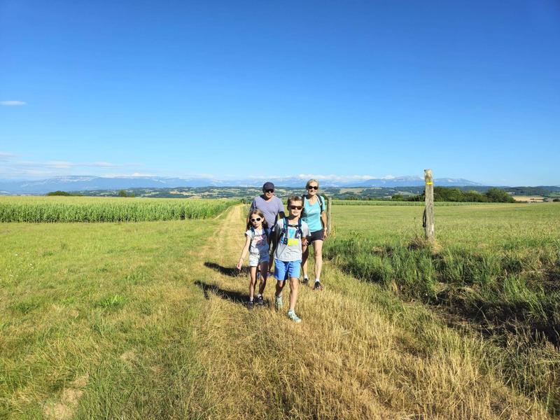
An easy route with plenty of views of the Chartreuse, the Savoyard foreland and Mont Blanc in the background.
The characteristics of the route.

Montagnieu (38)
- Distance 7.25 km
- Elevation gain 100 m
- Elevation lost 100 m
- Min. elevation 521 m
- Max. elevation. 583 m
- Duration (depending on pace) 2h
- Marking Yes
From the church car park, walk to the town hall (50m), then follow the yellow signs and the following junctions:
Chemin de Feydel > Mollard des Mottes > Cote 568 > Les Hauts d'Envelump > Beauregard > Le Feydel > Chemin de Feydel > Retour MONTAGNIEU
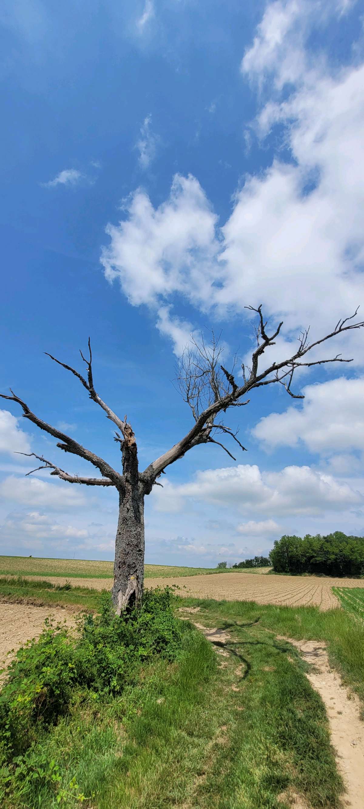
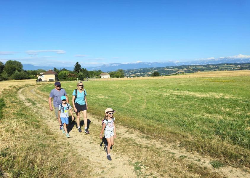
The route quickly takes you out of the village. After crossing the D17, you reach dirt tracks that you will follow almost until the end. Until Mollard des Mottes, the path rises slightly and offers beautiful views of meadows interspersed with groves where cows graze.
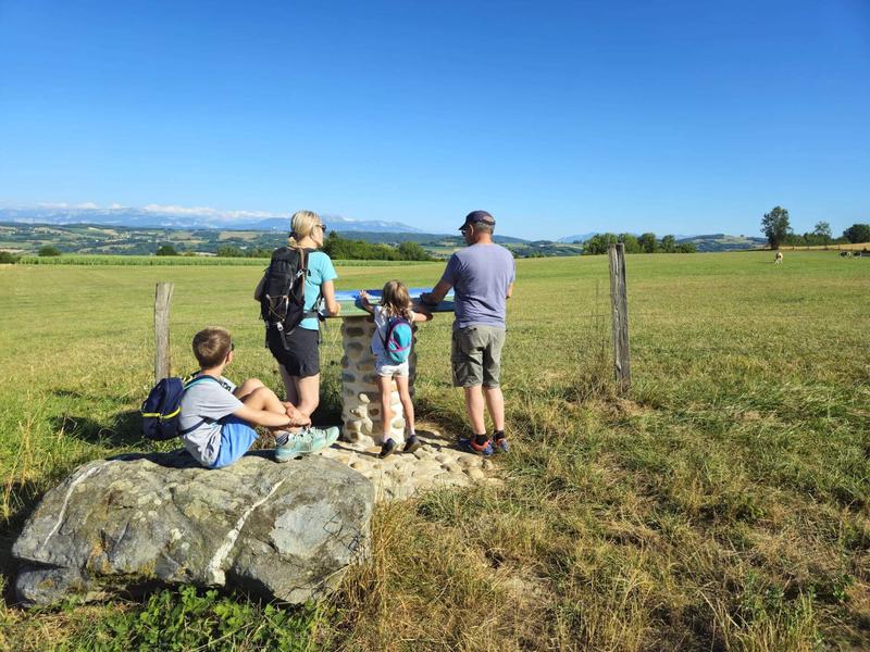
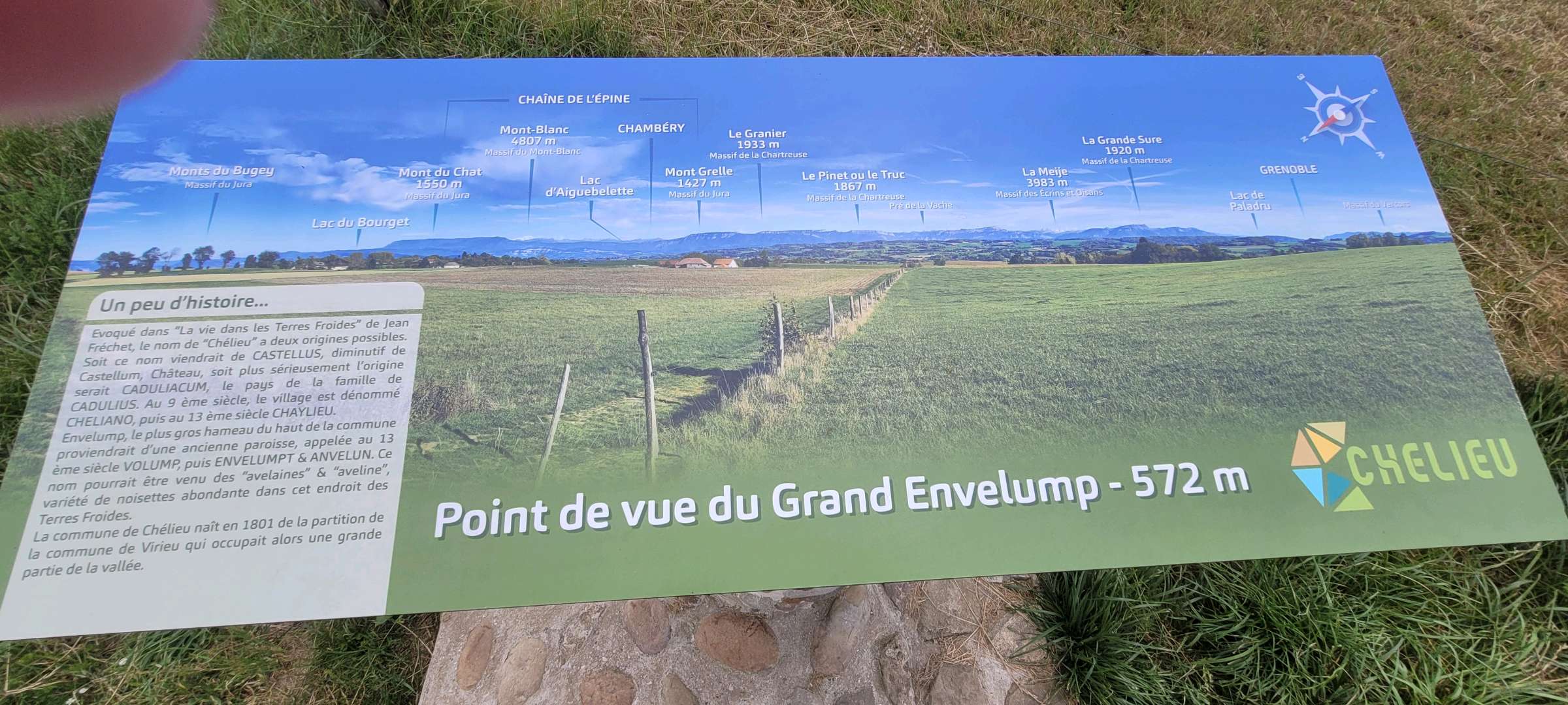
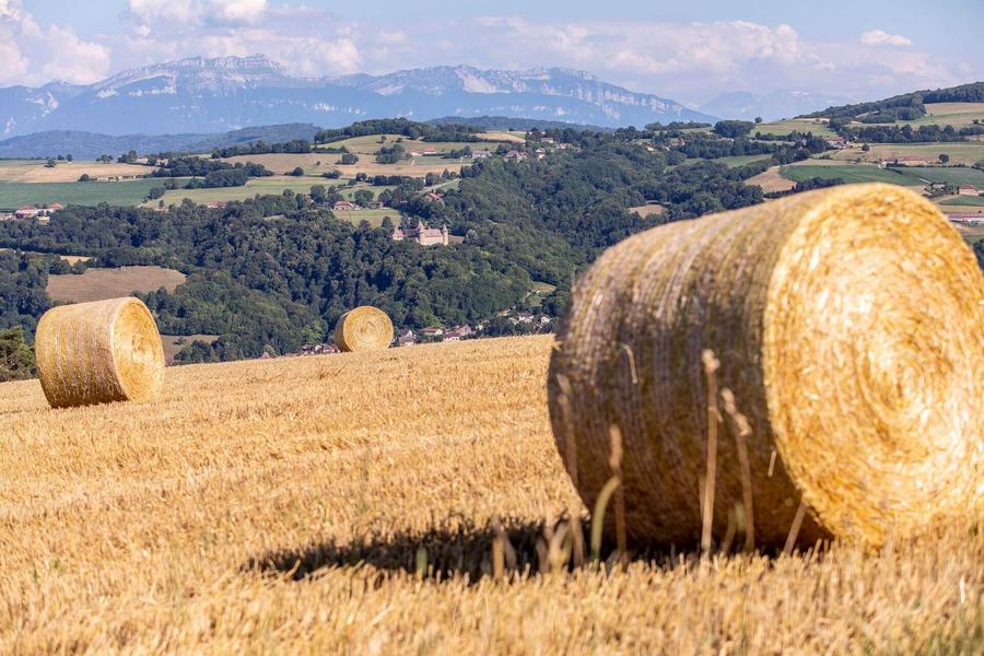
You then reach the ridges between Montagnieu and Chélieu, with beautiful views of the mountain ranges. At Cote 568, an orientation table details the Chartreuse panorama, the Savoyard foreland and, in the background, the Belledonne massif, Mont Blanc and the Ecrins.
Continue up to Beauregard before turning right to head back towards Montagnieu. There are plenty of woods and cow meadows along the way.Marking : From the church car park, walk to the town hall (50m), then follow the yellow signs and the following junctions: Chemin de Feydel > Mollard des Mottes > Cote 568 > Les Hauts d'Envelump > Beauregard > Le Feydel > Chemin de Feydel > Return to MONTAGNIEUEquipments : Car park, Public WC, Admission fee : Free access.Opening : All year round daily.
Chemin de Feydel > Mollard des Mottes > Cote 568 > Les Hauts d'Envelump > Beauregard > Le Feydel > Chemin de Feydel > Retour MONTAGNIEU
The route quickly takes you out of the village. After crossing the D17, you reach dirt tracks that you will follow almost until the end. Until Mollard des Mottes, the path rises slightly and offers beautiful views of meadows interspersed with groves where cows graze.
You then reach the ridges between Montagnieu and Chélieu, with beautiful views of the mountain ranges. At Cote 568, an orientation table details the Chartreuse panorama, the Savoyard foreland and, in the background, the Belledonne massif, Mont Blanc and the Ecrins.
Continue up to Beauregard before turning right to head back towards Montagnieu. There are plenty of woods and cow meadows along the way.Marking : From the church car park, walk to the town hall (50m), then follow the yellow signs and the following junctions: Chemin de Feydel > Mollard des Mottes > Cote 568 > Les Hauts d'Envelump > Beauregard > Le Feydel > Chemin de Feydel > Return to MONTAGNIEUEquipments : Car park, Public WC, Admission fee : Free access.Opening : All year round daily.
Area : Vals du Dauphiné
Report a problem
Website Features of the application :
- Location and orientation on detailed maps thanks to the GPS of your smartphone
- Description of routes and points of interest on the route
- Photo gallery by route
- Detailed elevation profile
- Route tracking alert to warn you if you stray from the route
- Send predefined messages by SMS to your contacts
- Emergency module: trigger a call or send an emergency SMS in case of problem
- Agenda: access to events organized in the department
- News: find in the application the latest news on the web portal
- Adding achievements
- Add reports in case of problems encountered on the routes
- Share on social networks
olivier38
The 2026/05/31
En savoir plus
olivier38
finished in 02:30:00
The 2026/05/31
En savoir plus
Ajouter votre chrono et partager vos sensations
2026/05/31 olivier38
Services nearby

Tourist information office of La Tour du Pin - Office de Tourisme des Vals du Dauphiné
La Tour-du-Pin

Clog museum
Val-de-Virieu

Relais Cyné de Châbons
Châbons
Relais Cyné de Chateauvilain
Châteauvilain
Dauphinois Weaving Museum
La Bâtie-Montgascon


Information updated on 2025-08-05 by Office de Tourisme des Vals du Dauphiné


Follow us on
the digital trails
the digital trails


![]()
The Isère Outdoor application was created
by the Département de l'Isère
Infos & contact
Conseil départemental de l'Isère
7 rue Fantin Latour
CS 41096
38 022 Grenoble cedex 1
Tel. 04 76 00 38 38
 Isère Outdoor - Parcours - Crests path
Hello, world! This is a toast message.
Isère Outdoor - Parcours - Crests path
Hello, world! This is a toast message.
Isère Outdoor - Parcours - Crests path
Hello, world! This is a toast message.


OK
Annuler