Chélieu over hills and streams
Add to my favorites

A beautiful walk with water as a common thread, offering a fairly gentle start before embarking on a beautiful descent through the Gabelles ravine and then a crescendo return through the Combe stream.
The characteristics of the route.

Chélieu (38)
- Distance 8.97 km
- Elevation gain 260 m
- Elevation lost 260 m
- Min. elevation 394 m
- Max. elevation. 582 m
- Duration (depending on pace) 2h30
- Marking Yes
From the car park, follow the yellow signs and the following junctions:
Les Hauts d'Envelump > Côte 568 > Mollard des Mottes > Ravin des Gabelles > Lézieu > La Mollat > Tancin > Aux Hayes > Retour Chélieu-Mairie.
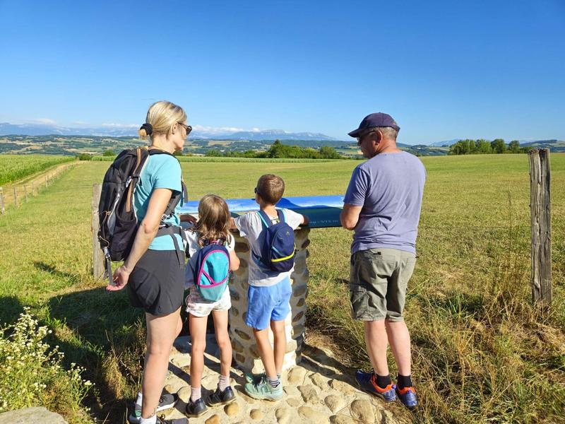
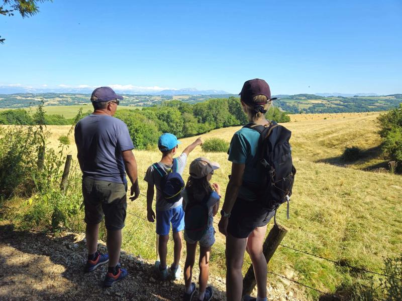
Follow the town hall on your left and climb towards Hauts d'Envelump and Cote 568. Take time to admire the postcard panorama ! An orientation table gives the panorama details. From left to right, you can see the Bugey peaks, the Monts du Chat, the Epine range and the Chartreuse mountains. In the background, you can see Mont Blanc on a clear day.
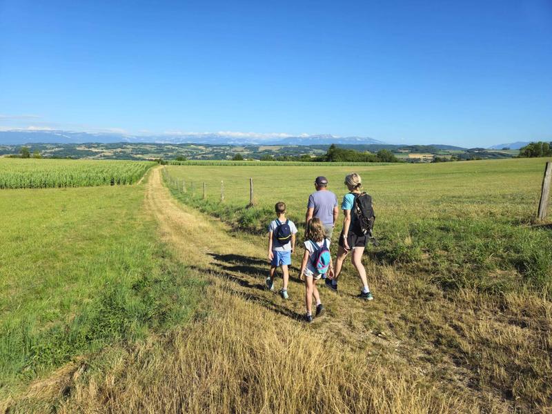
The path on the heights is very pleasant, lined with meadows and farmland. The view remains unobstructed as far as the Ravin des Gabelles before descending into undergrowth, never very far from the stream.
When you reach Lézieu, cross the level crossing and take the path immediately to the left. Watch over the children for the first 200 metres near the tracks.
After La Mollat, the small road and then the track go up through the Sauvagère woods towards Tancin, where you cross a small stream that often dries up in summer.
Turn left onto the woodland track as far as Les Hayes, then walk on the road for the remaining 400 metres to reach the car park.
Translated with DeepL.com (free version)Marking : From the car park, follow the yellow signs and the following junctions: Les Hauts d'Envelump > Côte 568 > Mollard des Mottes > Ravin des Gabelles > Lézieu > La Mollat > Tancin > Aux Hayes > Retour Chélieu-MairieEquipments : Public WC, Car park, Delicate passages : Watch over your children when you take the path that runs alongside the railway line at Lézieu for 200m.Admission fee : Free access.Opening : All year round daily.
Les Hauts d'Envelump > Côte 568 > Mollard des Mottes > Ravin des Gabelles > Lézieu > La Mollat > Tancin > Aux Hayes > Retour Chélieu-Mairie.
Follow the town hall on your left and climb towards Hauts d'Envelump and Cote 568. Take time to admire the postcard panorama ! An orientation table gives the panorama details. From left to right, you can see the Bugey peaks, the Monts du Chat, the Epine range and the Chartreuse mountains. In the background, you can see Mont Blanc on a clear day.
The path on the heights is very pleasant, lined with meadows and farmland. The view remains unobstructed as far as the Ravin des Gabelles before descending into undergrowth, never very far from the stream.
When you reach Lézieu, cross the level crossing and take the path immediately to the left. Watch over the children for the first 200 metres near the tracks.
After La Mollat, the small road and then the track go up through the Sauvagère woods towards Tancin, where you cross a small stream that often dries up in summer.
Turn left onto the woodland track as far as Les Hayes, then walk on the road for the remaining 400 metres to reach the car park.
Translated with DeepL.com (free version)Marking : From the car park, follow the yellow signs and the following junctions: Les Hauts d'Envelump > Côte 568 > Mollard des Mottes > Ravin des Gabelles > Lézieu > La Mollat > Tancin > Aux Hayes > Retour Chélieu-MairieEquipments : Public WC, Car park, Delicate passages : Watch over your children when you take the path that runs alongside the railway line at Lézieu for 200m.Admission fee : Free access.Opening : All year round daily.
Area : Vals du Dauphiné
Report a problem
Website Features of the application :
- Location and orientation on detailed maps thanks to the GPS of your smartphone
- Description of routes and points of interest on the route
- Photo gallery by route
- Detailed elevation profile
- Route tracking alert to warn you if you stray from the route
- Send predefined messages by SMS to your contacts
- Emergency module: trigger a call or send an emergency SMS in case of problem
- Agenda: access to events organized in the department
- News: find in the application the latest news on the web portal
- Adding achievements
- Add reports in case of problems encountered on the routes
- Share on social networks
Add your time and share your feelings
Services nearby

Clog museum
Val-de-Virieu

Tourist information office of La Tour du Pin - Office de Tourisme des Vals du Dauphiné
La Tour-du-Pin

Relais Cyné de Châbons
Châbons
Lake Paladru Archeological Museum
Villages du lac de Paladru

Espace Naturel Sensible des Marais de la Véronnière et du Courbon
Villages du lac de Paladru


Information updated on 2025-08-08 by Office de Tourisme des Vals du Dauphiné


Follow us on
the digital trails
the digital trails


![]()
The Isère Outdoor application was created
by the Département de l'Isère
Infos & contact
Conseil départemental de l'Isère
7 rue Fantin Latour
CS 41096
38 022 Grenoble cedex 1
Tel. 04 76 00 38 38
 Isère Outdoor - Parcours - Chélieu over hills and streams
Hello, world! This is a toast message.
Isère Outdoor - Parcours - Chélieu over hills and streams
Hello, world! This is a toast message.
Isère Outdoor - Parcours - Chélieu over hills and streams
Hello, world! This is a toast message.


OK
Annuler