Col de la vache - Hiking
Add to my favorites

Caution! Zone of vigilance near the route
Roches Jaunes - du 29/07/2026 au 09/09/2026 Upcoming
Les 7 Laux - du 20/06/2026 au 20/09/2026 In progress
La Pesée - du 10/07/2026 au 30/09/2026 Upcoming
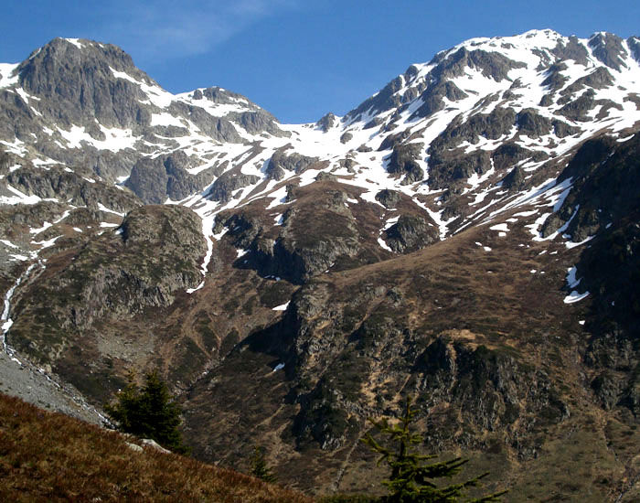
A lovely unspoiled walk featuring mountain lakes and ibex-spotting.
The characteristics of the route.

Allemond (38)
- Distance 15.08 km
- Elevation gain 1300 m
- Elevation lost 1300 m
- Min. elevation 1264 m
- Max. elevation. 2549 m
- Duration (depending on pace) 8h05
- Marking No
TECHNICAL INFORMATION
Starting point: Rivier d'Allemond
Height gain: 1253 m
Distance: 6.6 km
Level: Difficult
ROUTE
Starting from le Rivier d'Allemond, take the Pas de la Coche path, turning off when you see the sign at the Ruisseau des Combes stream. The path follows the bank upstream, before climbing rapidly under the Pic du Pin and joining back up with the path from the Pas de la Coche and crossing eastward under the Pic de la Belle Etoile. The path then climbs up steeply towards a peat bog (2322 m), before crossing a long rocky section, where hikers follow cairns. Another path leads up to the Col (2556 m).
EXTRA INFO
Make sure you have suitable footwear and gaiters as patches of snow persist into summer.
Area : Oisans
Report a problem
Features of the application :
- Location and orientation on detailed maps thanks to the GPS of your smartphone
- Description of routes and points of interest on the route
- Photo gallery by route
- Detailed elevation profile
- Route tracking alert to warn you if you stray from the route
- Send predefined messages by SMS to your contacts
- Emergency module: trigger a call or send an emergency SMS in case of problem
- Agenda: access to events organized in the department
- News: find in the application the latest news on the web portal
- Adding achievements
- Add reports in case of problems encountered on the routes
- Share on social networks
Add your time and share your feelings
Services nearby

Ibex museum - Space York Mallory
Allemond

Refuge le Habert d'Aiguebelle
Laval
Refuge Jean Collet
Sainte-Agnès
Vaujany museum
Vaujany

Office de Tourisme de Vaujany
Vaujany


Follow us on
the digital trails
the digital trails


![]()
The Isère Outdoor application was created
by the Département de l'Isère
Infos & contact
Conseil départemental de l'Isère
7 rue Fantin Latour
CS 41096
38 022 Grenoble cedex 1
Tel. 04 76 00 38 38
 Isère Outdoor - Parcours - Col de la vache - Hiking
Hello, world! This is a toast message.
Isère Outdoor - Parcours - Col de la vache - Hiking
Hello, world! This is a toast message.
Isère Outdoor - Parcours - Col de la vache - Hiking
Hello, world! This is a toast message.


OK
Annuler