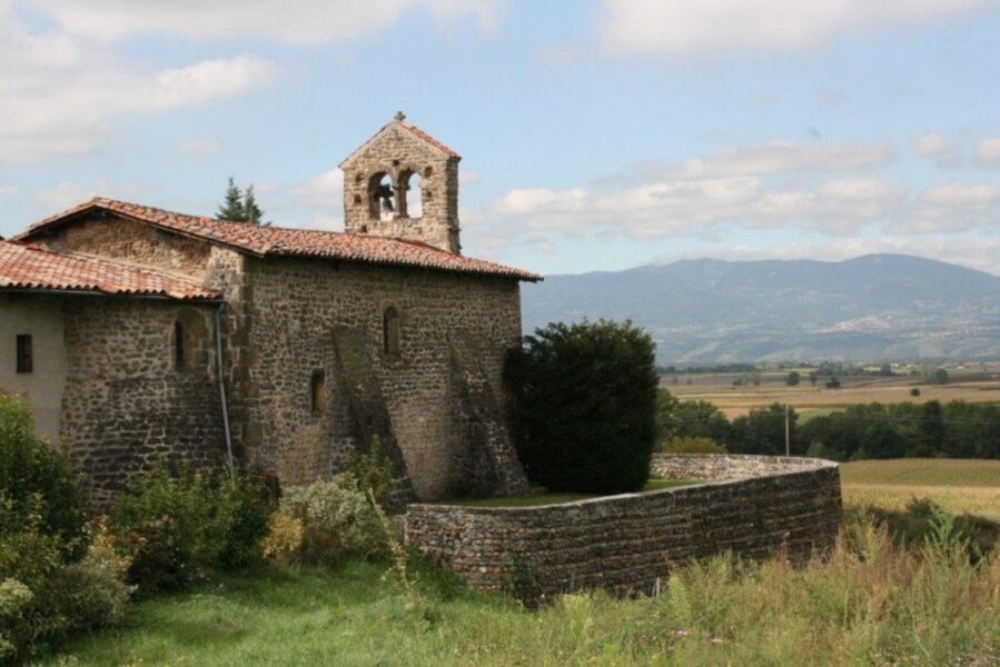
Autour de la chapelle Saint-Mamert
Add to my favorites

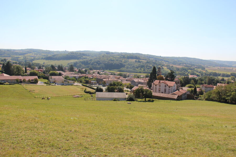
Walking tour in the agricultural landscape around Vienne, little streams and nice views on the regional park of the Pilat.
The characteristics of the route.

Les Côtes-d'Arey (38)
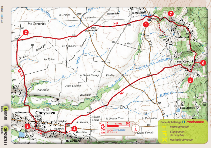
- Distance 11.98 km
- Elevation gain 200 m
- Elevation lost 200 m
- Min. elevation 206 m
- Max. elevation. 367 m
- Duration (depending on pace) 3h30
- Marking Yes
Equipments : Picnic area, Admission fee : Free access.Opening : All year round daily.
Area : Vienne Condrieu
Report a problem
Pdf file Features of the application :
- Location and orientation on detailed maps thanks to the GPS of your smartphone
- Description of routes and points of interest on the route
- Photo gallery by route
- Detailed elevation profile
- Route tracking alert to warn you if you stray from the route
- Send predefined messages by SMS to your contacts
- Emergency module: trigger a call or send an emergency SMS in case of problem
- Agenda: access to events organized in the department
- News: find in the application the latest news on the web portal
- Adding achievements
- Add reports in case of problems encountered on the routes
- Share on social networks
Add your time and share your feelings
Services nearby

La Villa de Licinius
Clonas-sur-Varèze

Tourist office of Vienne
Vienne
Archaelogical Museum - Saint Peter's Church
Vienne
Fine Arts and Archaeology Museum
Vienne
Saint-André-le-Bas Cloister
Vienne


Information updated on 2025-09-10 by Office de Tourisme de Vienne Condrieu Agglomération


Follow us on
the digital trails
the digital trails


![]()
The Isère Outdoor application was created
by the Département de l'Isère
Infos & contact
Conseil départemental de l'Isère
7 rue Fantin Latour
CS 41096
38 022 Grenoble cedex 1
Tel. 04 76 00 38 38
 Isère Outdoor - Parcours - Autour de la chapelle Saint-Mamert
Hello, world! This is a toast message.
Isère Outdoor - Parcours - Autour de la chapelle Saint-Mamert
Hello, world! This is a toast message.
Isère Outdoor - Parcours - Autour de la chapelle Saint-Mamert
Hello, world! This is a toast message.


OK
Annuler