Belvédère et Aiguille de Chalais
Add to my favorites

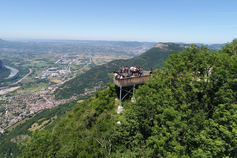
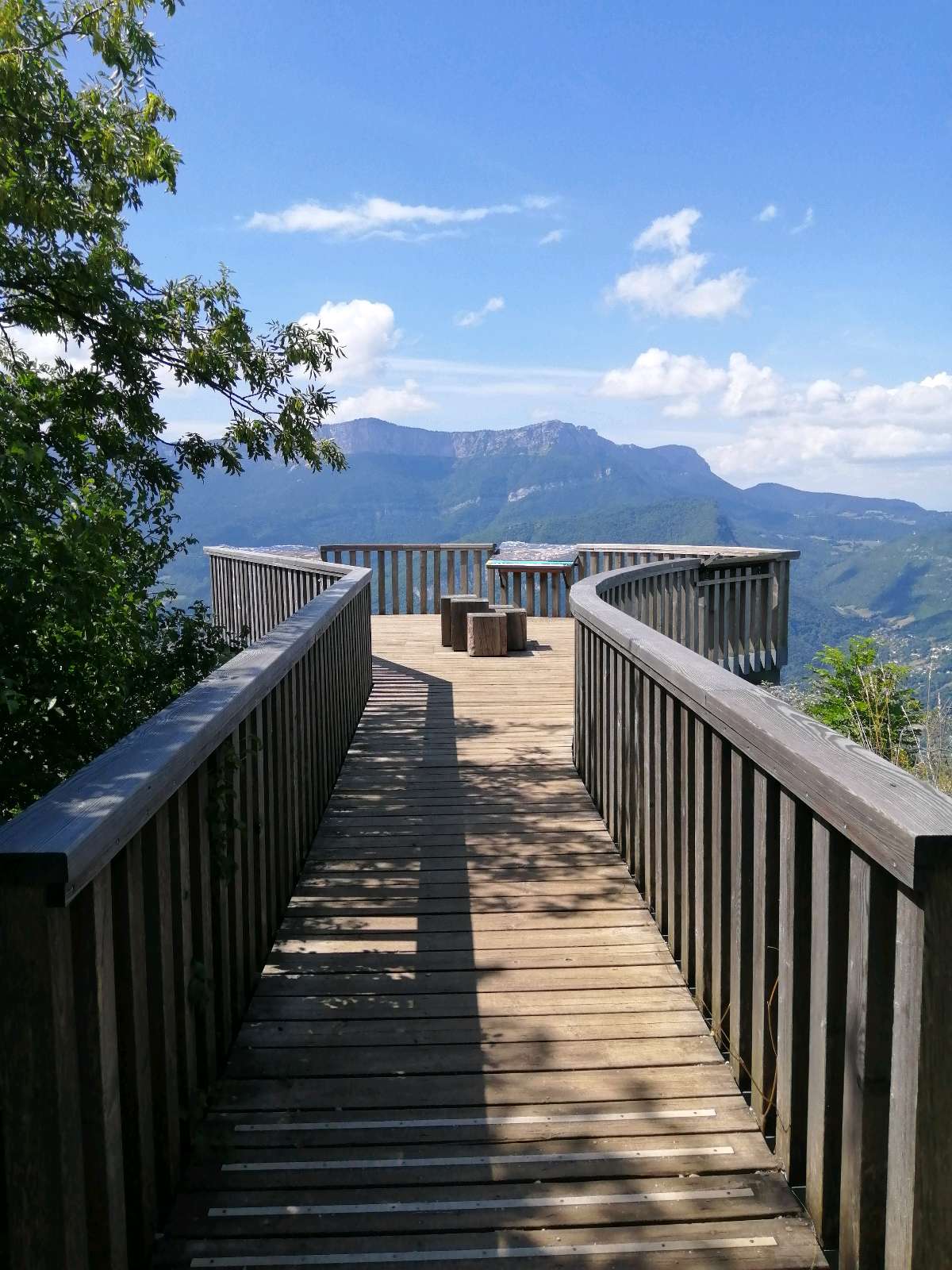
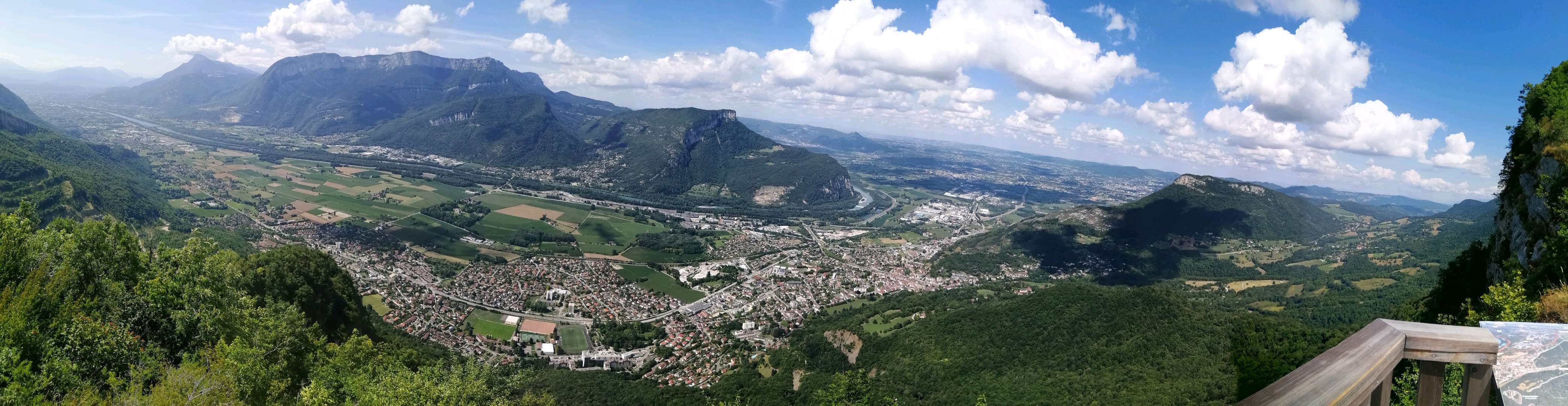
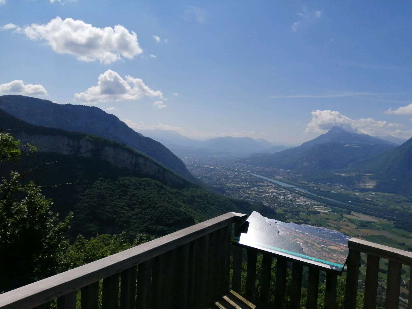
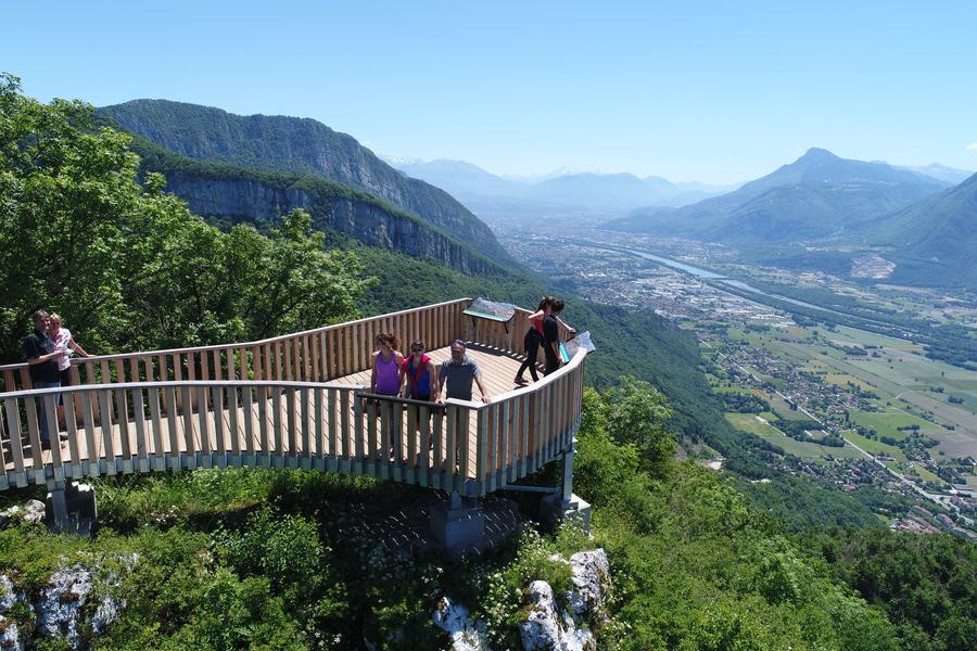
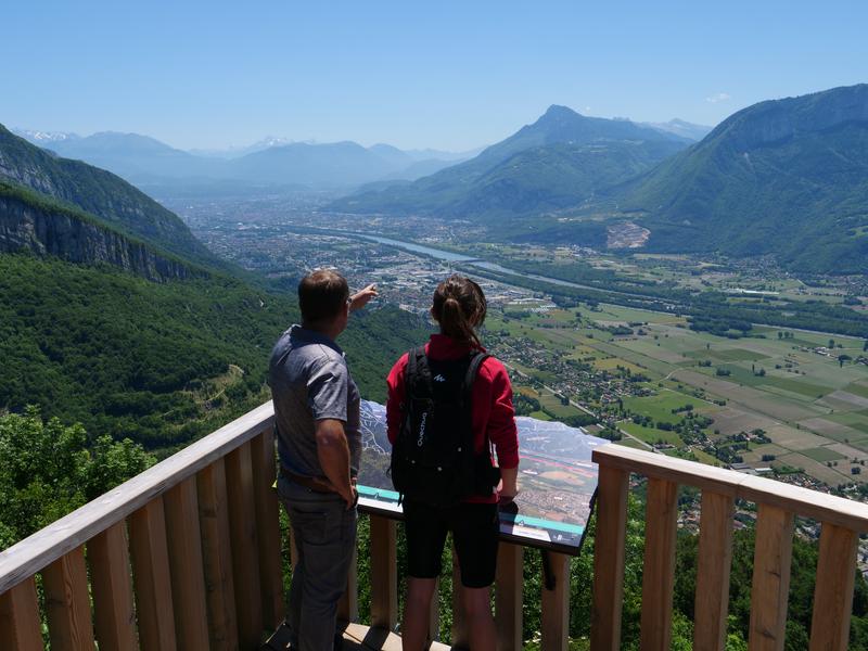
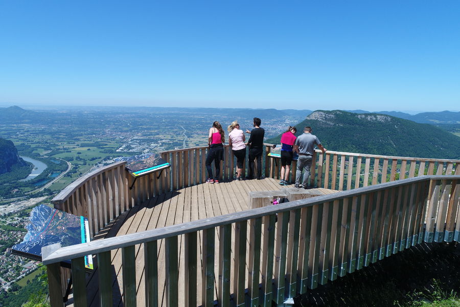
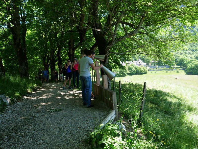
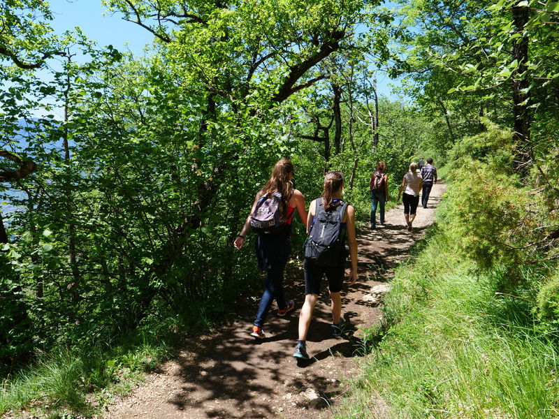
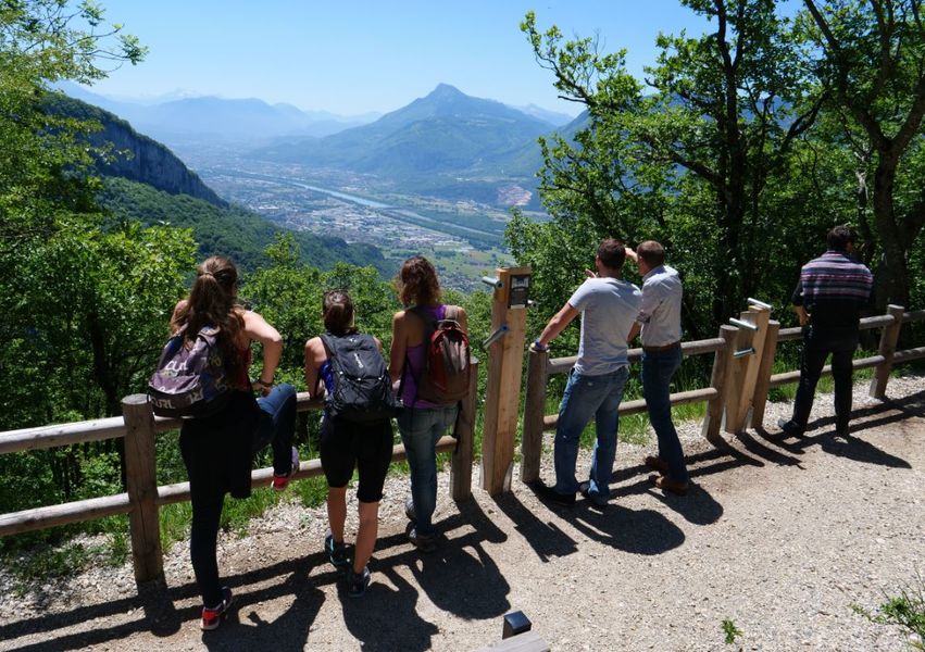
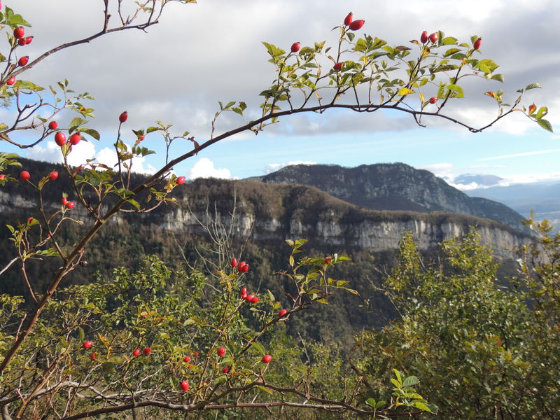
Une découverte ludique pour petits et grands au fil de 6 arrêts sensoriels, suivie de vues incroyables sur la Chartreuse, le Vercors et la Vallée de l’Isère depuis la plateforme panoramique.
Route labeled FFRandonnée

The characteristics of the route.

Voreppe (38)
- Distance 2.91 km
- Elevation gain 170 m
- Elevation lost 170 m
- Min. elevation 924 m
- Max. elevation. 1083 m
- Duration (depending on pace) 1h
- Marking Yes
Equipments : Public WC, Car park, Orientation board, Admission fee : Free access.Opening : All year round.
Subject to favorable weather.
Area : Pays Voironnais
Report a problem
Website Pdf file Features of the application :
- Location and orientation on detailed maps thanks to the GPS of your smartphone
- Description of routes and points of interest on the route
- Photo gallery by route
- Detailed elevation profile
- Route tracking alert to warn you if you stray from the route
- Send predefined messages by SMS to your contacts
- Emergency module: trigger a call or send an emergency SMS in case of problem
- Agenda: access to events organized in the department
- News: find in the application the latest news on the web portal
- Adding achievements
- Add reports in case of problems encountered on the routes
- Share on social networks
sandryne-38
finished in 01:01:00
The 2025/08/01
En savoir plus
Ajouter votre chrono et partager vos sensations
Services nearby

Col de Porte
Sarcenas

Sappey-en-Chartreuse Tourist Information Center
Le Sappey-en-Chartreuse
Sassenage Tourist Information Center
Sassenage
Pays Voironnais Tourist Office, Voiron information office
Voiron

Mainssieux Museum
Voiron


Information updated on 2025-05-14 by Office de Tourisme du Pays Voironnais


Follow us on
the digital trails
the digital trails


![]()
The Isère Outdoor application was created
by the Département de l'Isère
Infos & contact
Conseil départemental de l'Isère
7 rue Fantin Latour
CS 41096
38 022 Grenoble cedex 1
Tel. 04 76 00 38 38
 Isère Outdoor - Parcours - Belvédère et Aiguille de Chalais
Hello, world! This is a toast message.
Isère Outdoor - Parcours - Belvédère et Aiguille de Chalais
Hello, world! This is a toast message.
Isère Outdoor - Parcours - Belvédère et Aiguille de Chalais
Hello, world! This is a toast message.


OK
Annuler