Stories and legends around Lake Moras
Add to my favorites

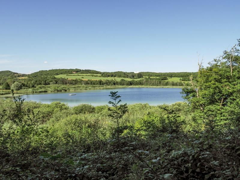
This partly shaded loop, starting from Saint-Hilaire-de-Brens, offers magnificent panoramic views over the Lac de Moras (private).
The characteristics of the route.

Saint-Hilaire-de-Brens (38)
- Distance 12 km
- Elevation gain 290 m
- Elevation lost 290 m
- Min. elevation 302 m
- Max. elevation. 389 m
- Marking Yes
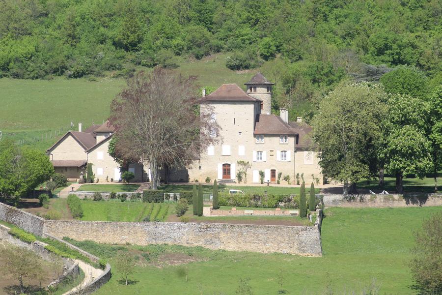
You'll also discover a wealth of architectural features along the way, including châteaux and small water-related buildings (wash-houses, fountains, wells).Marking : Yellow paint markingsAdmission fee : Free access.Opening : All year round.
Subject to favorable weather.Step by step description : 1- From Saint-Hilaire-de-Brens town hall, head towards Moras. At the crossroads, turn to the left and follow the road up to Château de Montplaisant. In front of the castle, turn right on the track.
2- At the "Les Côtes du Lac" signpost, continue towards Moras via Crizieu. Cross the hamlet of Crizieu and turn left on the road D18G.
3- After 200 m on the road, take the footpath which rises to the right. Walk past the cemetery, then take the footpath to the left of the road towards Moras.
Leave the car park on your right and go straight on the road D 18G. Follow it to the left, then take the path to the right and continue straight on until you reach the route de Vénérieu. Follow this road for 150 m and turn right through the hamlet of Frétignier.
4- Turn right and find the path which runs alongside the properties. At the crossroads, turn left and continue on this road as far as the "Seuillère" signpost. Follow the signs for Saint-Hilaire-de-Brens as far as the "Frétignier" sign.
5- Continue towards Saint-Hilaire-de-Brens, cross the road and go down the track opposite. Go along the road of Moras on your right and take the track on your left to find the post ‘Les Côtes du Lac’.
2- Head towards Saint-Hilaire-de-Brens on the same track as on the outward journey to get back to the starting car park.
Area : Balcons du Dauphiné
Report a problem
Website TOPO : Histoires et légendes autour du lac de Moras Features of the application :
- Location and orientation on detailed maps thanks to the GPS of your smartphone
- Description of routes and points of interest on the route
- Photo gallery by route
- Detailed elevation profile
- Route tracking alert to warn you if you stray from the route
- Send predefined messages by SMS to your contacts
- Emergency module: trigger a call or send an emergency SMS in case of problem
- Agenda: access to events organized in the department
- News: find in the application the latest news on the web portal
- Adding achievements
- Add reports in case of problems encountered on the routes
- Share on social networks
Add your time and share your feelings
Services nearby

Crémieu - Balcons du Dauphine Tourist Information Office
Crémieu
Saint-Chef - Balcons du Dauphine Tourist Information Office
Saint-Chef

Saint-Chef Museum
Saint-Chef
Mineralogica - The mineral museum
Villemoirieu

Marais de la Besseye Sensitive Natural Area
Villemoirieu


Information updated on 2025-03-12 by Office du Tourisme Les Balcons du Dauphiné


Follow us on
the digital trails
the digital trails


![]()
The Isère Outdoor application was created
by the Département de l'Isère
Infos & contact
Conseil départemental de l'Isère
7 rue Fantin Latour
CS 41096
38 022 Grenoble cedex 1
Tel. 04 76 00 38 38
 Isère Outdoor - Parcours - Stories and legends around Lake Moras
Hello, world! This is a toast message.
Isère Outdoor - Parcours - Stories and legends around Lake Moras
Hello, world! This is a toast message.
Isère Outdoor - Parcours - Stories and legends around Lake Moras
Hello, world! This is a toast message.


OK
Annuler