La Courbe - Hiking from Puy-le-Bas (Le Freney-d'Oisans)
Add to my favorites

Caution! Zone of vigilance near the route
Piefroid - du 15/06/2026 au 01/10/2026 In progress
Cassini - du 20/06/2026 au 20/10/2026 Upcoming
Alpage d'Auris - du 22/05/2026 au 22/10/2026 In progress
Circaète Jean-le-Blanc - du 01/03/2026 au 30/09/2026 In progress
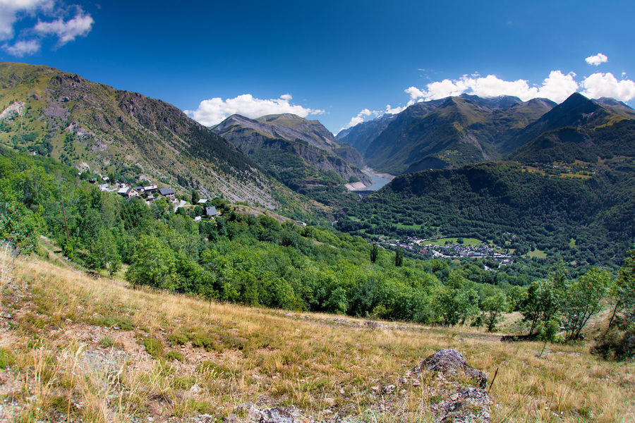
The Courbe site offers a pleasant afternoon stroll on the sunny slopes of the Grandes Rousses massif. You can visit the village of Clavans before returning.
The characteristics of the route.

Le Freney-d'Oisans (38)
- Distance 9.8 km
- Elevation gain 730 m
- Elevation lost 730 m
- Min. elevation 1211 m
- Max. elevation. 1843 m
- Duration (depending on pace) 3h30
- Marking Yes
TECHNICAL INFORMATION
Start: Puy le bas
Height difference: 500 m
Round trip time: 3h30
Return distance: 7.4 km
Level : Medium
ITINERARY
Above Puy-le-Bas, the trail crosses. The slope then steepens through the alpine pastures to reach a rockier area and finally the Rocher de la Courbe.
After crossing Puy-le-Bas, the carriage road turns right to the champ de Bonnefond, where the path is signposted on the right.
Enjoy the freshness of the water intake. Continue until you come to a wide bend in the road, where the path turns right into a meadow, always well-marked as far as La Courbe. You pass under the Bec de l'Aigle (where you might spot some chamois!).
You can continue on to the ruins of the chalet, where cairns indicate the way through the site to find the path down to Clavans. To avoid the village, look for a little-used, unmaintained path 50 m below the descent, which leads to a wider path from Clavans. Shaded area. Climb up to the Follet oratory and continue through the woods along the side of the Clapière to reach Puy-le-Bas.Opening : From 01/06 to 31/10 : open daily.Warning : As this route is potentially subject to severe damage due to major weather events and its viability may be uncertain, please enquire before embarking on it.
Area : Oisans
Report a problem
TOPO_Puy le bas > La Courbe Features of the application :
- Location and orientation on detailed maps thanks to the GPS of your smartphone
- Description of routes and points of interest on the route
- Photo gallery by route
- Detailed elevation profile
- Route tracking alert to warn you if you stray from the route
- Send predefined messages by SMS to your contacts
- Emergency module: trigger a call or send an emergency SMS in case of problem
- Agenda: access to events organized in the department
- News: find in the application the latest news on the web portal
- Adding achievements
- Add reports in case of problems encountered on the routes
- Share on social networks
Add your time and share your feelings
Services nearby

Chasal Lento Museum
Les Deux Alpes

Auris-en-Oisans tourist office
Auris-en-Oisans
Exhibition area - Maison de la Montagne
Les Deux Alpes
Tourist office of le Ferrand
Besse-en-Oisans
2 ALPES TOURIST OFFICE
Les Deux Alpes


Follow us on
the digital trails
the digital trails


![]()
The Isère Outdoor application was created
by the Département de l'Isère
Infos & contact
Conseil départemental de l'Isère
7 rue Fantin Latour
CS 41096
38 022 Grenoble cedex 1
Tel. 04 76 00 38 38
 Isère Outdoor - Parcours - La Courbe - Hiking from Puy-le-Bas (Le Freney-d'Oisans)
Hello, world! This is a toast message.
Isère Outdoor - Parcours - La Courbe - Hiking from Puy-le-Bas (Le Freney-d'Oisans)
Hello, world! This is a toast message.
Isère Outdoor - Parcours - La Courbe - Hiking from Puy-le-Bas (Le Freney-d'Oisans)
Hello, world! This is a toast message.


OK
Annuler