23 - Le Col de Bovinant on trail
Add to my favorites

Caution! Zone of vigilance near the route
Le Pas Dinay, Combe des Éparres, Col de Bovinant, Col de Léchaud, Pas du Loup, Col de la Ruchère, and Belvédère d'Arpison are all part of this trail route starting from La Ruchère.
The characteristics of the route.

Saint-Christophe-sur-Guiers (38)
- Distance 19.15 km
- Elevation gain 1190 m
- Elevation lost 1190 m
- Min. elevation 970 m
- Max. elevation. 1731 m
- Duration (depending on pace) 2h50
- Marking Yes
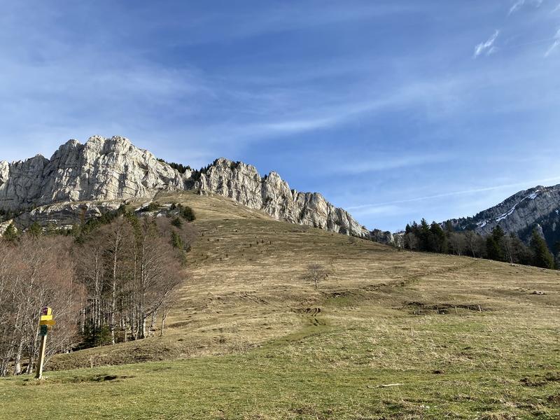
Discover Trail Route No. 23 – a red course in the heart of the Chartreuse, designed for experienced runners seeking a challenge. This demanding route takes you through technical trails, steep climbs, and fast descents, while offering breathtaking views of the surrounding mountains. Perfect for pushing your limits and enjoying the wild beauty of the Chartreuse.
Download the Raidlight-Trail-Experience App
Enjoy all the trail routes directly on your smartphone with several useful features:
*Track your real-time location along the route
*Access detailed trail descriptions during your outing and download the data for offline access
*Benefit from detailed IGN maps and add your timing results to the routes.Marking : Trail Marking No. 23 RedEquipments : Car park, Delicate passages : Le Pas DinayAdmission fee : Free access.Opening : Open every day. Subject to favorable snow and weather conditions.Step by step description : Starting from the La Ruche à Gîter lodge, take the path on the right that leads into the forest. At the intersection with a forest track, continue left, staying on the same wide path. At each junction, you will find the green trail markers No. 21 to guide you along the forest track. At the PDIPR Forêt du Quartier signpost, turn right towards the Belvédère des Riondettes, where you can enjoy a view of the Guiers Valley at your feet. To continue, facing the valley, take the small path that follows the ridge to your left. On this relatively steep trail, feel free to walk if needed. At the PDIPR Col de la Sariette signpost, turn left onto a wilder, rockier section of the trail. At the next intersection with a new forest track, continue left, then straight ahead to discover the Riondettes and its meadow, which serves as cross-country skiing tracks in winter. A short stretch on the road brings you to the PDIPR Les Riondettes signpost, where you will follow the Centre Nordique direction to the right. You will follow the stream for a few meters before crossing the Pré de la Morte meadow to take a wider track on the right. At the next intersection (yellow arrow), continue right on a path that leads you to the PDIPR Le Cerney signpost. Continue following the direction of Pré Gervet and then Col de Ruchère. Take the time to admire the stunning view in front of you of the Vallon du Monastère, with Chamechaude in the background. Be cautious as you enter the alpine pasture of Grand Som, where you may encounter the shepherd and his animals. Take care to walk slowly so as not to scare the animals and feel free to chat with the shepherd, who is passionate about his work and always happy to share his experiences. Continue towards the PDIPR Sous le Petit Som, then head to Pas du Loup, Habert de Bovinant, and Col de Bovinant. At the Col, you will enter the Combe des Éparres, a wild and preserved area in the heart of Chartreuse. Please stay on the trail. It’s at the PDIPR Grange Jacquet signpost that you will ascend towards Pas Dinay, preferably walking. The final section of this route is a balcony trail in the heart of the forest, allowing you to reach the Grand Village of Saint Christophe sur Guiers before climbing back along the road to La Ruche à Gîter.
Area : Cœur de Chartreuse
Report a problem
Pdf file Features of the application :
- Location and orientation on detailed maps thanks to the GPS of your smartphone
- Description of routes and points of interest on the route
- Photo gallery by route
- Detailed elevation profile
- Route tracking alert to warn you if you stray from the route
- Send predefined messages by SMS to your contacts
- Emergency module: trigger a call or send an emergency SMS in case of problem
- Agenda: access to events organized in the department
- News: find in the application the latest news on the web portal
- Adding achievements
- Add reports in case of problems encountered on the routes
- Share on social networks
Add your time and share your feelings
Services nearby

Coeur de Chartreuse Tourist Information center at Saint Pierre d'Entremont
Saint-Pierre-d'Entremont
Coeur de Chartreuse Tourist Information center at Saint Laurent du Pont
Saint-Laurent-du-Pont

Museum of la Grande Chartreuse
Saint-Pierre-de-Chartreuse

Espace Naturel Sensible des Tourbières de l'Herretang
Saint-Laurent-du-Pont
Coeur de Chartreuse Tourist Information center at Saint Pierre de Chartreuse
Saint-Pierre-de-Chartreuse


Information updated on 2026-06-10 by Chartreuse Tourisme


Follow us on
the digital trails
the digital trails


![]()
The Isère Outdoor application was created
by the Département de l'Isère
Infos & contact
Conseil départemental de l'Isère
7 rue Fantin Latour
CS 41096
38 022 Grenoble cedex 1
Tel. 04 76 00 38 38
 Isère Outdoor - Parcours - 23 - Le Col de Bovinant on trail
Hello, world! This is a toast message.
Isère Outdoor - Parcours - 23 - Le Col de Bovinant on trail
Hello, world! This is a toast message.
Isère Outdoor - Parcours - 23 - Le Col de Bovinant on trail
Hello, world! This is a toast message.


OK
Annuler