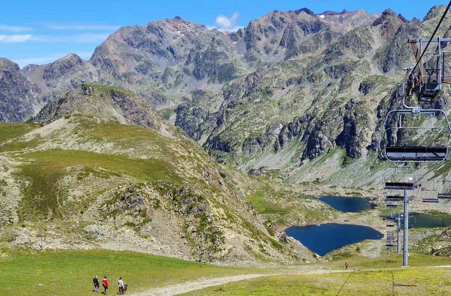
Croix of Chamrousse - Robert lakes by the slope
Add to my favorites

Caution! Zone of vigilance near the route
Bouquetin des Alpes - du 01/06/2026 au 30/09/2026 In progress
Bouquetin des Alpes - du 01/06/2026 au 30/09/2026 In progress
Bouquetin des Alpes - du 01/06/2026 au 30/09/2026 In progress
Bouquetin des Alpes - du 01/06/2026 au 30/09/2026 In progress
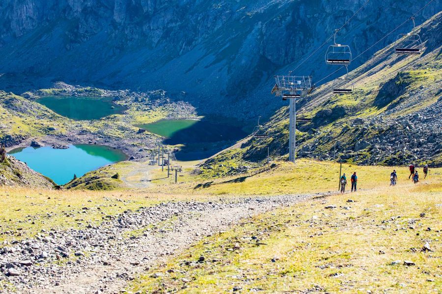
Departure: Croix gondola arrival (from Chamrousse 1650 - Recoin)
Please note that the gondola is only open in July and August and on certain weekends in June and September (otherwise it is a minimum 2.5 hour walk up the hill)
The characteristics of the route.

Chamrousse (38)
- Distance 2.9 km
- Elevation gain 250 m
- Elevation lost 250 m
- Min. elevation 1998 m
- Max. elevation. 2246 m
- Duration (depending on pace) 0h45
- Marking Yes
Head towards the finish of the Roberts lakes chairlift and continue straight on to the Trois Fontaines pass. Head left to follow the wide track alongside the chairlift.
Caution: the shepherd of Chamrousse has dogs with his herd (but no patous), for a good cohabitation between mountain people and the work of the shepherd, thank you for respecting some instructions. Do not cross the herd, do not try to pet or feed the dogs or the herd, do not make sudden gestures or throw things that could frighten the dog, do not start running and avoid taking photos from too close...
? Little extra: "Hiking star" a medal for children in summer too!
Showing us a picture taken during their hike, courageous little walkers will be awarded a diploma with their name + gold star "Robert lakes" on sale (2.50€ at the Tourist Offices) to wear proudly on the backpack.Marking : Yellow and green sign (PR) at the start, then follow the ski slope, below the Robert Lakes chairliftEquipments : Public WC, Parking nearby, Delicate passages : Steep and rocky trackAdmission fee : Free access.Opening : From 15/06 to 30/09. Please note that the cable car is only open in July and August and on certain weekends in June and September (otherwise it is a minimum 2.5 hour walk up the hill).
Area : Grésivaudan
Report a problem
Website Robert Lakes by the trail Features of the application :
- Location and orientation on detailed maps thanks to the GPS of your smartphone
- Description of routes and points of interest on the route
- Photo gallery by route
- Detailed elevation profile
- Route tracking alert to warn you if you stray from the route
- Send predefined messages by SMS to your contacts
- Emergency module: trigger a call or send an emergency SMS in case of problem
- Agenda: access to events organized in the department
- News: find in the application the latest news on the web portal
- Adding achievements
- Add reports in case of problems encountered on the routes
- Share on social networks
Add your time and share your feelings
Services nearby

Chamrousse Tourist Office
Chamrousse

Arselle Peatbog (Preserved Natural Area)
Chamrousse

Romanche Museum
Livet-et-Gavet

Refuge de la Pra
Revel
Office Thermal et Touristique d'Uriage-les-Bains
Saint-Martin-d'Uriage


Information updated on 2024-07-31 by Office du Tourisme de Chamrousse


Follow us on
the digital trails
the digital trails


![]()
The Isère Outdoor application was created
by the Département de l'Isère
Infos & contact
Conseil départemental de l'Isère
7 rue Fantin Latour
CS 41096
38 022 Grenoble cedex 1
Tel. 04 76 00 38 38
 Isère Outdoor - Parcours - Croix of Chamrousse - Robert lakes by the slope
Hello, world! This is a toast message.
Isère Outdoor - Parcours - Croix of Chamrousse - Robert lakes by the slope
Hello, world! This is a toast message.
Isère Outdoor - Parcours - Croix of Chamrousse - Robert lakes by the slope
Hello, world! This is a toast message.


OK
Annuler