Croix of Chamrousse - la Pra mountain refuge
Add to my favorites

Caution! Zone of vigilance near the route
Departure: arrival of the La Croix gondola at 2250m altitude.
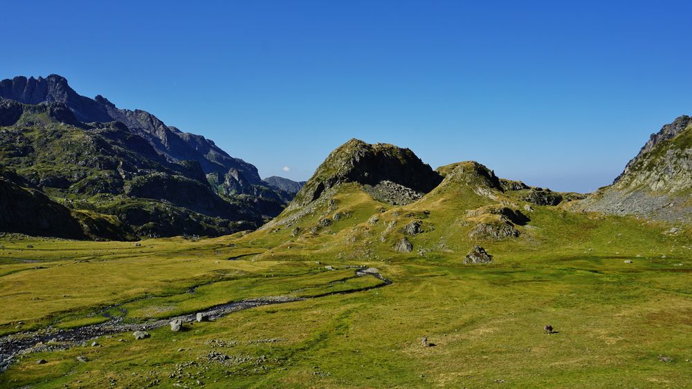
In a high-mountain atmosphere, discover the splendid mountain lakes along this hike, especially Lake Léama and its supernatural blue color.
Round trip 6h30 (12.8km)
The characteristics of the route.

Chamrousse (38)
- Distance 13.8 km
- Elevation gain 840 m
- Elevation lost 840 m
- Min. elevation 1834 m
- Max. elevation. 2246 m
- Duration (depending on pace) 3h
- Marking Yes
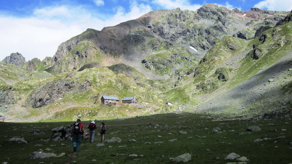
At the end of the path, gaze at this large open country scattered with streams and listen to the marmots whistling at your arrival. If you ever decide to sleep at the mountain hut of La Pra, you may see chamois early in the morning pasturing nearby.
La Pra is a mountain pasture too. Sheep are proudly looked after by patous (Pyrenean mountain dogs). We advise you not to cross the flock and to keep your dog on a leash going staying as far as possible.
Some advices for approaching a herd in the mountains:
• When approaching herds, slow down, don't run. Move with a steady step, and speak with a low and posed voice (without shouting)
• Don't agitate, don't wield sticks, have slow and gentle gestures
• Don't approach and want to seek contact with animals
• Avoid looking at the animals in the eyes as much as possible (lowering the head and observing them from the side). Also trying to remove sunglasses that can attack animals (their vision is not the same as ours).
Pets allowed: dogs are allowed in the gondola in the summer as well as on all trails on a leash.
The shepherd who works in Chamrousse in the summer has no Pyrenean Mountain Dog. However, you can meet some in the Pra sector.Marking : Yellow (and green) markings for the Promenade and Randonnée (PR) itineraries from the Croix to the Robert lakes, then white and red markings for the Grande Randonnée (GR) 738 from the Robert lakes to the Pra.Equipments : Public WC, Picnic area, Orientation board, Good plans : Discovery of the mountain lakes and of high mountain.Delicate passages : Rocky passages with scree, crossing of torrents.Admission fee : Free access. Gondola return ticket not included.Opening : From 30/06 to 01/10. Subject to snow conditions.
Area : Grésivaudan
Report a problem
Website Croix de Chamrousse - Pra mountain hut map Features of the application :
- Location and orientation on detailed maps thanks to the GPS of your smartphone
- Description of routes and points of interest on the route
- Photo gallery by route
- Detailed elevation profile
- Route tracking alert to warn you if you stray from the route
- Send predefined messages by SMS to your contacts
- Emergency module: trigger a call or send an emergency SMS in case of problem
- Agenda: access to events organized in the department
- News: find in the application the latest news on the web portal
- Adding achievements
- Add reports in case of problems encountered on the routes
- Share on social networks
Add your time and share your feelings
Services nearby

Chamrousse Tourist Office
Chamrousse

Arselle Peatbog (Preserved Natural Area)
Chamrousse

Romanche Museum
Livet-et-Gavet

Refuge de la Pra
Revel
Office Thermal et Touristique d'Uriage-les-Bains
Saint-Martin-d'Uriage


Information updated on 2025-04-23 by Office du Tourisme de Chamrousse


Follow us on
the digital trails
the digital trails


![]()
The Isère Outdoor application was created
by the Département de l'Isère
Infos & contact
Conseil départemental de l'Isère
7 rue Fantin Latour
CS 41096
38 022 Grenoble cedex 1
Tel. 04 76 00 38 38
 Isère Outdoor - Parcours - Croix of Chamrousse - la Pra mountain refuge
Hello, world! This is a toast message.
Isère Outdoor - Parcours - Croix of Chamrousse - la Pra mountain refuge
Hello, world! This is a toast message.
Isère Outdoor - Parcours - Croix of Chamrousse - la Pra mountain refuge
Hello, world! This is a toast message.


OK
Annuler