Chemin du Facteur for Villard-Reymond - Hiking from Le Bourg-d'Oisans
Add to my favorites

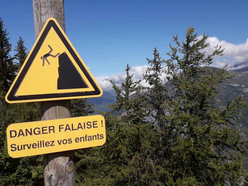
Caution! Zone of vigilance near the route
Circaète Jean-le-Blanc - du 01/03/2026 au 30/09/2026 In progress
Pregentil - du 15/05/2026 au 30/10/2026 In progress
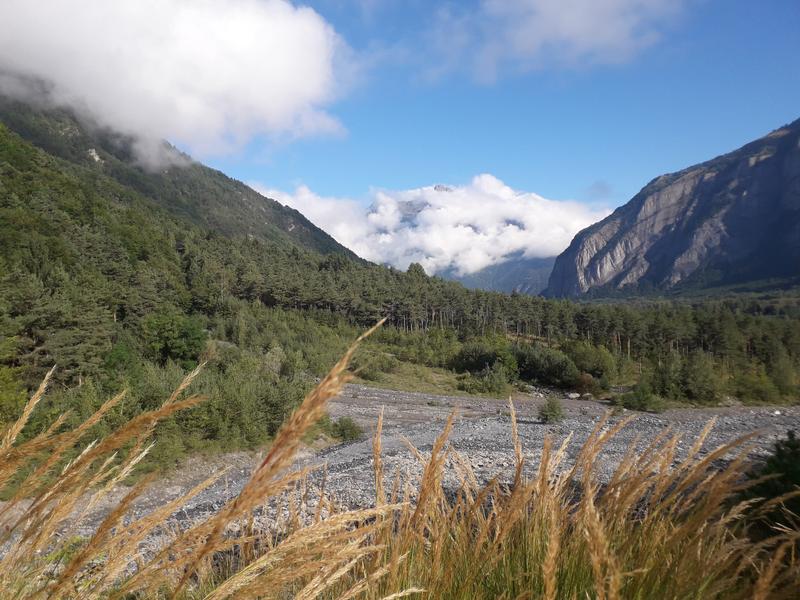
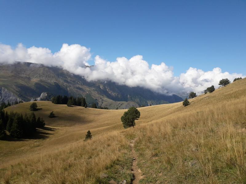
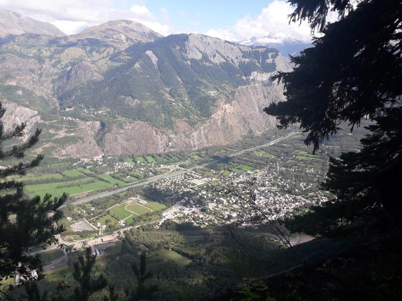
The path winds steeply up and down in the heart of a beech forest and offers a superb panorama over the plain of Le Bourg-d'Oisans and the Grandes Rousses massif.
The characteristics of the route.

Le Bourg-d'Oisans (38)
- Distance 13.7 km
- Elevation gain 1260 m
- Elevation lost 1260 m
- Min. elevation 723 m
- Max. elevation. 1935 m
- Duration (depending on pace) 6h15
- Marking Yes
TECHNICAL INFORMATION :
Departure: Le Bourg-d'Oisans - Parking Cinéma
Difference in altitude: 1100 m
Round trip time: 6h15
Distance: 12.4 km
Level: difficult
MAP AND TOPO :
IGN Top 25 map n°3335 E (EST)
OBP map No. 1 - 652 653 641
ITINERARY
The hike starts near the parking lot next to the cinema/Maison du Parc. Follow the signs to Villard-Reymond. This is where the Chemin du facteur begins.
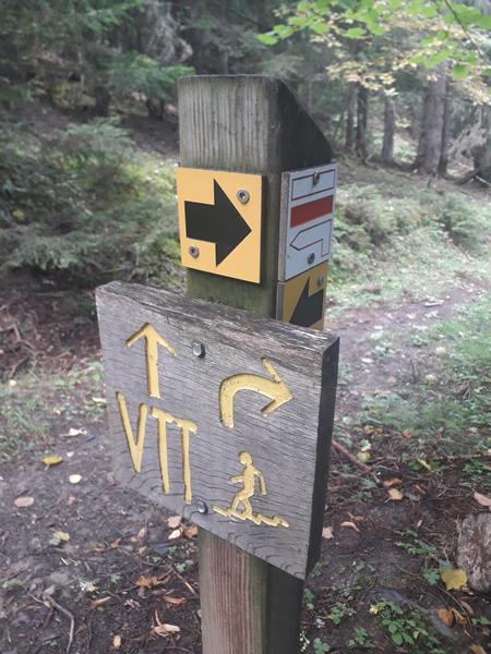
When you reach the Merlon, DO NOT cross the torrent, but stay on the same path. At the dam, climb down the tire steps and continue along the path to the left. This is where the real climb begins. All the way up, follow the signs for Villard-Reymond and the yellow markings on the trees.
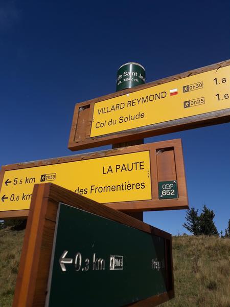
When you reach the Col de Solude, enjoy the breathtaking views before descending to the village of Villard-Reymond.
For the return journey, turn back to the Col de Solude and from there continue towards the Col de St Jean. On arrival at the Col, you can either start the descent directly or climb to Pré Gentil (15 minutes) for a superb 360-degree view.
For the descent, follow the sign to Tête des Fromentières, then follow the sign to Le Puy.
At Le Puy, turn right towards Le Merlon to return to the starting point.
THINGS TO SEE ALONG THE WAY
-Col de Solude, with breathtaking views of Bourg-d'Oisans and the surrounding villages and mountains.
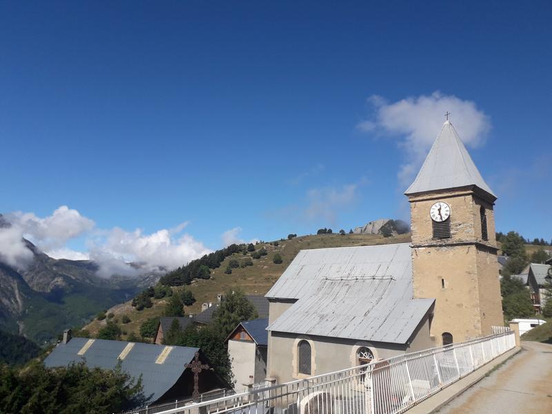
-The village of Villard-Reymond.
-La ferme du champ perché (RSF)
NEARBY ATTRACTIONS
-Maison du Parc in Le Bourg-d'Oisans
GOOD TO KNOW :
The Chemin du facteur (letter carrier's path) between Le Bourg-d'Oisans and Villard-Reymond was used by the local population and letter carriers, hence its name.
Villard-Reymond is the highest commune in Isère and the second highest village in France.
Part of the Ecrins National Park, Villard-Reymond enjoys unspoilt countryside and remarkable views over the Oisans mountains.Marking : The trail is signposted and marked in yellow.Delicate passages : A passage is equipped with cables between Le Bourg-d'Oisans and La cabane forestière. (OBP653) Several passages are vertiginous and equipped with cables between the Col de St Jean and Le Puy. (OBP 652)Admission fee : Free access.Opening : From 01/05 to 31/10. Subject to favorable snow and weather conditions.
Departure: Le Bourg-d'Oisans - Parking Cinéma
Difference in altitude: 1100 m
Round trip time: 6h15
Distance: 12.4 km
Level: difficult
MAP AND TOPO :
IGN Top 25 map n°3335 E (EST)
OBP map No. 1 - 652 653 641
ITINERARY
The hike starts near the parking lot next to the cinema/Maison du Parc. Follow the signs to Villard-Reymond. This is where the Chemin du facteur begins.
When you reach the Merlon, DO NOT cross the torrent, but stay on the same path. At the dam, climb down the tire steps and continue along the path to the left. This is where the real climb begins. All the way up, follow the signs for Villard-Reymond and the yellow markings on the trees.
When you reach the Col de Solude, enjoy the breathtaking views before descending to the village of Villard-Reymond.
For the return journey, turn back to the Col de Solude and from there continue towards the Col de St Jean. On arrival at the Col, you can either start the descent directly or climb to Pré Gentil (15 minutes) for a superb 360-degree view.
For the descent, follow the sign to Tête des Fromentières, then follow the sign to Le Puy.
At Le Puy, turn right towards Le Merlon to return to the starting point.
THINGS TO SEE ALONG THE WAY
-Col de Solude, with breathtaking views of Bourg-d'Oisans and the surrounding villages and mountains.
-The village of Villard-Reymond.
-La ferme du champ perché (RSF)
NEARBY ATTRACTIONS
-Maison du Parc in Le Bourg-d'Oisans
GOOD TO KNOW :
The Chemin du facteur (letter carrier's path) between Le Bourg-d'Oisans and Villard-Reymond was used by the local population and letter carriers, hence its name.
Villard-Reymond is the highest commune in Isère and the second highest village in France.
Part of the Ecrins National Park, Villard-Reymond enjoys unspoilt countryside and remarkable views over the Oisans mountains.Marking : The trail is signposted and marked in yellow.Delicate passages : A passage is equipped with cables between Le Bourg-d'Oisans and La cabane forestière. (OBP653) Several passages are vertiginous and equipped with cables between the Col de St Jean and Le Puy. (OBP 652)Admission fee : Free access.Opening : From 01/05 to 31/10. Subject to favorable snow and weather conditions.
Area : Oisans
Report a problem
Website TOPO_Boucle Bourg d'Oisans-Villard Reymond-Col Saint Jean Features of the application :
- Location and orientation on detailed maps thanks to the GPS of your smartphone
- Description of routes and points of interest on the route
- Photo gallery by route
- Detailed elevation profile
- Route tracking alert to warn you if you stray from the route
- Send predefined messages by SMS to your contacts
- Emergency module: trigger a call or send an emergency SMS in case of problem
- Agenda: access to events organized in the department
- News: find in the application the latest news on the web portal
- Adding achievements
- Add reports in case of problems encountered on the routes
- Share on social networks
Add your time and share your feelings
Services nearby

Tourist office of Le Bourg-d'Oisans
Le Bourg-d'Oisans

Museum of Minerals and Alpine Wildlife
Le Bourg-d'Oisans
Auris-en-Oisans tourist office
Auris-en-Oisans
Tourist office of Villard-Reculas
Villard-Reculas
Office de Tourisme
Alpe d'Huez


Information updated on 2026-03-11 by Oisans Tourisme


Follow us on
the digital trails
the digital trails


![]()
The Isère Outdoor application was created
by the Département de l'Isère
Infos & contact
Conseil départemental de l'Isère
7 rue Fantin Latour
CS 41096
38 022 Grenoble cedex 1
Tel. 04 76 00 38 38
 Isère Outdoor - Parcours - Chemin du Facteur for Villard-Reymond - Hiking from Le Bourg-d'Oisans
Hello, world! This is a toast message.
Isère Outdoor - Parcours - Chemin du Facteur for Villard-Reymond - Hiking from Le Bourg-d'Oisans
Hello, world! This is a toast message.
Isère Outdoor - Parcours - Chemin du Facteur for Villard-Reymond - Hiking from Le Bourg-d'Oisans
Hello, world! This is a toast message.


OK
Annuler