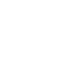
Le puits des Rioux à cheval
Add to my favorites

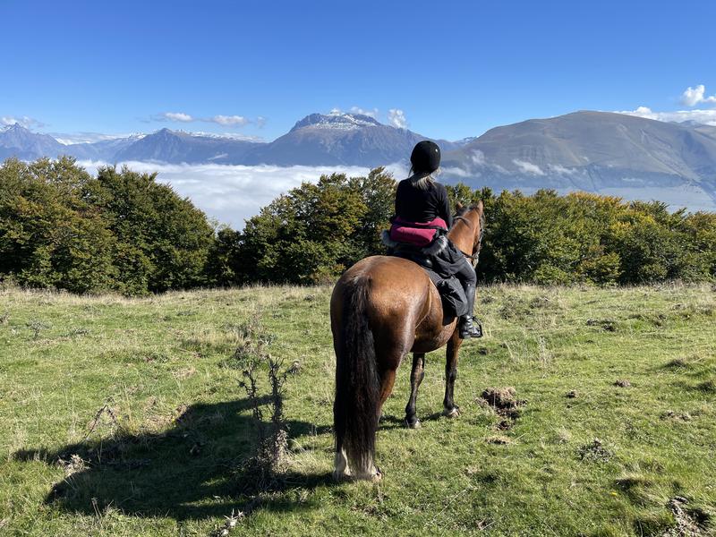
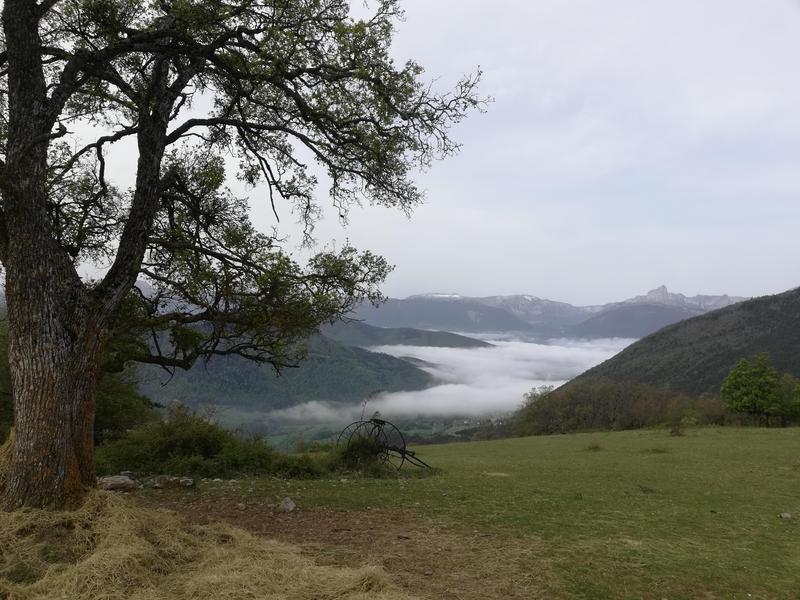
Une boucle assez courte mais avec un peu de dénivelé, on ne va pas très vite sur cet itinéraire. Coup de cœur pour les points de vue, pour l'incursion dans la zone d'alpage et pour la rencontre avec le puits des Rioux, emblème minier du territoire.
The characteristics of the route.
Susville (38)
- Distance 12.2 km
- Elevation gain 630 m
- Elevation lost 630 m
- Min. elevation 845 m
- Max. elevation. 1440 m
- Duration (depending on pace) 4h
- Marking Yes
Admission fee : Free access.Opening : All year round.
Subject to favorable weather.
Area : Matheysine
Report a problem
Website Pdf file Features of the application :
- Location and orientation on detailed maps thanks to the GPS of your smartphone
- Description of routes and points of interest on the route
- Photo gallery by route
- Detailed elevation profile
- Route tracking alert to warn you if you stray from the route
- Send predefined messages by SMS to your contacts
- Emergency module: trigger a call or send an emergency SMS in case of problem
- Agenda: access to events organized in the department
- News: find in the application the latest news on the web portal
- Adding achievements
- Add reports in case of problems encountered on the routes
- Share on social networks
Add your time and share your feelings
Services nearby

Museum "Musée Matheysin"
La Mure
Musuem "La Mine Image"
La Motte-d'Aveillans

Maison du Tourisme de La Motte d'Aveillans
La Motte-d'Aveillans
Point d'information du Môle (Lac de Monteynard-Avignonet)
Treffort

Belvédère Olivier Messiaen
Saint-Théoffrey


Information updated on 2024-12-05 by Isère Cheval Vert


Follow us on
the digital trails
the digital trails


![]()
The Isère Outdoor application was created
by the Département de l'Isère
Infos & contact
Conseil départemental de l'Isère
7 rue Fantin Latour
CS 41096
38 022 Grenoble cedex 1
Tel. 04 76 00 38 38
 Isère Outdoor - Parcours - Le puits des Rioux à cheval
Hello, world! This is a toast message.
Isère Outdoor - Parcours - Le puits des Rioux à cheval
Hello, world! This is a toast message.
Isère Outdoor - Parcours - Le puits des Rioux à cheval
Hello, world! This is a toast message.


OK
Annuler