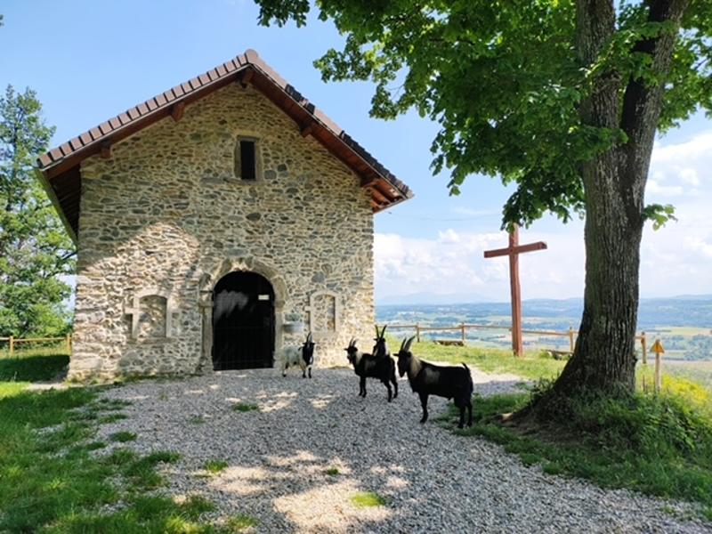
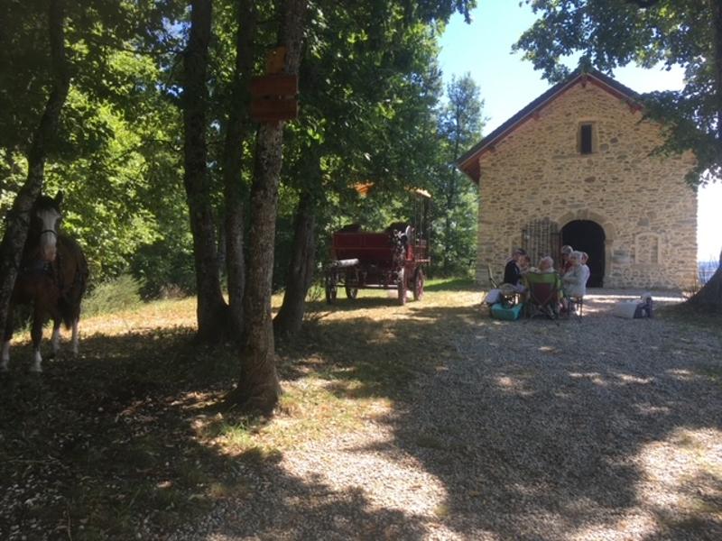
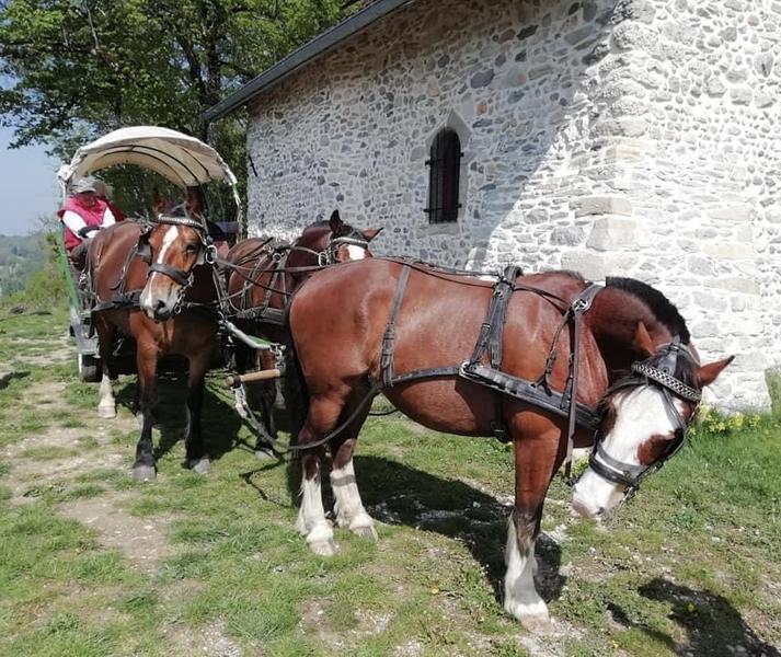
Chapelle de Cessieu à cheval
Add to my favorites

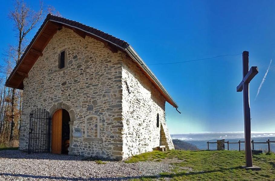
Un petit coin de paradis au dessus de Cessieu qui offre une vue incroyable sur les châteaux du Dauphiné, la plaine de la Tour du Pin, les collines et les sommets des Alpes. La chapelle est très belle, très bien rénovée, site de pique-nique idéal !
The characteristics of the route.
Saint-Jean-de-Soudain (38)
- Distance 19.4 km
- Elevation gain 340 m
- Elevation lost 340 m
- Min. elevation 294 m
- Max. elevation. 499 m
- Duration (depending on pace) 5h
- Marking Yes
Features of the application :
- Location and orientation on detailed maps thanks to the GPS of your smartphone
- Description of routes and points of interest on the route
- Photo gallery by route
- Detailed elevation profile
- Route tracking alert to warn you if you stray from the route
- Send predefined messages by SMS to your contacts
- Emergency module: trigger a call or send an emergency SMS in case of problem
- Agenda: access to events organized in the department
- News: find in the application the latest news on the web portal
- Adding achievements
- Add reports in case of problems encountered on the routes
- Share on social networks
Victoria_38
The 2024/09/29
En savoir plus
Ajouter votre chrono et partager vos sensations
2024/09/29 Victoria_38
Une balade très sympa. Avec un magnifique panorama et zone de pique-nique à la Chapelle.
Francois et sa femme sont vraiment adorables et très accueillants. Vous serez reçu comme des amis. Merci beaucoup !!
2024/09/29 Victoria_38
Une balade très sympa. Avec un magnifique panorama et zone de pique-nique à la Chapelle.
Francois et sa femme sont vraiment adorables et très accueillants. Vous serez reçu comme des amis. Merci beaucoup !!
Services nearby

Tourist information office of La Tour du Pin - Office de Tourisme des Vals du Dauphiné
La Tour-du-Pin

Etang de Gôle Sensitive Natural Area
Montcarra

Saint-Chef Museum
Saint-Chef
Saint-Chef - Balcons du Dauphine Tourist Information Office
Saint-Chef

Relais Cyné de Chateauvilain
Châteauvilain


Information updated on 2024-06-03 by Isère Cheval Vert


Follow us on
the digital trails
the digital trails


![]()
The Isère Outdoor application was created
by the Département de l'Isère
Infos & contact
Conseil départemental de l'Isère
7 rue Fantin Latour
CS 41096
38 022 Grenoble cedex 1
Tel. 04 76 00 38 38
 Isère Outdoor - Parcours - Chapelle de Cessieu à cheval
Hello, world! This is a toast message.
Isère Outdoor - Parcours - Chapelle de Cessieu à cheval
Hello, world! This is a toast message.
Isère Outdoor - Parcours - Chapelle de Cessieu à cheval
Hello, world! This is a toast message.


OK
Annuler