1 - Le petit tour de Saint-Pierre de Chartreuse en trail
Add to my favorites

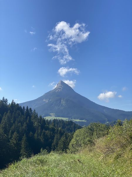
Un petit tour de Saint Pierre de Chartreuse en alternant route, sentier en forêt et piste le long du Guiers. Idéal en échauffement, en reprise, en récupération, en randonnée en famille, ...
The characteristics of the route.
Saint-Pierre-de-Chartreuse (38)
- Distance 3.89 km
- Elevation gain 150 m
- Elevation lost 150 m
- Min. elevation 790 m
- Max. elevation. 895 m
- Duration (depending on pace) 1h
- Marking Yes
Admission fee : Free access.Opening : All year round.
Subject to snow conditions.
Area : Cœur de Chartreuse
Report a problem
Website Pdf file Features of the application :
- Location and orientation on detailed maps thanks to the GPS of your smartphone
- Description of routes and points of interest on the route
- Photo gallery by route
- Detailed elevation profile
- Route tracking alert to warn you if you stray from the route
- Send predefined messages by SMS to your contacts
- Emergency module: trigger a call or send an emergency SMS in case of problem
- Agenda: access to events organized in the department
- News: find in the application the latest news on the web portal
- Adding achievements
- Add reports in case of problems encountered on the routes
- Share on social networks
Add your time and share your feelings
Services nearby

Coeur de Chartreuse Tourist Information center at Saint Pierre de Chartreuse
Saint-Pierre-de-Chartreuse

Museum of la Grande Chartreuse
Saint-Pierre-de-Chartreuse
Museum of Contemporary Sacred Art
Saint-Pierre-de-Chartreuse

Location de matériel au foyer de ski de fond
Saint-Pierre-de-Chartreuse

Espace naturel sensible du col du Coq
Plateau des Petites Roches


Information updated on 2024-08-30 by Office de Tourisme Coeur de Chartreuse


Follow us on
the digital trails
the digital trails


![]()
The Isère Outdoor application was created
by the Département de l'Isère
Infos & contact
Conseil départemental de l'Isère
7 rue Fantin Latour
CS 41096
38 022 Grenoble cedex 1
Tel. 04 76 00 38 38
 Isère Outdoor - Parcours - 1 - Le petit tour de Saint-Pierre de Chartreuse en trail
Hello, world! This is a toast message.
Isère Outdoor - Parcours - 1 - Le petit tour de Saint-Pierre de Chartreuse en trail
Hello, world! This is a toast message.
Isère Outdoor - Parcours - 1 - Le petit tour de Saint-Pierre de Chartreuse en trail
Hello, world! This is a toast message.


OK
Annuler