7 - Le Grand Som on trail
Add to my favorites

Caution! Zone of vigilance near the route
Bellefont - du 01/06/2026 au 31/10/2026 In progress
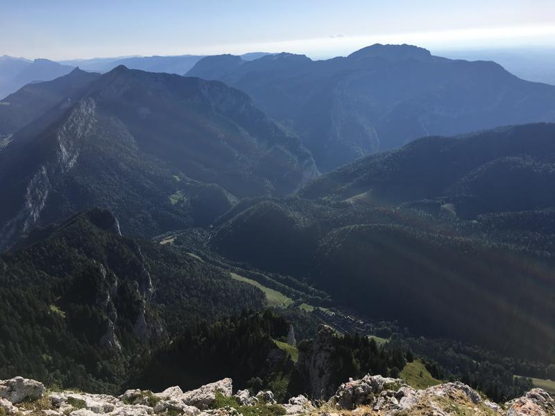
A major challenge for experienced trail runners. You pass by the foot of the Grande Chartreuse Monastery and climb up to the Grand Som. Technical, demanding and resolutely Chartreuse.
The characteristics of the route.

Saint-Pierre-de-Chartreuse (38)
- Distance 23.51 km
- Elevation gain 1710 m
- Elevation lost 1710 m
- Min. elevation 772 m
- Max. elevation. 2017 m
- Duration (depending on pace) 4h
- Marking Yes
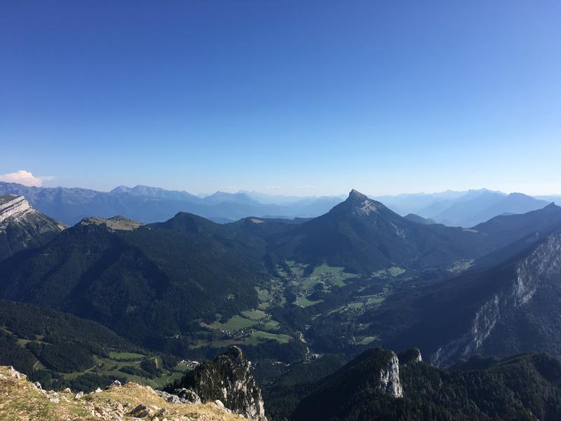
Set off to explore trail no. 7 in Chartreuse, a harmonious route that will appeal to those who enjoy a measured challenge. Between gradual climbs and fun descents, the trail also has a few technical sections to raise the level of difficulty and stimulate your spirit of adventure. All this takes place in spectacular surroundings, punctuated by exceptional panoramic views of the Chartreuse mountains. An ideal route for reconnecting with nature, enjoying the trails and pushing your limits in complete control.
Download the Raidlight-Trail-Experience App
Enjoy all the trail routes directly on your smartphone with several useful features:
*Track your real-time location along the route
*Access detailed trail descriptions during your outing and download the data for offline access
*Benefit from detailed IGN maps and add your timing results to the routes.Marking : Trail Marking No. 6 Red Starting panels are placed in villages at parking or public welcome points. To follow your route, posts are installed at intersections, identifiable by a plaque indicating their name and altitude. Between two posts, trail markings painted along the path indicate the way to follow (or not). You can also be guided by small direction signs.Admission fee : Free access.Opening : Open every day. Subject to favorable snow and weather conditions.Step by step description : After descending to the bottom of the station, you'll reach the Porte de l'Enclos (entrance to the Grande Chartreuse domain). You’ll embark on a long ascent of 1000m+ while passing by the Museum and the Monastery Convent (please respect the tranquility of the area!). After an initial forest section along the chapels of Saint-Bruno and Casalibus (without entering), you’ll cross the first meadows at the Col de la Ruchère before tackling more exposed sections at Petit Som. Next, you’ll find yourself on the plateau of Habert de Bovinant before reaching the summit of Grand Som. The descent starts with some tricky sections at Racapé, followed by a pleasant sequence of switchbacks from the Col des Aures (optional detour to the col du Cucheron for a view of the Entremont valley). At the foot of this trail, you’ll make a brief ascent before switching to the slope of La Scia and returning to the base area via a scenic path.
Download the Raidlight-Trail-Experience App
Enjoy all the trail routes directly on your smartphone with several useful features:
*Track your real-time location along the route
*Access detailed trail descriptions during your outing and download the data for offline access
*Benefit from detailed IGN maps and add your timing results to the routes.Marking : Trail Marking No. 6 Red Starting panels are placed in villages at parking or public welcome points. To follow your route, posts are installed at intersections, identifiable by a plaque indicating their name and altitude. Between two posts, trail markings painted along the path indicate the way to follow (or not). You can also be guided by small direction signs.Admission fee : Free access.Opening : Open every day. Subject to favorable snow and weather conditions.Step by step description : After descending to the bottom of the station, you'll reach the Porte de l'Enclos (entrance to the Grande Chartreuse domain). You’ll embark on a long ascent of 1000m+ while passing by the Museum and the Monastery Convent (please respect the tranquility of the area!). After an initial forest section along the chapels of Saint-Bruno and Casalibus (without entering), you’ll cross the first meadows at the Col de la Ruchère before tackling more exposed sections at Petit Som. Next, you’ll find yourself on the plateau of Habert de Bovinant before reaching the summit of Grand Som. The descent starts with some tricky sections at Racapé, followed by a pleasant sequence of switchbacks from the Col des Aures (optional detour to the col du Cucheron for a view of the Entremont valley). At the foot of this trail, you’ll make a brief ascent before switching to the slope of La Scia and returning to the base area via a scenic path.
Area : Cœur de Chartreuse
Report a problem
Website Pdf file Features of the application :
- Location and orientation on detailed maps thanks to the GPS of your smartphone
- Description of routes and points of interest on the route
- Photo gallery by route
- Detailed elevation profile
- Route tracking alert to warn you if you stray from the route
- Send predefined messages by SMS to your contacts
- Emergency module: trigger a call or send an emergency SMS in case of problem
- Agenda: access to events organized in the department
- News: find in the application the latest news on the web portal
- Adding achievements
- Add reports in case of problems encountered on the routes
- Share on social networks
Add your time and share your feelings
Services nearby

Coeur de Chartreuse Tourist Information center at Saint Pierre de Chartreuse
Saint-Pierre-de-Chartreuse

Location de matériel au foyer de ski de fond
Saint-Pierre-de-Chartreuse

Museum Arcabas in Chartreuse
Saint-Pierre-de-Chartreuse
Museum of la Grande Chartreuse
Saint-Pierre-de-Chartreuse

Espace naturel sensible du col du Coq
Plateau des Petites Roches


Information updated on 2026-06-10 by Chartreuse Tourisme


Follow us on
the digital trails
the digital trails





The Isère Outdoor application was created
by the Département de l'Isère
Infos & contact
Conseil départemental de l'Isère
7 rue Fantin Latour
CS 41096
38 022 Grenoble cedex 1
Tel. 04 76 00 38 38
 Isère Outdoor - Parcours - 7 - Le Grand Som on trail
Hello, world! This is a toast message.
Isère Outdoor - Parcours - 7 - Le Grand Som on trail
Hello, world! This is a toast message.
Isère Outdoor - Parcours - 7 - Le Grand Som on trail
Hello, world! This is a toast message.


OK
Annuler