5 - Le tour du Roc d'Arguille on trail
Add to my favorites

Caution! Zone of vigilance near the route
Praouta - du 19/06/2026 au 10/10/2026 In progress
Bellefont - du 01/06/2026 au 31/10/2026 In progress
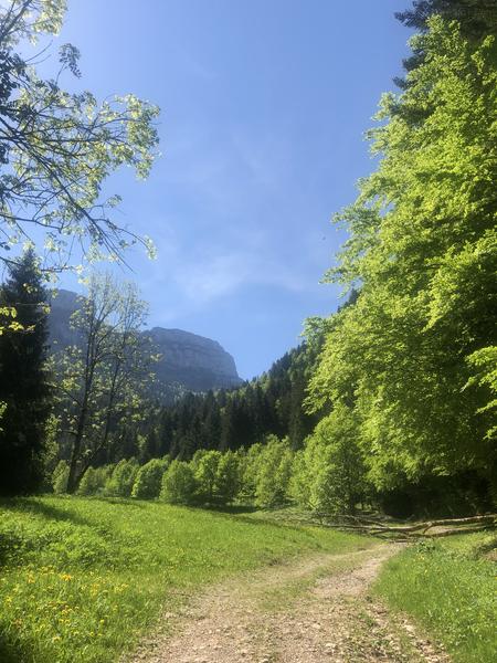
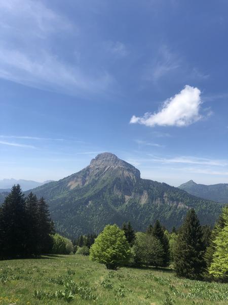
A long loop with the Col du Coq as its highlight, classified as a Sensitive Natural Area. Discover the ridges beneath the Dent de Crolles and the Pravouta meadow. Wild and panoramic.
The characteristics of the route.

Saint-Pierre-de-Chartreuse (38)
- Distance 15.86 km
- Elevation gain 1080 m
- Elevation lost 1080 m
- Min. elevation 832 m
- Max. elevation. 1545 m
- Duration (depending on pace) 3h
- Marking Yes
A blue trail in Chartreuse designed for intermediate runners looking for fun. Here, everything comes together for an enjoyable trail run: a beautiful variety of terrain, accessible climbs and descents, and a few fast sections to pick up the pace. With no technical challenges, this course allows you to focus on the sensations and pleasure of running, all in a magnificent setting. An ideal route for improving your skills, gently challenging yourself, and getting away from it all in the heart of nature.
Marking : Trail Marking No. 5 Blue - Specific Trail Starting panels are placed in the villages. To follow your route, posts are installed at intersections, identifiable by a plaque indicating the name and altitude. Between the posts, painted markers guide the path, although not always. You may also be guided by small directional signs.
Admission fee : Free access.
Opening : All year round daily. Subject to favorable snow and weather conditions.
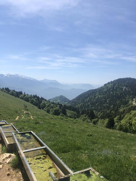
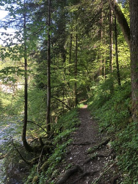
Step by step description : You take a gently ascending road towards Perquelin. Upon reaching Pont Giclard, you leave the main road to begin the main ascent (approximately 600 meters of elevation gain) towards Col des Ayes, located at the foot of Dent de Crolles. A short descent leads you to Col du Coq, where you find the trails leading to the PDIPR Pré Giclas signpost, offering breathtaking views of Chamechaude, the highest peak in Chartreuse. You enter a Sensitive Natural Area, so please respect the site and its regulations. Next, you begin your descent through the Océpée forest towards Saint Hugues. Upon returning to the forest road, you will need to ascend to your right to follow the winding trail that snakes above the hamlets, deep in the forest. At the hamlet of Antonins, cross the road to continue on the path towards Bois du Ban. An ascent will then allow you to join the road and return to your starting point.
Marking : Trail Marking No. 5 Blue - Specific Trail Starting panels are placed in the villages. To follow your route, posts are installed at intersections, identifiable by a plaque indicating the name and altitude. Between the posts, painted markers guide the path, although not always. You may also be guided by small directional signs.
Admission fee : Free access.
Opening : All year round daily. Subject to favorable snow and weather conditions.
Step by step description : You take a gently ascending road towards Perquelin. Upon reaching Pont Giclard, you leave the main road to begin the main ascent (approximately 600 meters of elevation gain) towards Col des Ayes, located at the foot of Dent de Crolles. A short descent leads you to Col du Coq, where you find the trails leading to the PDIPR Pré Giclas signpost, offering breathtaking views of Chamechaude, the highest peak in Chartreuse. You enter a Sensitive Natural Area, so please respect the site and its regulations. Next, you begin your descent through the Océpée forest towards Saint Hugues. Upon returning to the forest road, you will need to ascend to your right to follow the winding trail that snakes above the hamlets, deep in the forest. At the hamlet of Antonins, cross the road to continue on the path towards Bois du Ban. An ascent will then allow you to join the road and return to your starting point.
Area : Cœur de Chartreuse
Report a problem
Website 5 - Le tour du Roc d'Arguille on trail Features of the application :
- Location and orientation on detailed maps thanks to the GPS of your smartphone
- Description of routes and points of interest on the route
- Photo gallery by route
- Detailed elevation profile
- Route tracking alert to warn you if you stray from the route
- Send predefined messages by SMS to your contacts
- Emergency module: trigger a call or send an emergency SMS in case of problem
- Agenda: access to events organized in the department
- News: find in the application the latest news on the web portal
- Adding achievements
- Add reports in case of problems encountered on the routes
- Share on social networks
Add your time and share your feelings
Services nearby

Coeur de Chartreuse Tourist Information center at Saint Pierre de Chartreuse
Saint-Pierre-de-Chartreuse

Museum of Contemporary Sacred Art
Saint-Pierre-de-Chartreuse

Location de matériel au foyer de ski de fond
Saint-Pierre-de-Chartreuse
Museum of la Grande Chartreuse
Saint-Pierre-de-Chartreuse

Espace naturel sensible du col du Coq
Plateau des Petites Roches


Information updated on 2026-01-22 by Chartreuse Tourisme


Follow us on
the digital trails
the digital trails


![]()
The Isère Outdoor application was created
by the Département de l'Isère
Infos & contact
Conseil départemental de l'Isère
7 rue Fantin Latour
CS 41096
38 022 Grenoble cedex 1
Tel. 04 76 00 38 38
 Isère Outdoor - Parcours - 5 - Le tour du Roc d'Arguille on trail
Hello, world! This is a toast message.
Isère Outdoor - Parcours - 5 - Le tour du Roc d'Arguille on trail
Hello, world! This is a toast message.
Isère Outdoor - Parcours - 5 - Le tour du Roc d'Arguille on trail
Hello, world! This is a toast message.


OK
Annuler