Plan Col hike from Vaunoire valley
Add to my favorites

Caution! Zone of vigilance near the route
Le Pay - du 01/07/2026 au 01/08/2026 Upcoming
Combe Oursière - du 01/08/2026 au 15/08/2026 Upcoming
Plan Col - du 15/08/2026 au 25/09/2026 Upcoming
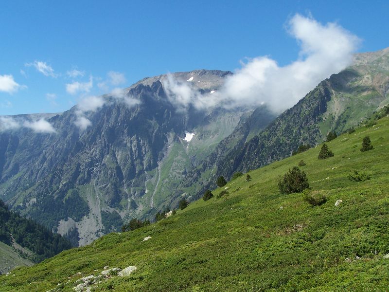
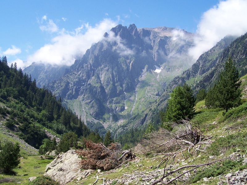
Very beautiful trail starting from the Vaunoire's valley, between Taillefer and Armet ranges.
Plan Col is a high mountain pasture perched on a pass which allows to join Ornon's village and the Malsanne's valley.
The summer a shepherd leads its herd there, pay attention on his dog Patou
The characteristics of the route.

Lavaldens (38)
- Distance 9.8 km
- Elevation gain 720 m
- Elevation lost 710 m
- Min. elevation 1213 m
- Max. elevation. 1871 m
- Duration (depending on pace) 5h
- Marking Yes
Plan Col is a mountain pasture located at the top of the pass, connecting Moulin Vieux (Roizonne valley) and Ornon (Malsanne valley).
During this hike, follow the Vaunoire stream and observe how the flora adapts to changes in altitude: starting in the forest, you’ll gradually leave the woods behind for alpine pastures at nearly 1900 meters.
Drive up to the parking area at the end of the road that leads into the Vaunoire valley from Moulin Vieux. From there, follow the wide and gently sloping path that continues toward the end of the valley. Keep going on this trail, cross the stream coming from the Taillefer, and begin climbing through the beech forest via well-marked switchbacks. After an initial steep section, reach a small flat area, often still covered in snow late into the season. After crossing the stream again (via a bridge), a short series of switchbacks leads you into a broad basin. Past a small rise, the valley opens up slightly; continue on the trail and ford the stream. Climb diagonally up the slope of Plan Col, which you’ll reach after a final switchback. Use the same route for the descent.
Caution!
You are in a protected natural area. Please stay on marked trails, keep your dog on a leash, do not light fires, and carry your waste back with you or dispose of it in the nearest bins. Respecting and preserving this special environment is essential!Marking : Yellow waymarkingEquipments : Car park, Admission fee : Free access.Opening : From 15/06 to 15/09 daily. Subject to favorable snow and weather conditions.
Area : Matheysine
Report a problem
Website TOPO_Plan Col depuis la vallée de Vaunoire TOPO_Plan Col depuis la vallée de Vaunoire Features of the application :
- Location and orientation on detailed maps thanks to the GPS of your smartphone
- Description of routes and points of interest on the route
- Photo gallery by route
- Detailed elevation profile
- Route tracking alert to warn you if you stray from the route
- Send predefined messages by SMS to your contacts
- Emergency module: trigger a call or send an emergency SMS in case of problem
- Agenda: access to events organized in the department
- News: find in the application the latest news on the web portal
- Adding achievements
- Add reports in case of problems encountered on the routes
- Share on social networks
Add your time and share your feelings
Services nearby

Foyer de ski de fond du Col d'Ornon
Chantelouve

Alpe du Grand Serre Tourist Office
Alpe Du Grand Serre

Taillefer Hut
Oulles

Romanche Museum
Livet-et-Gavet
Museum of Minerals and Alpine Wildlife
Le Bourg-d'Oisans


Information updated on 2026-03-25 by Matheysine Tourisme


Follow us on
the digital trails
the digital trails


![]()
The Isère Outdoor application was created
by the Département de l'Isère
Infos & contact
Conseil départemental de l'Isère
7 rue Fantin Latour
CS 41096
38 022 Grenoble cedex 1
Tel. 04 76 00 38 38
 Isère Outdoor - Parcours - Plan Col hike from Vaunoire valley
Hello, world! This is a toast message.
Isère Outdoor - Parcours - Plan Col hike from Vaunoire valley
Hello, world! This is a toast message.
Isère Outdoor - Parcours - Plan Col hike from Vaunoire valley
Hello, world! This is a toast message.


OK
Annuler