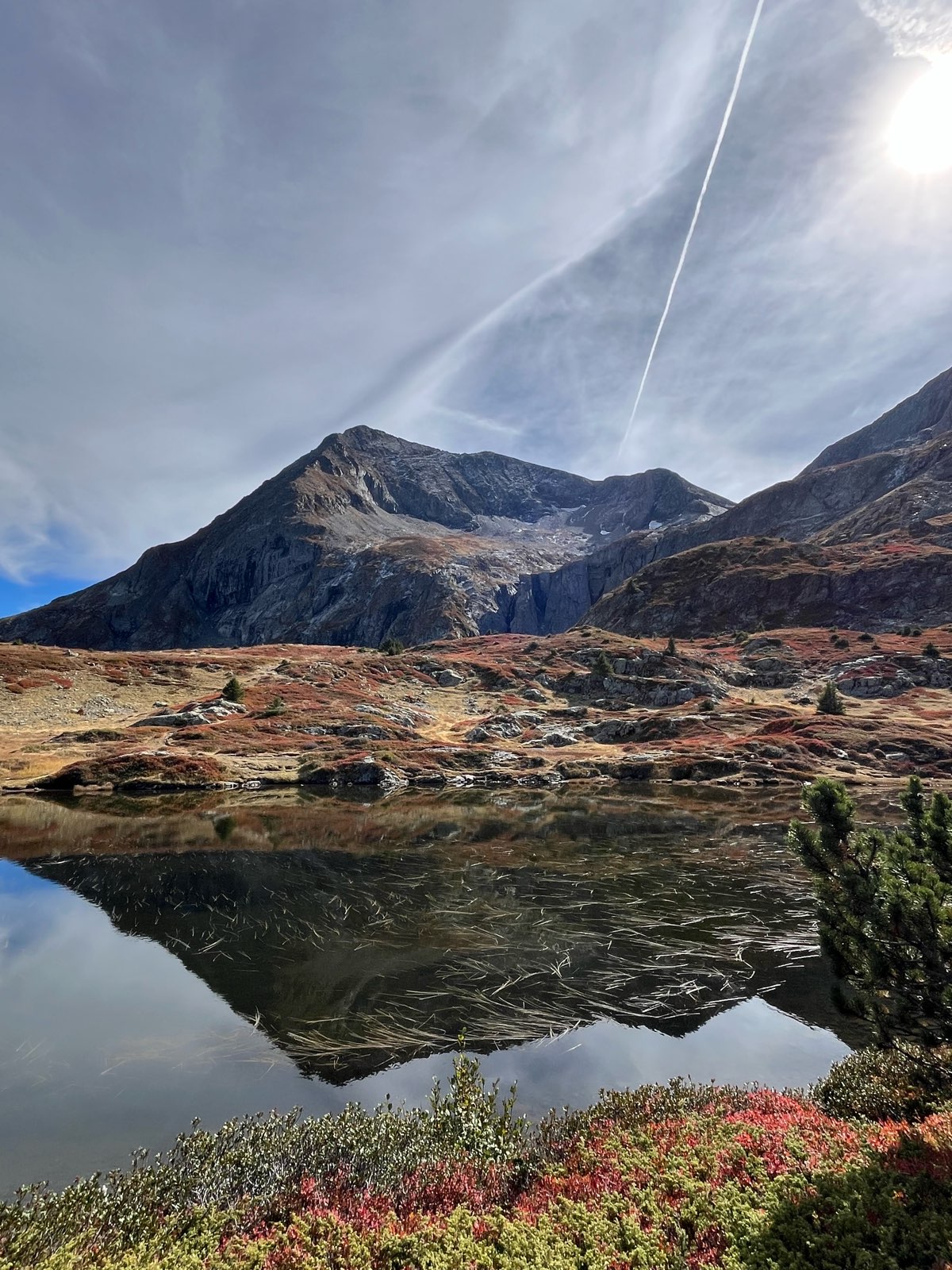
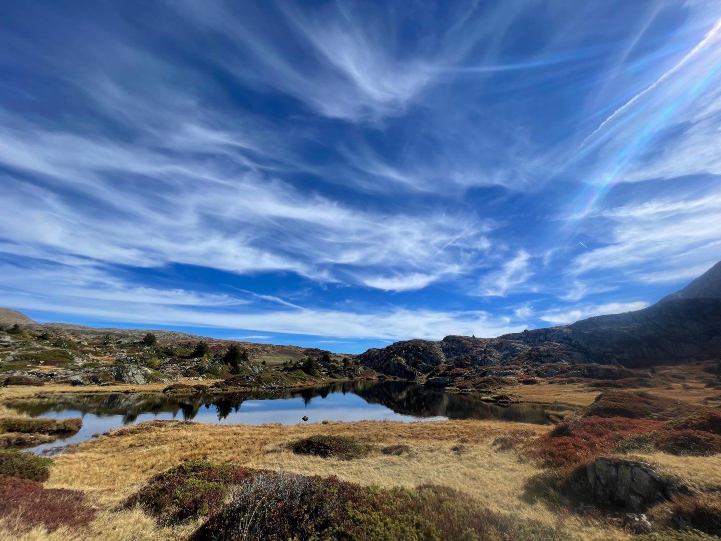
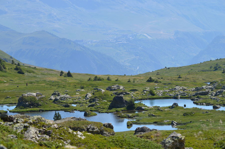
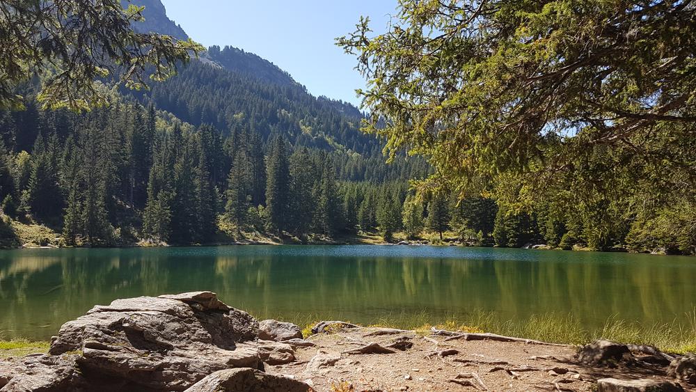
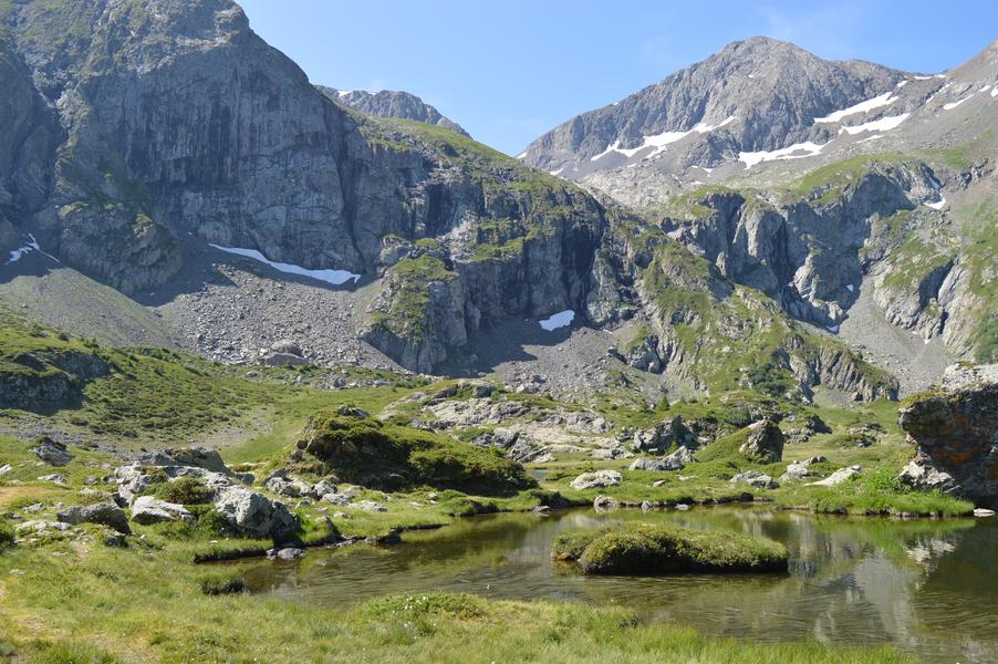
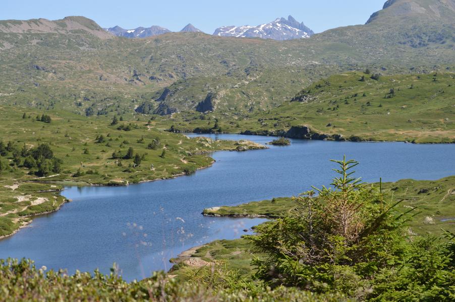
Fourchu Lake and the Lakes plateau
Add to my favorites

Caution! Zone of vigilance near the route
Les Lacs - du 31/08/2026 au 13/09/2026 Upcoming
Quartier d'août - du 31/07/2026 au 31/08/2026 Upcoming
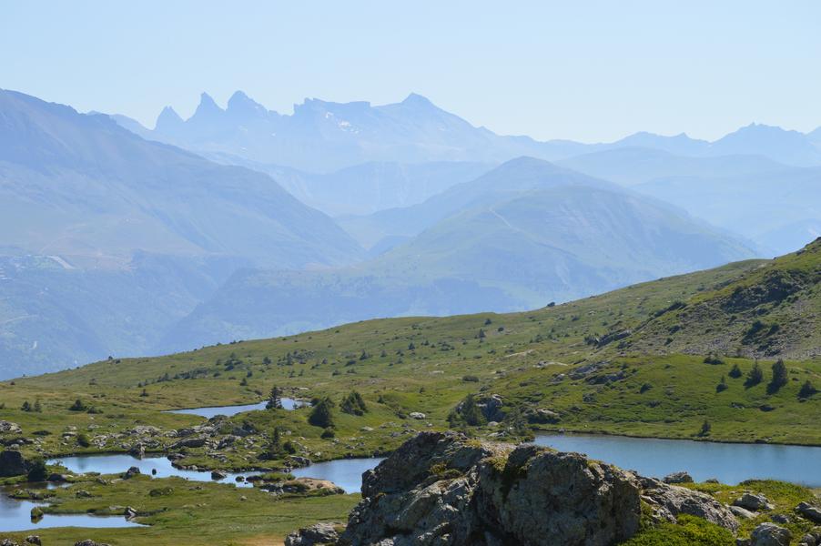
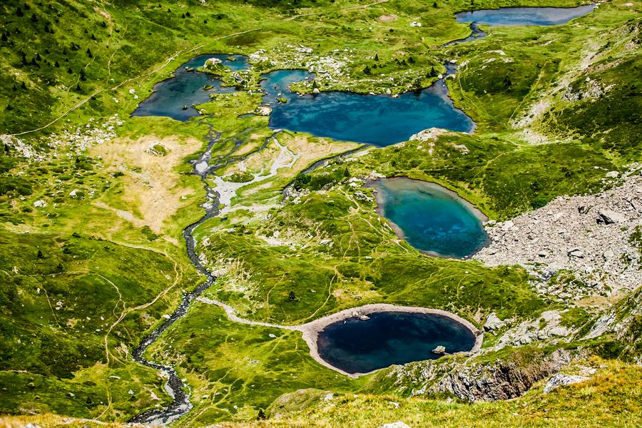
Head to a legendary place, a true paradise on Earth: the Plateau des Lacs is home to a multitude of bodies of water, including Lac Fourchu, the largest in the area.
A timeless space with unforgettable scenery not to be missed!
The characteristics of the route.

Alpe Du Grand Serre (38)
- Distance 7.8 km
- Elevation gain 430 m
- Elevation lost 430 m
- Min. elevation 1629 m
- Max. elevation. 2055 m
- Duration (depending on pace) 3h30
- Marking Yes
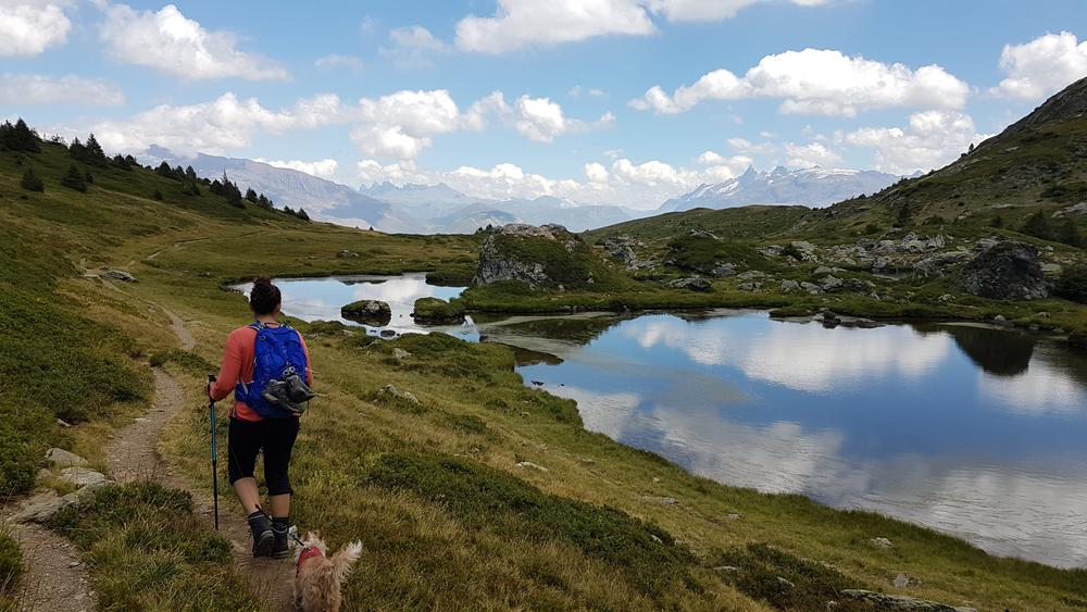
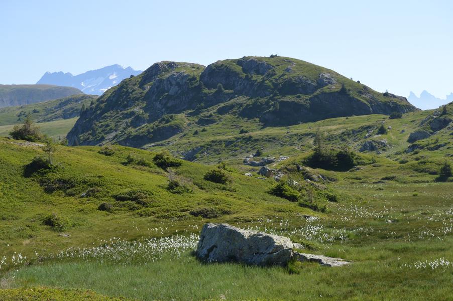
All around you, the landscapes are breathtaking, inviting you to completely disconnect from the real world and its worries.
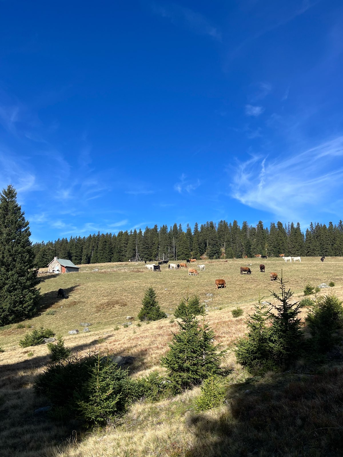
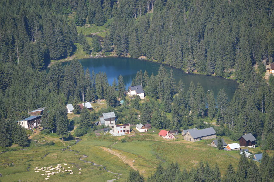
Starting point: Chalets du Poursollet
From the resort, take the D114E “Route du Poursollet” (note: this road is closed to vehicles over 7.5 tons and is shut in winter). Follow the road to its end at the Poursollet parking area.
At the parking lot, after the information board, take the path on the right (GR50). The trail passes by the Poursollet chalets before heading into the mountain. Follow this path to reach Lac Fourchu (a fairly steep climb of about 1h30 to 1h45).
Once on the plateau, take in the view of Lac Fourchu and explore the other nearby lakes (Lac Noir, Lac de la Veche, Lac de l’Agneau, etc.) by heading toward the Pas de l’Envious. For the return, follow the direction to Chalets de la Barrière.
Please note!
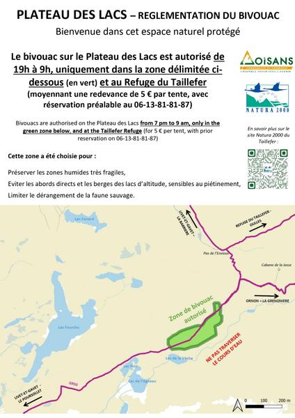
You are in a protected natural area. Please stay on marked trails, keep your dog on a leash, avoid picking plants, do not light fires, and take your trash with you or dispose of it in the nearest bin. Respecting and preserving this unique environment is essential!Marking : Yellow PDIPR waymarking and red and white GR (Grande Randonnée) trail markings.Admission fee : Free access.Opening : From 01/06 to 31/10 daily.Warning : The site experiences very high visitor numbers during the summer season. We recommend discovering this area in spring or autumn, when the weather allows. Try to visit on weekdays outside of school holidays and avoid weekends for a more peaceful experience.
Starting point: Chalets du Poursollet
From the resort, take the D114E “Route du Poursollet” (note: this road is closed to vehicles over 7.5 tons and is shut in winter). Follow the road to its end at the Poursollet parking area.
At the parking lot, after the information board, take the path on the right (GR50). The trail passes by the Poursollet chalets before heading into the mountain. Follow this path to reach Lac Fourchu (a fairly steep climb of about 1h30 to 1h45).
Once on the plateau, take in the view of Lac Fourchu and explore the other nearby lakes (Lac Noir, Lac de la Veche, Lac de l’Agneau, etc.) by heading toward the Pas de l’Envious. For the return, follow the direction to Chalets de la Barrière.
Please note!
You are in a protected natural area. Please stay on marked trails, keep your dog on a leash, avoid picking plants, do not light fires, and take your trash with you or dispose of it in the nearest bin. Respecting and preserving this unique environment is essential!Marking : Yellow PDIPR waymarking and red and white GR (Grande Randonnée) trail markings.Admission fee : Free access.Opening : From 01/06 to 31/10 daily.Warning : The site experiences very high visitor numbers during the summer season. We recommend discovering this area in spring or autumn, when the weather allows. Try to visit on weekdays outside of school holidays and avoid weekends for a more peaceful experience.
Area : Matheysine
Report a problem
Website Pdf file TOPO_Le Lac Fourchu et le plateau des lacs Features of the application :
- Location and orientation on detailed maps thanks to the GPS of your smartphone
- Description of routes and points of interest on the route
- Photo gallery by route
- Detailed elevation profile
- Route tracking alert to warn you if you stray from the route
- Send predefined messages by SMS to your contacts
- Emergency module: trigger a call or send an emergency SMS in case of problem
- Agenda: access to events organized in the department
- News: find in the application the latest news on the web portal
- Adding achievements
- Add reports in case of problems encountered on the routes
- Share on social networks
ecile20
The 2025/10/07
En savoir plus
Ajouter votre chrono et partager vos sensations
Services nearby

Romanche Museum
Livet-et-Gavet

Alpe du Grand Serre Tourist Office
Alpe Du Grand Serre

Taillefer Hut
Oulles

Arselle Peatbog (Preserved Natural Area)
Chamrousse

Foyer de ski de fond du Col d'Ornon
Chantelouve


Information updated on 2026-06-19 by Matheysine Tourisme


Follow us on
the digital trails
the digital trails


![]()
The Isère Outdoor application was created
by the Département de l'Isère
Infos & contact
Conseil départemental de l'Isère
7 rue Fantin Latour
CS 41096
38 022 Grenoble cedex 1
Tel. 04 76 00 38 38
 Isère Outdoor - Parcours - Fourchu Lake and the Lakes plateau
Hello, world! This is a toast message.
Isère Outdoor - Parcours - Fourchu Lake and the Lakes plateau
Hello, world! This is a toast message.
Isère Outdoor - Parcours - Fourchu Lake and the Lakes plateau
Hello, world! This is a toast message.


OK
Annuler