The farms of Rif Bruyants - Family Walk
Add to my favorites

Caution! Zone of vigilance near the route
Le Sappey - du 15/06/2026 au 30/09/2026 In progress
Very nice hike to the abandoned farms of Rif Bruyant. Discover this small charming hamlet.
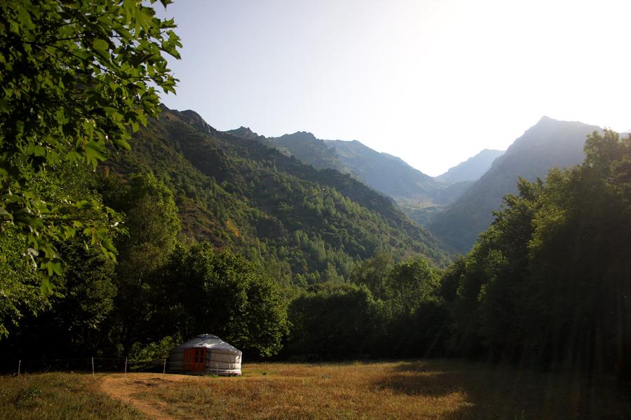
Sleeping and eating available in The Rif Bruyant Refuge.
START at "Le Mollard" or "Le Fontagneu"
The characteristics of the route.

Lavaldens (38)
- Distance 3.6 km
- Elevation gain 210 m
- Elevation lost 210 m
- Min. elevation 981 m
- Max. elevation. 1179 m
- Duration (depending on pace) 2h
- Marking Yes
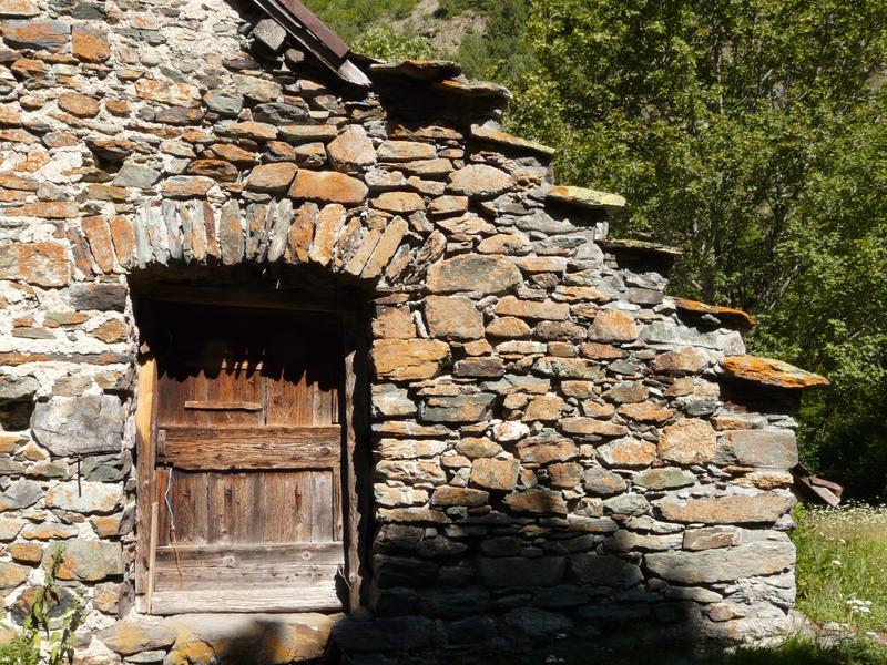
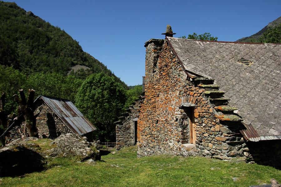
Connected to the Roizonne valley by an old "calade" path (a rough cobbled trail made of embedded stones), the little-known Rif Bruyant valley is full of hidden treasures. Discover the stone houses of the old hamlet, with their slate roofs and stepped gable ends. As you stroll through the beautiful hay meadows bordered by low stone walls, you may come across the natural icehouses, once used to age the valley’s cheeses.
Parking from Alpe du Grand Serre:
Take the D114 towards La Mure. After passing the hamlet of Fontagneu, you’ll find a parking area on your left, near the hamlet of Le Mollard.
From La Mure:
Take the D114 towards Alpe du Grand Serre. After the village of La Valette, the parking area and the hamlet of Le Mollard are on your right.
If the parking is full, you can turn back to the hamlet of Fontagneu, which also offers parking. The additional few hundred meters are signposted and follow the river below.
Trail Directions:
Take the path toward Le Mollard. Once in the hamlet, turn right to reach the Rif Bruyant stream. Continue through the wooded area until you reach a stone-arched bridge. Do not cross this bridge — instead, follow the stream uphill. At the second bridge, cross over the Rif Bruyant and take the narrower trail to the left, which leads into the forest and up to the old hamlet.
Important:
You are in a protected natural area.
Please stay on marked trails, keep your dog on a leash, do not light fires, and carry out all your trash or dispose of it in the nearest bins. Respecting and preserving this special place is essential!Marking : PDIPR SignageEquipments : Parking nearby, Good plans : For more adventurous hikers: experienced walkers can continue up the steep valley of the Rif Bruyant, lined with lush meadows, all the way to the lake of the same name, hidden in the heart of a wild, rocky cirque.Opening : From May 1st to October 31st. Subject to snow conditions. The Rivobruenti refuge is open daily in July and August, and on weekends from May to October.
Area : Matheysine
Report a problem
Website TOPO_rando famille: les fermes de rif bruyant Features of the application :
- Location and orientation on detailed maps thanks to the GPS of your smartphone
- Description of routes and points of interest on the route
- Photo gallery by route
- Detailed elevation profile
- Route tracking alert to warn you if you stray from the route
- Send predefined messages by SMS to your contacts
- Emergency module: trigger a call or send an emergency SMS in case of problem
- Agenda: access to events organized in the department
- News: find in the application the latest news on the web portal
- Adding achievements
- Add reports in case of problems encountered on the routes
- Share on social networks
Add your time and share your feelings
Services nearby

Alpe du Grand Serre Tourist Office
Alpe Du Grand Serre

Belvédère Olivier Messiaen
Saint-Théoffrey

Foyer de ski de fond du Col d'Ornon
Chantelouve

Museum "Musée Matheysin"
La Mure
Musuem "La Mine Image"
La Motte-d'Aveillans


Information updated on 2025-09-21 by Matheysine Tourisme


Follow us on
the digital trails
the digital trails


![]()
The Isère Outdoor application was created
by the Département de l'Isère
Infos & contact
Conseil départemental de l'Isère
7 rue Fantin Latour
CS 41096
38 022 Grenoble cedex 1
Tel. 04 76 00 38 38
 Isère Outdoor - Parcours - The farms of Rif Bruyants - Family Walk
Hello, world! This is a toast message.
Isère Outdoor - Parcours - The farms of Rif Bruyants - Family Walk
Hello, world! This is a toast message.
Isère Outdoor - Parcours - The farms of Rif Bruyants - Family Walk
Hello, world! This is a toast message.


OK
Annuler